

more stats
4,285 ft
Distance
39 ft
Climb
-426 ft
Descent
00:05:59
Avg time
-386 ft
Altitude change
861 ft
Altitude min
1,289 ft
Altitude max
1,247 ft
Altitude start
860 ft
Altitude end
-9%
Grade
-32.8%
Grade max
22.2%
Grade min
623 ft
Distance climb
3,491 ft
Distance down
174 ft
Distance flat
00:05:59
Avg time

Tempest Details

  • Activities
    • Mountain Bike
  • Riding Area
    Mountain Creek Resort
    Vernon, New Jersey
  • Difficulty Rating
  • Voted Difficulty
    Blue (3 votes)
  • Local Popularity
    75 in Mountain Biking
  • Global Ranking
    #42601 in Mountain Biking
  • State Ranking
    #218 in Mountain Biking · New Jersey
  • Trail Type
    Singletrack
  • Bike Type
    DH, AM
  • Physical Rating
    Moderate
  • Trail Visibility
    Always easy to follow
  • TTFs on Trail
    Berm, Drop, Jump, Gap Jump, Other

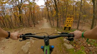
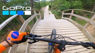
Hidden flow trail tucked away in the back of the park. Truly a hidden gem. Starts off with a fast gapped wooden banana drop, and goes into a large dirt tabletop jump. From there the trail continues with a rock drop, a few more large table tops, and plenty of fast and flowy berms

Access Info

Check the map for trails that go to the back side of the park. When you get to the lake take the gravel road up the mountain. The trail is at the end of the gravel road on the left side.

Tags
BermsDropsFlowyJumps

Bike Park

Traditionally Indigenous Territory

Recent Activity on Trail

Past Week
  • 1 rides
  • 16 miles average
6 Months
  • 190 rides
  • 23 miles avg distance
All
  • 1,437 rides
  • Last: Oct 24, 2026
c1c2c3c4
January
February
March
April
May
June
July
August
September
October
November
December
Status:
on Oct 25, 2026
Dry
Avg: 4.49 (10 votes)
Your vote: 0

view (11,264)
close
      Directions to tempest-34118 trailhead (41.181180, -74.500460)

      Photos

      51 more »
      mtb
      345 |
      Jun 30, 2023 @ 9:56am
      Jun 30, 2023
      mtb
      318 |
      Jun 30, 2023 @ 9:56am
      Jun 30, 2023
      mtb
      240 |
      Jun 30, 2023 @ 9:56am
      Jun 30, 2023
      mtb
      84 |
      Oct 18, 2022 @ 3:07am
      Oct 18, 2022

      Videos

      42 more »
      Mountain Creek Bike Park / Blue & Black...
      mtb
      9:46 | 213 | Nov 21, 2023 , Vernon
      New Jersey has a bike park! My first time at...
      mtb
      14:36 | 227 | Aug 12, 2023 , Vernon
      youtuber Lower Tempest Revealed 'So New, It's Got...
      mtb
      13:42 | 378 | Oct 14, 2021 , Vernon
      Mountain Creek Bike Park // Just Trying Not To Die
      mtb
      19:45 | 173 | Jun 14, 2021 , Vernon
      4.8 ★★★★★
      10 Ratings
      5 ★ 80%
      4 ★ 20%
      3 ★
      2 ★
      1 ★

      2 Reviews & Comments

      PatMAE PatMAE
      Hidden up a hill from the lift. Cool drops, big berms, and bigger jumps. Really fun run if you're confident on the blue jump trails, and are looking for something bigger, or if Dominion is getting a bit repetitive. Looking forward to the extension opening in 2021.
      ryanhanys ryanhanys
      Sick flow trail with multiple gap jumps and drops for advanced riders. Best turns in the park.

      A new intermediate section is coming in the 2021 season to continue the trail all the way to candyland.

      We hope you've been enjoying Trailforks!

      Create a FREE account to view all trail reviews and much more.

      • By umbodie & contributors
      • #34118 - 3,621 views

      Frequently Asked Questions

      ▼ Where is Tempest located?
      Tempest is located in Mountain Creek Resort, Vernon, New Jersey, United States. It is part of the Mountain Creek Resort trail network. The trailhead is located at coordinates 41.18118, -74.50046.
      ▼ How hard is Tempest?
      Tempest is rated as Blue difficulty. The physical rating is Moderate. The average grade is 9%.
      ▼ What is the elevation gain for Tempest?
      Tempest has 39 ft of elevation gain. The trail has 426 ft of elevation descent. The elevation ranges from 861 ft to 1,289 ft.
      ▼ How long is Tempest?
      Tempest is 4,285 ft long. The trail type is singletrack.
      ▼ Are dogs allowed on Tempest?
      There is no information about dogs being allowed on Tempest. Check with local trail managers or the trail page for the latest access rules.
      ▼ How do I access Tempest? Where is the closest parking trailhead?
      The closest parking and trailhead locations to Tempest are: View all parking locations in the area.
      ▼ How long does it take to ride Tempest?
      Based on recorded activities, it takes an average of 6 minutes to ride Tempest. The trail is 4,285 ft long. Actual times will vary based on fitness level, conditions, and pace. View recent activity logs for more details.
      ▼ How busy is Tempest?
      Tempest is a very popular trail. There have been 9,364 recorded activities on this trail. The trail has received 11,264 check-ins. View recent activity on this trail.

      Hit the Trail

      Open in App

      Get this trail on your phone instantly.

      open trail in app

      Download Trail

      Save to wishlist, Garmin & download.
      save the trail

      Find Related Routes

      Find routes and users activities that include this trail.
      find routes for this trail

      You must enter a description before submitting.

