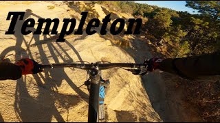
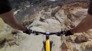
more stats
3.0 miles
Distance
867 ft
Climb
-934 ft
Descent
00:45:54
Avg time
-67 ft
Altitude change
6,394 ft
Altitude min
6,568 ft
Altitude max
6,556 ft
Altitude start
6,489 ft
Altitude end
-0.424%
Grade
-113.242%
Grade max
93.129%
Grade min
1 mile
Distance climb
2 miles
Distance down
1,082 ft
Distance flat
00:45:54
Avg time

Templeton Details

  • Activities
    • Mountain Bike
    • Hike
    • Trail Running
  • Riding Area
    Palmer Park
    Colorado Springs, Colorado
  • Difficulty Rating
  • Local Popularity
    45 in Mountain Biking [+]
    • 75 in Trail Running
    • 65 in Hiking
  • Global Ranking
    #114896 in Mountain Biking [+]
    • #43537 in Trail Running
    • #93612 in Hiking
  • Trail Type
    Singletrack
  • Direction
    Both Directions
  • Dogs Allowed
    Yes

No community description for Templeton trail has been added yet!

AI Generated Description

Templeton is a 3 mile moderately popular black diamond difficulty singletrack trail located near Colorado Springs Colorado. This mountain bike primary trail can be used both directions. On average it takes 45 minutes to complete this trail.

Local Trail Association

Recent Activity on Trail

Past Week
  • 0 rides
  •  
6 Months
  • 2 rides
  • 6 miles avg distance
All
  • 42 rides
  • Last: Sep 14, 2026
c1c2c3c4
January
February
March
April
May
June
July
August
September
October
November
December
Status:
on Jul 3, 2026
Very Dry
Avg: 4.19 (4 votes)
Your vote: 0

view (507)
close
      Directions to templeton trailhead (38.880410, -104.772080)

      Photos

      16 more »
      mtb
      5 |
      Sep 13, 2026 @ 9:59am
      Sep 13, 2026
      mtb
      5 |
      Sep 13, 2026 @ 9:58am
      Sep 13, 2026
      mtb
      239 |
      Sep 2, 2021 @ 10:50am
      Sep 2, 2021
      mtb
      261 |
      Sep 2, 2021 @ 10:50am
      Sep 2, 2021

      Videos

      2 more »
      MTB Snippets| Riding Templeton, The Hardest...
      mtb
      3:48 | 711 | Dec 23, 2020 , Colorado Springs
      youtuber CO MTB ♦︎ | Palmer Park | Templeton Trail...
      mtb
      1411 | Aug 31, 2016 , Colorado Springs

      Routes with this trail

      1.0 6 miles 915 ft 6 Loop
      A fin ride through Plamer Park.
      4.5
      4 Ratings
      5 50%
      4 50%
      3
      2
      1

      4 Reviews & Comments

      kooshpow
      If you like techy climbing with hike a bike sections, ride in recommended direction (counter clockwise). If you like downhill tech, ride in opposite direction (clockwise).
      Jrhockney
      This is the long black monster of Palmer Park... While the downhill parts are blackish, riding the uphill parts (or the downhill parts backwards as many do) border on double black. For a trail in the middle of the city, it is stupidly legit chunky difficulty... if you have tennis like me (or even golfers elbow) don't do this period because it will hurt it like hell with all the up-down rocky transitions. I would have somewhat liked this trail back in the day but after becoming more of a downhill rider who prefers smoother long up and then long down and done, this trail was just a miserable, confusing, and exhausting experience and probably took a full month if riding life off my dropper post. Might be more fun ridden with higher speed if you can just nail everything on the downhill parts fast and hit the constant nasty uphill transitions with speed to get up them but theres usually not alot of room for that. Probably best done with an all mountain but slightly slacker trail bike.
      JackAmlingKIo
      Great Trail, please keep in mind whether this is in your persona skill level, lots of steep sections with big rock features

      We hope you've been enjoying Trailforks!

      Create a FREE account to view all trail reviews and much more.

      • By toddTF Pro Trailforks & contributors
      • #12632 - 3,684 views

      Frequently Asked Questions

      Where is Templeton located?
      Templeton is located in Palmer Park, Colorado Springs, Colorado, United States. It is part of the Palmer Park trail network. The trailhead is located at coordinates 38.88041, -104.77208.
      How hard is Templeton?
      Templeton is rated as Black Diamond difficulty. The average grade is 0.424%.
      What is the elevation gain for Templeton?
      Templeton has 867 ft of elevation gain. The trail has 934 ft of elevation descent. The elevation ranges from 6,394 ft to 6,568 ft.
      Is Templeton a point to point trail?
      Templeton is not a point to point trail. The direction is Both Directions. The trail type is singletrack.
      How long is Templeton?
      Templeton is 3.0 miles long. The trail type is singletrack.
      Are dogs allowed on Templeton?
      Yes, dogs are allowed on Templeton. Please keep dogs on a leash where required and clean up after them.
      When is the best time of year to ride Templeton?
      Based on activity log data, the most popular months to ride Templeton are:
      • July (2 activities)
      • January (1 activities)
      • February (1 activities)
      Check the reports page for current trail conditions.
      How do I access Templeton? Where is the closest parking trailhead?
      The closest parking and trailhead locations to Templeton are: View all parking locations in the area.
      How long does it take to ride Templeton?
      Based on recorded activities, it takes an average of 41 minutes to ride Templeton. The trail is 3.0 miles long. Actual times will vary based on fitness level, conditions, and pace. View recent activity logs for more details.
      How busy is Templeton?
      Templeton is a moderately popular trail. There have been 521 recorded activities on this trail. The trail has received 507 check-ins. View recent activity on this trail.

      Hit the Trail

      Open in App

      Get this trail on your phone instantly.

      open trail in app

      Download Trail

      Save to wishlist, Garmin & download.
      save the trail

      Find Related Routes

      Find routes and users activities that include this trail.
      find routes for this trail

      You must enter a description before submitting.