
more stats
4.5 miles
Distance
234 ft
Climb
-1,848 ft
Descent
00:46:47
Avg time
-1,615 ft
Altitude change
9,483 ft
Altitude min
11,288 ft
Altitude max
11,098 ft
Altitude start
9,482 ft
Altitude end
-6.8%
Grade
-111.1%
Grade max
32.7%
Grade min
3,494 ft
Distance climb
4 miles
Distance down
217 ft
Distance flat
00:46:47
Avg time

Teocalli Ridge Details

  • Activities
    • Mountain Bike
    • E-Bike
    • Horse
    • Hike
    • Trail Running
    • Dirtbike/Moto
  • Riding Area
    Brush Creek
    Crested Butte, Colorado
  • Ref Number
    #557
  • Difficulty Rating
  • Voted Difficulty
    Black Diamond (1 vote)
  • Local Popularity
    90 in Mountain Biking heatmap [+]
    • 100 in E-Biking
    • 90 in Trail Running
    • 45 in Hiking
    • 70 in Dirtbiking
    • 5 in Horseback
  • Global Ranking
    #25820 in Mountain Biking [+]
    • #76127 in E-Biking
    • #70569 in Trail Running
    • #50363 in Hiking
    • #5215 in Dirtbiking
    • #1028 in Horseback
  • State Ranking
    #340 in Mountain Biking · Colorado [+]
    • #739 in E-Biking
    • #2,082 in Trail Running
    • #1,741 in Hiking
    • #219 in Dirtbiking
    • #20 in Horseback
  • Hiking SAC Scale
    T2 Mountain Hiking
  • Trail Type
    Singletrack
  • Direction
    Downhill Primary
    Popular Direction Shown
  • Climb Difficulty
    Black Diamond
  • Physical Rating
    Hard
  • Dogs Allowed
    Yes
  • eBike Allowed
    Yes up to Class 1

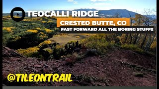
This is an epic trail with a fast and furious downhill. Embedded rocks all along the way down. Lost of places to grip climbing up, though sometimes loose in locations where it gets a bit washed out in some spots that are like little gullys. But a lot of buff sections as it gets a lot of traffic during summer.

Tags
Ridgeline

Trail Supporters

Local Trail Association

Traditionally Indigenous Territory

Recent Activity on Trail

Past Week
  • 0 rides
  •  
6 Months
  • 85 rides
  • 17 miles avg distance
All
  • 406 rides
  • Last: Oct 9, 2026
c1c2c3c4
January
February
March
April
May
June
July
August
September
October
November
December
update trails status or condition

Teocalli Ridge Trail Reports

statusdatedescription
Aug 29, 2026 @ 10:31am (America/Denver)
Aug 29, 2026
No wet spots, no ruts, just braking bumps
Jun 11, 2026 @ 9:27am (America/Denver)
Jun 11, 2026
One tree near start of trail up top.
May 27, 2026 @ 9:56am (America/Denver)
May 27, 2026
Still snowy up top in the trees, have patience it’s still May
Oct 30, 2025 @ 11:27am (America/Denver)
Oct 30, 2025
Snow/ice on north facing sections, but otherwise in great shape
Jul 11, 2025 @ 9:35am
Jul 11, 2025
more »
Status:
on Aug 29, 2026
Dry
Avg: 4.28 (37 votes)
Your vote: 0

view (2,636)
close
      Directions to teocalli-ridge trailhead (38.945950, -106.873840)

      Photos

      75 more »
      mtb
      222 |
      Jul 15, 2024 @ 4:10pm
      Jul 15, 2024
      mtb
      208 |
      Jul 15, 2024 @ 4:10pm
      Jul 15, 2024
      mtb
      196 |
      Jul 15, 2024 @ 4:10pm
      Jul 15, 2024
      mtb
      188 |
      Jul 15, 2024 @ 4:09pm
      Jul 15, 2024

      Videos

      11 more »
      youtuber Is this the best high-speed trail in the US? |...
      mtb
      9:10 | 930 | Aug 10, 2021 , Crested Butte
      youtuber Is the Descent on Teocalli Ridge Really Worth...
      mtb
      14:16 | 754 | Sep 3, 2019 , Crested Butte
      youtuber Best Trail in Crested Butte?! | Teocalli Ridge...
      mtb
      7:25 | 825 | Oct 4, 2018 , Crested Butte
      Teocalli ridge - Crested Butte, CO - MTB Trail...
      mtb
      5:16 | 124 | Dec 20, 2024 , Crested Butte

      Routes with this trail

      more »
      ★ 4.0 • 19 miles • 3,334 ft • 10 • Loop •
      Teocalli Ridge defines Crested Butte mountain biking! A classic mix of unforgettable alpine vistas, steep...
      ★ 5.0 • 11 miles • 2,234 ft • 3 •
      ★ 5.0 • 102 miles • 16,878 ft • 19 • Loop •
      Originally, this trail was ridden by Crested Butte locals each year at the end of the season. This is the...
      4.3 ★★★★★
      37 Ratings
      5 ★ 65%
      4 ★ 14%
      3 ★ 16%
      2 ★
      1 ★ 5%

      14 Reviews & Comments

      Vanouellette Vanouellette
      xav1029 must be smoking cr*ck or something. This is an amazing trail that is incredibly beautiful. Really sick fast down that has many line choices and a bunch of sweet gaps. I had a blast, the end of the climb is forsure challenging but absolutely worth it. Gets a little more chill at the bottom with some sweet lil doubles and jibs
      xav1029
      The juice wasn't worth the squeeze. Amazing views, however, the descent only a VERY short section that would warrant a black rating. If you don't have Colorado lungs, then the climb isn't easy. I was expecting something a bit more technical that would last longer, instead it was a fairly smooth high speed descent lasting roughly 15min without pushing. If you enjoy climbing and great views, then this is the trail. If you are looking for a bit more challenging track, then skip this.
      Mahturbs
      Upper section so fun then becomes wandering and XC...epitome of Colorado riding 15 yrs ago but feeling a bit tired now

      We hope you've been enjoying Trailforks!

      Create a FREE account to view all trail reviews and much more.

      • By toddTF Pro Trailforks & contributors
      • #13432 - 12,823 views

      Frequently Asked Questions

      ▼ Where is Teocalli Ridge located?
      Teocalli Ridge is located in Brush Creek, Crested Butte, Colorado, United States. It is part of the Brush Creek trail network. The trailhead is located at coordinates 38.94595, -106.87384.
      ▼ How hard is Teocalli Ridge?
      Teocalli Ridge is rated as Black Diamond difficulty. The physical rating is Hard. The average grade is 6.8%. The climb difficulty is rated Black Diamond.
      ▼ What is the elevation gain for Teocalli Ridge?
      Teocalli Ridge has 234 ft of elevation gain. The trail has 1,848 ft of elevation descent. The elevation ranges from 9,483 ft to 11,288 ft.
      ▼ Is Teocalli Ridge a point to point trail?
      Teocalli Ridge is not a point to point trail. The direction is Downhill Primary. The trail type is singletrack.
      ▼ How long is Teocalli Ridge?
      Teocalli Ridge is 4.5 miles long. The trail type is singletrack.
      ▼ Are dogs allowed on Teocalli Ridge?
      Yes, dogs are allowed on Teocalli Ridge. Please keep dogs on a leash where required and clean up after them.
      ▼ How do I access Teocalli Ridge? Where is the closest parking trailhead?
      The closest parking and trailhead locations to Teocalli Ridge are: View all parking locations in the area.
      ▼ How long does it take to ride Teocalli Ridge?
      Based on recorded activities, it takes an average of 47 minutes to ride Teocalli Ridge. The trail is 4.5 miles long. Actual times will vary based on fitness level, conditions, and pace. View recent activity logs for more details.
      ▼ How busy is Teocalli Ridge?
      Teocalli Ridge is a very popular trail. There have been 2,685 recorded activities on this trail. The trail has received 2,636 check-ins. View recent activity on this trail.

      Hit the Trail

      Open in App

      Get this trail on your phone instantly.

      open trail in app

      Download Trail

      Save to wishlist, Garmin & download.
      save the trail

      Find Related Routes

      Find routes and users activities that include this trail.
      find routes for this trail

      You must enter a description before submitting.