



Open in App
Get this trail on your phone instantly.

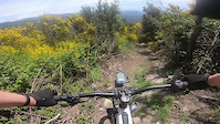
CAT: comença per un tros del GR11 en pujada, just començada la baixada enllaça a esquerra amb el Trail, tècnic al principi per pedres, amb més flow la segona part, amb algun salt. Molt recomanable.
ENG: it begins following uphill the GR11 marks, a hundred meters after ending the uphill section, turns left, first with a long rock and technical section. The second part is much flow with few jumps. Highly recommended.
CAT: Coll de l'Auleda, mirant a nord inici a l'esquerra, per les marques de GR.
ENG: Auleda pass, following the GR marks (red and white), to the west.
| c1 | c2 | c3 | c4 |
|---|---|---|---|
January | February | March | April |
May | June | July | August |
September | October | November | December |

Service Road Atlas is a free to use, community-driven service for viewing and creating reports on the numerous back-country service roads around B.C. and Alberta.
Save the current map location and zoom level as your default home location whenever this page is loaded.
SaveWe hope you've been enjoying Trailforks!
Create a FREE account to view all trail reviews and much more.
You must enter a description before submitting.

