
more stats
4,327 ft
Distance
31 ft
Climb
-853 ft
Descent
00:08:32
Avg time
-823 ft
Altitude change
2,066 ft
Altitude min
2,888 ft
Altitude max
2,888 ft
Altitude start
2,067 ft
Altitude end
-19%
Grade
-61.8%
Grade max
14.6%
Grade min
390 ft
Distance climb
3,796 ft
Distance down
144 ft
Distance flat
00:08:32
Avg time

The Baconator Details

  • Activities
    • Mountain Bike
    • E-Bike
  • Riding Area
    Noble Canyon
    Vernon, British Columbia
  • Difficulty Rating
  • Voted Difficulty
    Black Diamond (2 votes)
  • Local Popularity
    75 in Mountain Biking heatmap [+]
    • 55 in E-Biking
  • Global Ranking
    #37775 in Mountain Biking [+]
    • #43761 in E-Biking
  • Provincial Ranking
    #1,869 in Mountain Biking · British Columbia [+]
    • #3,043 in E-Biking
  • Trail Type
    Singletrack
  • Bike Type
    DH, AM
  • Physical Rating
    Hard
  • Season
    End of April - November
  • Dogs Allowed
    Yes
  • eBike Allowed
  • TTFs on Trail
    Bridge, Drop, Jump

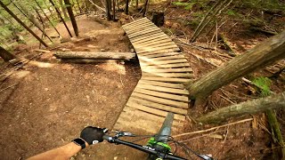
The Baconator is a fast flowy reclaimed/rebuffed trail with some steeper lines and dirt/wood jump features. As some of the older features become dated please remember to always look before you leap. It can be ridden as the second half of the combination Sauce on Side/Baconator run from the top or it can be ridden solo earlier in the season providing the snow level allows access to the trailhead. All around fun trail for your 145mm to 200mm bike.

Tags
BridgesDropsFlowyJumps

Local Trail Association

Recent Activity on Trail

Past Week
  • 0 rides
  •  
6 Months
  • 20 rides
  • 8 miles avg distance
All
  • 139 rides
  • Last: Nov 15, 2026
c1c2c3c4
January
February
March
April
May
June
July
August
September
October
November
December
update trails status or condition

The Baconator Trail Reports

statusdatedescription
Apr 26, 2026 @ 8:03pm (America/Vancouver)
Apr 26, 2026
Mar 31, 2026 @ 4:56pm (America/Vancouver)
Mar 31, 2026
Ice on the road and a handful of trees down on the trail. None in any of the “crux” zones, so don’t worry too much. Props to the builders...
Jun 29, 2025 @ 10:57am
Jun 29, 2025
Jun 14, 2025 @ 1:43pm
Jun 14, 2025
May 5, 2024 @ 12:33pm
May 5, 2024
Trail is in perfect shape.
more »
Status:
on Apr 26, 2026
Ideal
Avg: 4.43 (23 votes)
Your vote: 0

view (1,107)
close
      Directions to the-baconator trailhead (50.260790, -119.098060)

      Photos

      38 more »
      mtb
      52 |
      Apr 26, 2026 @ 5:46pm
      Apr 26, 2026
      mtb
      273 |
      Sep 8, 2021 @ 9:20pm
      Sep 8, 2021
      mtb
      204 |
      Sep 8, 2021 @ 9:20pm
      Sep 8, 2021
      mtb
      384 |
      Oct 3, 2020 @ 6:14pm
      Oct 3, 2020

      Videos

      11 more »
      youtuber Vernon's best Trail: BACONATOR!
      mtb
      5:44 | 564 | Aug 30, 2022 , Vernon
      youtuber I broke my back - Injury Update
      mtb
      7:33 | 408 | Oct 5, 2023 , Vernon
      Baconator (Cinematic)
      mtb
      2:10 | 612 | Apr 3, 2021 , Vernon
      Snowble Canyon
      mtb
      2:48 | 313 | Dec 17, 2019 , Vernon
      4.6 ★★★★★
      23 Ratings
      5 ★ 78%
      4 ★ 13%
      3 ★
      2 ★ 4%
      1 ★ 4%

      8 Reviews & Comments

      dfbland dfbland
      Put the GPS on if you're not riding with the locals... Lots of dirtbike trails in the area. Gnarly and fun.
      shredb4dead shredb4dead
      If you go left off the road at the 7k marker across/under the power lines you should be able to find the entrance to the Baconator. We enter from there in the early season at 7k and ride only the Baconator when there is still snow up high. On your way in you will cross a moto trail and go up and down some. There are some downed trees at this time. Once you get past the last downed tree the trail merging in on the right is the end of Sauce on Side. The video above shows the end of SOS at 4:21. Not sure if that helps but you can always PM me and I can show you person sometime if you like.
      RMWB RMWB
      This might help with GPS. The trail forks segment is named Baconator but is both trails right now, I broke them down on Strava as best as I could.

      https://www.strava.com/segments/10159876

      https://www.strava.com/segments/10159878

      We hope you've been enjoying Trailforks!

      Create a FREE account to view all trail reviews and much more.

      • By ThatDanTF Pro & contributors
      • #33045 - 10,186 views

      Frequently Asked Questions

      ▼ Where is The Baconator located?
      The Baconator is located in Noble Canyon, Vernon, British Columbia, Canada. It is part of the Noble Canyon trail network. The trailhead is located at coordinates 50.26079, -119.09806.
      ▼ How hard is The Baconator?
      The Baconator is rated as Black Diamond difficulty. The physical rating is Hard. The average grade is 19%.
      ▼ What is the elevation gain for The Baconator?
      The Baconator has 31 ft of elevation gain. The trail has 853 ft of elevation descent. The elevation ranges from 2,066 ft to 2,888 ft.
      ▼ How long is The Baconator?
      The Baconator is 4,327 ft long. The trail type is singletrack.
      ▼ Are dogs allowed on The Baconator?
      Yes, dogs are allowed on The Baconator. Please keep dogs on a leash where required and clean up after them.
      ▼ When is the best time of year to ride The Baconator?
      The Baconator is best visited during: End of April - November.
      ▼ How do I access The Baconator? Where is the closest parking trailhead?
      The closest parking and trailhead locations to The Baconator are: View all parking locations in the area.
      ▼ How long does it take to ride The Baconator?
      Based on recorded activities, it takes an average of 9 minutes to ride The Baconator. The trail is 4,327 ft long. Actual times will vary based on fitness level, conditions, and pace. View recent activity logs for more details.
      ▼ How busy is The Baconator?
      The Baconator is a very popular trail. There have been 992 recorded activities on this trail. The trail has received 1,107 check-ins. View recent activity on this trail.

      Hit the Trail

      Open in App

      Get this trail on your phone instantly.

      open trail in app

      Download Trail

      Save to wishlist, Garmin & download.
      save the trail

      Find Related Routes

      Find routes and users activities that include this trail.
      find routes for this trail

      You must enter a description before submitting.


