The Brazilian Details
-
Activities
- Mountain Bike
- Hike
- Trail Running
-
Riding AreaDome Valley
Warkworth -
Difficulty Rating
-
Trail TypeSingletrack
-
Bike TypeAM, XC
-
DirectionDownhill PrimaryPopular direction shown
-
Dogs AllowedYes
-
TTFs on TrailBridge, Log Ride
-
Global Ranking#153898 in Mountain Biking
-
Local Popularity40 in Mountain Biking [+]
- 5 in Trail Running
- 5 in Hiking
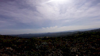
Predominantly downhill trail through grass and pine forest. Log bridge midway requires carry, short pinch climbs. Can be ridden all year. Start is hard to see, entry is up bank to left (south) side of forest road when riding downhill. look for pink marker tape in tree opposite side of road.
Local Trail Association
-

-
Please consider joining or donating to the local trail association to supportdonate to earn trail karma!
trail development & maintenance.
Traditionally Indigenous Territory
More Stats for The Brazilian mountain bike trail trail
-
Altitude change-294 ft
-
Altitude min595 ft
-
Altitude max888 ft
-
Altitude start888 ft
-
Altitude end595 ft
-
Grade max-33.254%
-
Grade min10.348%
-
Distance climb435 ft
-
Distance down2,491 ft
-
Distance flat1,239 ft
-
Avg time00:17:47
-
Avg reverse time00:25:21
- view trail stats
-
Layers w
- Map Content
- More Layers
- Pro
- Pro
- Pro
- Pro
- Pro
- Pro
- Pro
- Pro
-
Upgrade to

- Unknown
- Snow Groomed
- Snow Packed
- Snow Covered
- Snow Cover Partial
- Freeze/thaw Cycle
- Icy
- Prevalent Mud
- Wet
- Variable
- Ideal
- Dry
- Very Dry
The colour categories are based on what percentage of riders are riding a trail in its intended direction.
- > 96%
- > 90%
- > 80%
- > 70%
- > 50%
- < 50%
- bi-directional trail
- no data
- < 2 days
- < 1 week
- < 2 weeks
- < 1 month
- < 6 months
- > 6 months
- Downhill Only
- Downhill Primary
- Both Directions
- Uphill Primary
- Uphill Only
- One Direction
- Description
- Photos
- Description & Photos
- Videos
- most popular
- popular
- less popular
- not popular

- mountain biking recent
- mountain biking (>6 month)
- hiking (1 year)
- moto (1 year)
- Downhill Ski
- Backcountry Ski
- Nordic Ski
- Snowmobile
Save the current map location and zoom level as your default home location whenever this page is loaded.
SaveThe Brazilian Trail Reports
Trail reports are used to indicate a trails current condition and inform builders and other riders about any issues on a trail.
Recent Ridelog Activity on Trail
- 0 rides
- 1 rides
- 8.8 km avg distance
- 76 rides
- Last: Feb 8, 2024
Photos
Trail Lists
-
bestof
11 trails
Reviews / Comments
No reviews yet, be the first to write a review or ask a question.
Use trail reports to comment on trail conditions.
We hope you've been enjoying Trailforks!
Create a FREE account to view trail comments and much more.
Videos
Nearby Trails
- Dome Valley Dh 1 mile
- Arborland 1 mile
- Radio Towers 1 mile
- Forestry Road 2 miles
- Matakana To Omaha Flats Cycle Path 11 miles
- By ralley
 & contributors
 - #39198 - 2,272 views
- follow/subscribe
- login to download gpx or kml files.
You must enter a description before submitting.