

more stats
3,927 ft
Distance
-469 ft
Descent
00:22:39
Avg time
-471 ft
Altitude change
1,177 ft
Altitude min
1,648 ft
Altitude max
1,648 ft
Altitude start
1,178 ft
Altitude end
-12%
Grade
-64%
Grade max
-0.9%
Grade min
3,816 ft
Distance down
112 ft
Distance flat
00:22:39
Avg time

The Chad Details

  • Activities
    • Mountain Bike
    • E-Bike
    • Hike
    • Trail Running
  • Riding Area
  • Difficulty Rating
  • Local Popularity
    20 in Mountain Biking [+]
    • 50 in E-Biking
    • 60 in Trail Running
    • 75 in Hiking
  • Global Ranking
    #115958 in Mountain Biking [+]
    • #48754 in E-Biking
    • #125746 in Trail Running
    • #72474 in Hiking
  • National Ranking
    #627 in Mountain Biking · México [+]
    • #427 in E-Biking
    • #342 in Trail Running
    • #128 in Hiking
  • Hiking SAC Scale
    T1 Hiking
  • Trail Type
    Singletrack
  • Bike Type
    AM, XC
  • Climb Difficulty
    Double Black Diamond
  • Physical Rating
    Hard
  • Dogs Allowed
    Yes
  • eBike Allowed
    Yes up to Class 1
  • TTFs on Trail
    Drop, Rock Face, Rock Garden, Roller Coaster, Other

Welcome to "The Chad"
The Chad is named after Chad Christy, he used to spend his winters in La Ventana, biking, kiting, enjoying life !
Chad tragically passed away in October 2019 in Whistler riding his bike.
If you knew Chad you will remember his charismatic big Smile and long curly hair, this man was like no other.
Chad loved junky riding, so this trail is the perfect one for his memory.
Play.
laugh like a kid.
Enjoy this rad trail guy.
We love you Chad, we will never forget you.

Tags
DropsRock gardensRock slabsRollers
Local Trail Association
Traditionally Indigenous Territory

Recent Activity on Trail

Past Week
  • 0 rides
  •  
6 Months
  • 0 rides
  •  
All
  • 42 rides
  • Last: Mar 5, 2026
c1c2c3c4
January
February
March
April
May
June
July
August
September
October
November
December
update trails status or condition

The Chad Trail Reports

statusdatedescription
Jan 4, 2026 @ 9:43am (America/Mazatlan)
Jan 4, 2026
looks like it hasn't been ridden in a while, some sections are eroded or damaged by the recent rains
Jan 21, 2025 @ 8:32am
Jan 21, 2025
Nov 26, 2024 @ 9:35am
Nov 26, 2024
Feb 21, 2024 @ 9:44am
Feb 21, 2024
Cleaning up the Monster Truck Arroyo on The Chad.
Feb 16, 2024 @ 7:57pm
Feb 16, 2024
I didn't know Chad, but he must have been a gem to have a trail named in his memory. Early this morning we had our final spa date including a...
more »
Status:
on Jan 4, 2026
Dry
Avg: 4.17 (5 votes)
Your vote: 0

view (232)
close
      Directions to the-chad trailhead (24.116110, -110.029460)

      Photos

      36 more »
      mtb
      112 |
      Feb 9, 2025 @ 7:55pm
      Feb 9, 2025
      mtb
      96 |
      Feb 9, 2025 @ 7:55pm
      Feb 9, 2025
      mtb
      86 |
      Feb 9, 2025 @ 7:54pm
      Feb 9, 2025
      mtb
      117 |
      Feb 9, 2025 @ 7:54pm
      Feb 9, 2025

      Videos

      1 more »
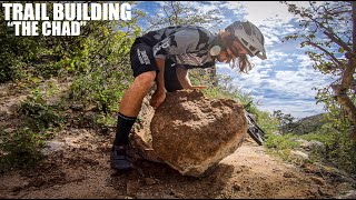
      youtuber CAVEMAN TRAIL BUILDING, NO TOOLS 'THE CHAD' !!
      mtb
      13:30 | 1472 | Feb 22, 2020 , El Sargento

      Routes with this trail

      14 miles • 2,785 ft • 8 • Loop •
      Originally ridden with an E-bike this would also be suitable for a regular bike outing. You will get great...
      4.4 ★★★★★
      5 Ratings
      5 ★ 40%
      4 ★ 60%
      3 ★
      2 ★
      1 ★

      6 Reviews & Comments

      birdman74 birdman74
      I didn't know Chad, but he must have been a gem to have a trail named in his memory.
      Early this morning we had our final spa date including a Mani, Pedi, and a comb-over.
      I brought a rake up to help maintain The Chad, formerly known as Don Diablo to be left at the start of the trail.
      Named after the annual running race from LA Paz to the hot spring beach in El Sargento.
      In 2017 I found this donkey trail that I started renovating to be a gnarly tech-flow trail.
      It's quite possibly the most difficult mountain bike trail in Baja.
      Pre-ride, ride and shred...safely!
      I managed to fix it up over the last week during my dawn patrol rides.
      It's in amazing shape right now for bikes, hikes and running.
      Tomorrow is my last day before we fly home to Fernie B.C. and get back to grooming winter trails and some Chubbin before the spring.
      I just wanted to say a huge thank you to all involved in keeping all these trails in awesome shape.
      Here are some photos I took this morning.
      Enjoy the ride!
      rdhfreethought
      This is one of those technocal trails that deserves double black, just because its hard to clean it. There are several rocky sections that might damage bike or body. Nothing steep, just tight and rocky, so easy to OTB or rip off a derailleur. Between these sections is sand, which kills what would have more flow. 4/5 because its the only technical trail in the area. However, the single black Las Minitas has much better flow, but is really a spicy blue, and only a black due to hairpin switchbacks. Climb Minitas to get to the blue connector to Chad. THE CHAD ends back at Brio.
      Leojb Leojb
      Double black is not an exaggeration - i had to walk the hardest parts of the trail. But that's all good. Important to have a trail that is too technical for me. How else am i going to get better?

      We hope you've been enjoying Trailforks!

      Create a FREE account to view all trail reviews and much more.

      • By yoannbarelliTF Pro & contributors
      • #256891 - 4,466 views

      Frequently Asked Questions

      ▼ Where is The Chad located?
      The Chad is located in El Sargento Trail System, El Sargento, México. It is part of the El Sargento Trail System trail network. The trailhead is located at coordinates 24.11611, -110.02946.
      ▼ How hard is The Chad?
      The Chad is rated as Double Black Diamond difficulty. The physical rating is Hard. The average grade is 12%. The climb difficulty is rated Double Black Diamond.
      ▼ What is the elevation gain for The Chad?
      The trail has 469 ft of elevation descent. The elevation ranges from 1,177 ft to 1,648 ft.
      ▼ How long is The Chad?
      The Chad is 3,927 ft long. The trail type is singletrack.
      ▼ Are dogs allowed on The Chad?
      Yes, dogs are allowed on The Chad. Please keep dogs on a leash where required and clean up after them.
      ▼ How do I access The Chad? Where is the closest parking trailhead?
      The closest parking and trailhead locations to The Chad are: View all parking locations in the area.
      ▼ How long does it take to ride The Chad?
      Based on recorded activities, it takes an average of 23 minutes to ride The Chad. The trail is 3,927 ft long. Actual times will vary based on fitness level, conditions, and pace. View recent activity logs for more details.
      ▼ How busy is The Chad?
      The Chad is a less popular trail with lighter traffic. There have been 208 recorded activities on this trail. The trail has received 232 check-ins. View recent activity on this trail.

      Hit the Trail

      Open in App

      Get this trail on your phone instantly.

      open trail in app

      Download Trail

      Save to wishlist, Garmin & download.
      save the trail

      Find Related Routes

      Find routes and users activities that include this trail.
      find routes for this trail

      You must enter a description before submitting.