

more stats
4,590 ft
Distance
25 ft
Climb
-493 ft
Descent
00:07:50
Avg time
-466 ft
Altitude change
3,511 ft
Altitude min
3,986 ft
Altitude max
3,986 ft
Altitude start
3,520 ft
Altitude end
-10.1%
Grade
-40.5%
Grade max
13.7%
Grade min
594 ft
Distance climb
3,337 ft
Distance down
633 ft
Distance flat
00:07:50
Avg time

The Deep End Details

  • Activities
    • Mountain Bike
    • E-Bike
    • Hike
    • Trail Running
  • Riding Area
    Cranbrook Community Forest
    Cranbrook, British Columbia
  • Difficulty Rating
  • Voted Difficulty
    Black Diamond (4 votes)
  • Local Popularity
    80 in Mountain Biking [+]
    • 60 in E-Biking
    • 65 in Trail Running
    • 55 in Hiking
  • Global Ranking
    #46279 in Mountain Biking [+]
    • #45021 in E-Biking
    • #87042 in Trail Running
    • #92838 in Hiking
  • Trail Type
    Singletrack
  • Bike Type
    DH, AM
  • Climb Difficulty
    Black Diamond
  • Physical Rating
    Hard
  • Trail Visibility
    Always easy to follow
  • Dogs Allowed
    Yes
  • eBike Allowed
    Yes up to Class 1
  • Land Owner
    FLNROD

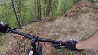
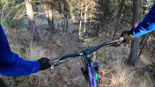
A challenging decent from the height of land between Cranbrook and the Steeples Range.

Local Trail Association
Traditionally Indigenous Territory

Recent Activity on Trail

Past Week
  • 1 rides
  • 8 miles average
6 Months
  • 54 rides
  • 11 miles avg distance
All
  • 249 rides
  • Last: Sep 20, 2026
update trails status or condition

The Deep End Trail Reports

statusdatedescription
Apr 7, 2026 @ 5:01pm (America/Edmonton)
Apr 7, 2026
reporter CRANBROOK COMMUNITY FOREST OFFICIAL: We are now fully open. Beware of early season hazards as our trail crew continues to remove winter debris.
Mar 12, 2026 @ 6:09pm (America/Edmonton)
Mar 12, 2026
reporter CRANBROOK COMMUNITY FOREST OFFICIAL: If it’s not frozen - don’t ride. When warm, the ground is WAY too soft for tires. The trails experienced...
Feb 13, 2026 @ 2:39pm (America/Edmonton)
Feb 13, 2026
reporter OFFICIAL CRANBROOK COMMUNITY FOREST: Ride only when the trails are frozen / firm. We are turning around when we encounter soft conditions - are...
Oct 25, 2025 @ 11:28am (America/Creston)
Oct 25, 2025
Jun 15, 2025 @ 4:27pm
Jun 15, 2025
The conditions were not bad, but his trail is tough.
more »
Status:
on Apr 7, 2026
Variable
Avg: 4.23 (11 votes)
Your vote: 0

view (928)
close
      Directions to the-deep-end trailhead (49.535880, -115.704390)

      Photos

      5 more »
      mtb
      213 |
      Jun 14, 2018 @ 2:37pm
      Jun 14, 2018
      mtb
      187 |
      Jun 14, 2018 @ 9:49am
      Jun 14, 2018
      mtb
      250 |
      May 28, 2016 @ 1:42pm
      May 28, 2016
      report
      mtb
      79 |
      Jul 13, 2024 @ 8:36pm
      Jul 13, 2024

      Videos

      2 more »
      the deep end (1440p60)
      mtb
      6:25 | 537 | Aug 20, 2021 , Cranbrook
      Deep End - Cranbrook Community Forest
      mtb
      2:18 | 504 | Nov 4, 2020 , Cranbrook

      Routes with this trail

      3.5 12 miles 1,955 ft 9 Loop
      Route showcasing some of the best descents in the forest
      3.0 18 miles 2,763 ft 13 Loop
      This route takes in some of the best riding in the CCF
      4.4
      11 Ratings
      5 64%
      4 18%
      3 9%
      2 9%
      1

      7 Reviews & Comments

      clandrock clandrock
      One of the funnier trails I rode while in Cranbrook - nice tight single track. Mostly blue, but earns the black with some steep technical sections with a bit of exposure. Would be a blue or easy black on the north shore.
      tombraumandl
      if an old fart can ride it in the snow it ain't double black
      sixohfourx sixohfourx
      Super fun, not a double black if your from the north shore. I would say dark blue maybe single black.

      We hope you've been enjoying Trailforks!

      Create a FREE account to view all trail reviews and much more.

      • By Prez2900TF Pro WCC CCFS & contributors
      • #26567 - 2,338 views

      Frequently Asked Questions

      Where is The Deep End located?
      The Deep End is located in Cranbrook Community Forest, Cranbrook, British Columbia, Canada. It is part of the Cranbrook Community Forest trail network. The trailhead is located at coordinates 49.53588, -115.70439.
      How hard is The Deep End?
      The Deep End is rated as Black Diamond difficulty. The physical rating is Hard. The average grade is 10.1%. The climb difficulty is rated Black Diamond.
      What is the elevation gain for The Deep End?
      The Deep End has 25 ft of elevation gain. The trail has 493 ft of elevation descent. The elevation ranges from 3,511 ft to 3,986 ft.
      How long is The Deep End?
      The Deep End is 4,590 ft long. The trail type is singletrack.
      Are dogs allowed on The Deep End?
      Yes, dogs are allowed on The Deep End. Please keep dogs on a leash where required and clean up after them.
      How do I access The Deep End? Where is the closest parking trailhead?
      The closest parking and trailhead locations to The Deep End are: View all parking locations in the area.
      How long does it take to ride The Deep End?
      Based on recorded activities, it takes an average of 8 minutes to ride The Deep End. The trail is 4,590 ft long. Actual times will vary based on fitness level, conditions, and pace. View recent activity logs for more details.
      How busy is The Deep End?
      The Deep End is a very popular trail. There have been 951 recorded activities on this trail. The trail has received 928 check-ins. View recent activity on this trail.

      Hit the Trail

      Open in App

      Get this trail on your phone instantly.

      open trail in app

      Download Trail

      Save to wishlist, Garmin & download.
      save the trail

      Find Related Routes

      Find routes and users activities that include this trail.
      find routes for this trail

      You must enter a description before submitting.