close
-
Layers w
- Weather Layers
- Pro
- Pro
- Pro
- Pro
- Pro
- Pro
- More Layers
- Pro
- Pro
- Pro
- Pro
-
Upgrade to

3D
Trail Conditions
- Unknown
- Snow Groomed
- Snow Packed
- Snow Covered
- Snow Cover Partial
- Freeze/thaw Cycle
- Icy
- Prevalent Mud
- Wet
- Variable
- Ideal
- Dry
- Very Dry
Trail Flow (Ridden Direction)
Trailforks scans users activity logs to determine the most popular direction each trail is ridden. A good flowing trail network will have most trails flowing in a single direction according to their intension.
The colour categories are based on what percentage of users are riding a trail in its intended direction.
The colour categories are based on what percentage of users are riding a trail in its intended direction.
- > 96%
- > 90%
- > 80%
- > 70%
- > 50%
- < 50%
- bi-directional trail
- no data
Trail Last Ridden
Trailforks scans activity logs to determine the last time a trail was ridden.
- < 2 days
- < 1 week
- < 2 weeks
- < 1 month
- < 6 months
- > 6 months
Trail Ridden Direction
The intended direction a trail should be ridden.
- Downhill Only
- Downhill Primary
- Both Directions
- Uphill Primary
- Uphill Only
- One Direction
Contribute Details
Colors indicate trail is missing specified detail.
- Description
- Photos
- Description & Photos
- Videos
Trail Popularity ?
Trailforks scans activity logs to determine which trails are ridden the most in the last 9 months.
Trails are compared with nearby trails in the same city region with a possible 25 colour shades.
Think of this as a heatmap, more activities = more kinetic energy = warmer colors.
- most popular
- popular
- less popular
- not popular
ATV/ORV/OHV Filter
Max Vehicle Width
inches
US Cell Coverage
Legend

Radar Time
Activity Recordings
Trailforks uses anonymized public activity data.
?
Activity Recordings
Trailforks uses anonymized public activity data.
?
Personal Heatmap
▶
Activity Types
all
/
none
▶
Options
2
Date range
month
–
Winter Trails
Warning
A routing network for winter maps does not exist. Selecting trails using the winter trails layer has been disabled.
Missing Trails
Most Popular
Least Popular
Trails are colored based on popularity. The more popular a trail is, the more red. Less popular trails trend towards green.
Jump Magnitude Heatmap
Heatmap of where users jump on trails. Zoom in to see individual jumps, click circles to view jump details.
BC Backroad Status
![map legend]()
Service Road Atlas is a free to use, community-driven service for viewing and creating reports on the numerous back-country service roads around B.C. and Alberta.

Slope Aspect
Direction the slope faces
Trails Deemphasized
Trails are shown in grey.
Only show trails with no bike usage.
Suggested Layers
Based on selected activity type
Save the current map location and zoom level as your default home location whenever this page is loaded.
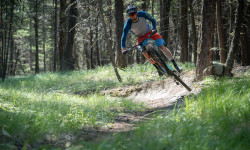
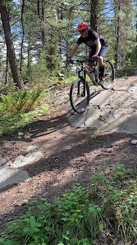
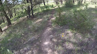
SaveSunny days and mild winters mean that this region of the Kootenay Rockies is one of the first to see the trails clear of snow come spring. Sitting in the Rocky Mountain Trench between the Purcell and Rocky Mountains, this is an ideal mountain bike destination with several distinct trail areas situated close to the city with quiet singletrack trails to black-diamond descents.
Activities Click to view
- Mountain Bike
239 trails
- E-Bike
206 trails
- Gravel Bike
0 trails
- Adaptive Bike
0 trails
- Winter Fat Bike
0 trails
- Horse
50 trails
- Hike
249 trails
- Trail Running
247 trails
- Snowshoe
73 trails
- Nordic Ski
29 trails
Region Details
- 29
- 6
- 50
- 110
- 42
- 2
Region Status
Open as of 1 dayStats
- Avg Trail Rating
- Trails (view details)
- 269
- Trails Mountain Bike
- 239
- Trails E-Bike
- 206
- Trails Horse
- 50
- Trails Hike
- 249
- Trails Trail Running
- 247
- Trails Dirtbike/Moto
- 2
- Trails ATV/ORV/OHV
- 2
- Trails Snowshoe
- 73
- Trails Nordic Ski
- 29
- Total Distance
- 254 miles
- Total Descent
- 45,425 ft
- Total Vertical
- 9,278 ft
- Highest Trailhead
- 9,281 ft
- Reports
- 6,158
- Photos
- 884
- Completed Counter
- 44,934
Articles
Exploring BC's Lesser Known Riding Destinations on the Bikes & Beers Tour
Sep 14, 2019 from pinkbike.com
Seven days of full-on riding on some of British Columbia's best trail networks.
Sub Regions
-
Baker South
- 2
- 2
- 1
-
Cranbrook Community Forest
- 3
- 26
- 52
- 26
-
Mount Baker
- 2
-
South Hill
- 11
- 5
-
South Star Trails
- 17
- 22
- 1
-
Wycliffe Regional Park
- 5
- 22
- 5
- 2
Popular Cranbrook Mountain Biking Trails
• 100 ★ 4.2 • 2 miles • 394 ft • 1,336 •
Pilisit Trail was named after the wife of revered Ktunaxa Chief Isadore. This is an easy beginner trail that is 1.2 meters wide that climbs at 3 - 5 % from the Chief Isadore Trail to the Kettle Lake parking lot. The lower part of the...
• 100 ★ 4.7 • 3,442 ft • 28 ft • 982 •
Continuation of to the forest low point. Natural gully berms, Gs & jumps. Climb back up on .
• 100 ★ 4.4 • 2,110 ft • 18 ft • 936 •
is your classic resort trail, big berms, rock wall rides, wooden ladders and the occasional jump. Sure to put a grin on your face.
• 100 ★ 3.7 • 1,942 ft • 86 ft • 911 •
Small roots and long turns this mostly straight trail can be used to extend your Knights ride or used to access the area.
• 100 ★ 4.5 • 1 mile • 61 ft • 787 •
Great variety as you start on rocky ridges then flow downhill with berms and rock rolls. The grand finale is a machine built flow section that moves into a gully with 14 crossings with natural berms and jumps. Climb back up on or exit...
• 100 ★ 4.1 • 3,517 ft • 235 ft • 777 •
provides a moderate intermediate climb into the middle and upper parts of the trail system. It also provides a fun flowy descent to Kettle Lake as an alternative to .
• 100 ★ 4.1 • 4,173 ft • 232 ft • 763 •
Usually used as a to better riding, is a faster, steeper version of .
• 100 ★ 4.8 • 3 miles • 406 ft • 753 •
Is an Ewok kind of like a small, cute and friendlier version of a Wookie? Compared to , that describes this trail. It makes for either a nice warm up or a final add-on to your mountain bike adventure in the Eager Hills. It rides well in...
Cranbrook Mountain Bike Routes
★ 3.5 • 12 miles • 1,955 ft • 9 • Loop •
Route showcasing some of the best descents in the forest
★ 4.5 • 27 miles • 1,129 ft • 12 • Point to Point •
.The trail is maintained and supported by Trails BC/Rockies Region The Chief Isadore Trail from Cranbrook...
★ 2.9 • 27 miles • 1,129 ft • 12 • Point to Point •
.The trail is maintained and supported by Trails BC/Rockies Region The Chief Isadore Trail from Cranbrook...
★ 3.0 • 18 miles • 2,763 ft • 13 • Loop •
This route takes in some of the best riding in the CCF
★ 1.4 • 10 miles • 552 ft • 10 • Loop •
Opened in May of 2019 The 16km+ loop intergrates graveled dirt trails within the Cranbrook Community...
★ 1.0 • 16 miles • 1,685 ft • 37 • Loop •
This route shows the trails that will be groomed with the Snow Dogs in 2020.
Photos of Cranbrook Mountain Bike
Videos of Cranbrook Mountain Bike
trail: Wizard DH
2:23 |
62 |
May 7, 2022
trail: Wizard DH
0:26 |
24 |
May 7, 2022
trail: Roller Coaster
0:22 |
162 |
Apr 10, 2022
trail: Forest Grove
0:11 |
48 |
Jul 21, 2021
trail: Curly
0:15 |
186 |
Jun 20, 2021
trail: Upper Coaster
0:00 |
257 |
Aug 15, 2019
trail: R2DTour
0:00 |
455 |
Jul 26, 2019
trail: Trail
0:32 |
75 |
Jun 10, 2017
Current Trail Warnings
| status | trail | date | condition | user | info |
|---|---|---|---|---|---|
| The Path #3 | Jul 5, 2026 @ 7:02pm (America/Edmonton) Jul 5, 2026 | Unknown | tkroz | The first elevated drop structure has a... |
Recent Trail Reports
Activity Feed
| username | action | type | title | date |
|---|---|---|---|---|
| PuAZtE | add | report | activity #99790025 | Jul 22, 2026 @ 6:31pm 1 day |
| KenBar | vote | trail | activity #99625251 | Jul 20, 2026 @ 12:01pm Jul 20, 2026 |
| BreRL4JqB | wishlist | trail | activity #99610320 | Jul 20, 2026 @ 8:30am Jul 20, 2026 |
| MBateman | ridden | trail | activity #99580667 | Jul 19, 2026 @ 6:01pm Jul 19, 2026 |
| Bogg16 | add | report | activity #99550380 | Jul 19, 2026 @ 10:48am Jul 19, 2026 |
Recent Comments
| username | type | title | comment | date |
|---|---|---|---|---|
| trail | It may be good climbing it it is great down.... | Jul 13, 2026 @ 1:34pm Jul 13, 2026 | ||
| trail | What a fun day! As a blue rider, it had its... | Jul 7, 2026 @ 7:25pm Jul 7, 2026 | ||
| trail | Totally agree with @onecogpaul. Wish I had... | Jul 1, 2026 @ 1:42pm Jul 1, 2026 | ||
| trail | good trail but outta maintenance. Ride at... | Jun 21, 2026 @ 8:29pm Jun 21, 2026 | ||
| trail | trail needs some love | Jun 21, 2026 @ 2:59pm Jun 21, 2026 |
Local Badges
-

Star Wars Trails - 12 awarded -

The Stooges11 awarded -
Forest Loops0 awarded -

Big Ride 30k1,792 awarded -

Top 10 Trails2 awarded -

Epic Ride 50k720 awarded
Bike & Skill Parks
| name | type | city | rating |
|---|---|---|---|
| Cranbrook Bike Skills Park | skill park | Cranbrook |
Activity Type Stats
| activitytype | trails | distance | descent | descent distance | total vertical | rating | global rank | state rank | photos | reports | routes | activity logs |
|---|---|---|---|---|---|---|---|---|---|---|---|---|
| Mountain Bike | 239 | 204 miles | 37,612 ft | 91 miles | 7,231 ft | #305 | #33 | 803 | 6,084 | 20 | 39,278 | |
| E-Bike | 206 | 177 miles | 29,360 ft | 79 miles | 7,231 ft | #460 | #34 | 6 | 5,839 | 9 | 2,463 | |
| Horse | 50 | 53 miles | 5,817 ft | 23 miles | 1,509 ft | #35 | #4 | 1,282 | 2 | 302 | ||
| Hike | 249 | 239 miles | 41,404 ft | 93 miles | 9,278 ft | #376 | #26 | 53 | 6,058 | 6 | 5,364 | |
| Trail Running | 247 | 238 miles | 40,715 ft | 92 miles | 9,278 ft | #376 | #26 | 10 | 5,984 | 8 | 4,091 | |
| Dirtbike/Moto | 2 | 6 miles | 374 ft | 3 miles | 574 ft | 546 | 70 | |||||
| ATV/ORV/OHV | 2 | 6 miles | 374 ft | 3 miles | 574 ft | 545 | 27 | |||||
| Snowshoe | 73 | 57 miles | 8,645 ft | 17 miles | 5,640 ft | #175 | #19 | 494 | 1 | 220 | ||
| Nordic Ski | 29 | 19 miles | 1,266 ft | 6 miles | 1,427 ft | #433 | #28 | 440 | 2 | 495 |
Frequently Asked Questions About Cranbrook
▼
What are the best places to ride in Cranbrook?
Cranbrook has 10 areas to explore for mountain biking. The top rated areas are:
▼
What are the highest rated mountain biking trails in Cranbrook?
The highest rated mountain biking trails in Cranbrook are:
- Bee-Line DH (4.6/5)
- Stunty (4.6/5)
- Pole Dancer (The Wall Part IV) (4.6/5)
- Ewok and Roll (4.6/5)
- More Poultry (4.5/5)
▼
What is the best time of the year to ride in Cranbrook?
Based on activity log data, the most popular months to ride in Cranbrook are:
- July (1,054 activities)
- August (957 activities)
- June (912 activities)
▼
Where can I park to ride in Cranbrook?
There are 31 parking locations listed in Cranbrook. The most popular parking spots are:
- Isadore Canyon Trailhead
- Kettle Lake Trail Head
- Lower Baker Rd. Trailhead
- Fraggle Rock Trail Head
- Upper Baker Rd. Trail Head
Activities
Trails
Points of Interest
- By barry-mclane
 & contributors
 - Admins: barry-mclane, WCC, CCFS, RDEK, STMS, RDEK
- #3022 - 58,017 views
- cranbrook activity log | embed map of Cranbrook mountain bike trails | cranbrook mountain biking points of interest polygons
Downloading of trail gps tracks in kml & gpx formats is enabled for Cranbrook.
You must login to download files.