more stats
7.2 miles
Distance
63 ft
Climb
-2,046 ft
Descent
00:29:31
Avg time
-1,984 ft
Altitude change
4,778 ft
Altitude min
6,762 ft
Altitude max
6,762 ft
Altitude start
4,777 ft
Altitude end
-5.2%
Grade
-27.9%
Grade max
13.3%
Grade min
1,883 ft
Distance climb
6 miles
Distance down
2,123 ft
Distance flat
00:29:31
Avg time

The Summit Trail Details

  • Activities
    • Mountain Bike
  • Riding Area
    Whitefish Mountain Resort
    Whitefish, Montana
  • Difficulty Rating
  • Voted Difficulty
    Blue (2 votes)
  • Local Popularity
    65 in Mountain Biking heatmap
  • Global Ranking
    #86497 in Mountain Biking
  • State Ranking
    #570 in Mountain Biking · Montana
  • Trail Type
    Singletrack
  • Bike Type
    DH, AM, XC
  • Climb Difficulty
    Blue
  • Physical Rating
    Moderate
  • Trail Visibility
    Always easy to follow
  • Season
    Summer
  • eBike Allowed
  • Land Owner

The trail that started it all This was one of the first machine cut lift accessed bike trails in the west! Classic singletrack cross-country trail with great views. Perfect for beginner and intermediate riders. Connects to the top of the Bad Rock Zone. Uphill riding is discouraged between noon and 5 p.m..
Average Ride Time: Uphill ~2 hours, downhill ~45 minutes

Tags
Hut or cabinSummitViews

Trail Supporters

Bike Park

Local Trail Association

Traditionally Indigenous Territory

Recent Activity on Trail

Past Week
  • 0 rides
  •  
6 Months
  • 35 rides
  • 34.1 km avg distance
All
  • 239 rides
  • Last: Oct 25, 2026
c1c2c3c4
January
February
March
April
May
June
July
August
September
October
November
December
update trails status or condition

The Summit Trail Trail Reports

statusdatedescription
Aug 10, 2026 @ 10:57am (America/Creston)
Aug 10, 2026
Jun 13, 2025 @ 12:48pm
Jun 13, 2025
good to go. minor snow patches at top, but trail is all rideable.
Aug 8, 2024 @ 12:54pm
Aug 8, 2024
Jul 29, 2023 @ 6:36am
Jul 29, 2023
May 12, 2023 @ 8:45pm
May 12, 2023
Clear to top of Zep. Then some mud patches and a couple snow drifts near top of chair 2, but navigable. Past chair 2 still half covered in snow.
more »
Status:
on Aug 10, 2026
Dry
Avg: 3.6 (18 votes)
Your vote: 0

view (1,383)
close
      Directions to the-summit-trail trailhead (48.502860, -114.341610)

      Photos

      10 more »
      mtb
      93 |
      Aug 21, 2025 @ 6:25pm
      Aug 21, 2025
      mtb
      73 |
      Jun 20, 2025 @ 5:43pm
      Jun 20, 2025
      mtb
      145 |
      Jun 21, 2023 @ 2:48pm
      Jun 21, 2023
      mtb
      369 |
      Sep 2, 2019 @ 8:21am
      Sep 2, 2019

      Videos

      1 more »
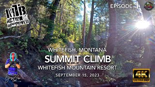
      youtuber MTB Riding Summit, Climbing to Kashmir,...
      mtb
      12:34 | 345 | Oct 16, 2023 , Whitefish

      Routes with this trail

      more »
      ★ 2.0 • 13 miles • 1,773 ft • 13 • Point to Point • Race •
      Stage 1: To get your legs warmed up without a big climb, we'll have you ride up Chair 1 and down GNR,...
      17 miles • 2,734 ft • 9 • Loop • Race •
      Transfer 1 - Ride Up Chair One. Stage 1 - Kashmir (Face) to Freebird (Upper section to summit trail...
      ★ 4.0 • 21 miles • 5,230 ft • 10 • Loop • Race •
      This year's race crosses the resort in 5 stages. Transfer 1 – Up Limelight Stage 1 – Careless Whisper...
      3.5 ★★★★★
      18 Ratings
      5 ★ 22%
      4 ★ 28%
      3 ★ 33%
      2 ★ 11%
      1 ★ 6%

      9 Reviews & Comments

      Mhament22
      Found the climb to be really enjoyable. Has a mellow grade all the way up with stunning views at every corner. Definitely worth the sweat.
      casslemmer
      Easy, a few berms and not really any features to speak of. Went down (not up) after Kashmir ended- could definitely be a green.

      We hope you've been enjoying Trailforks!

      Create a FREE account to view all trail reviews and much more.

      Frequently Asked Questions

      ▼ Where is The Summit Trail located?
      The Summit Trail is located in Whitefish Mountain Resort, Whitefish, Montana, United States. It is part of the Whitefish Mountain Resort trail network. The trailhead is located at coordinates 48.50286, -114.34161.
      ▼ How hard is The Summit Trail?
      The Summit Trail is rated as Blue difficulty. The physical rating is Moderate. The average grade is 5.2%. The climb difficulty is rated Blue.
      ▼ What is the elevation gain for The Summit Trail?
      The Summit Trail has 63 ft of elevation gain. The trail has 2,046 ft of elevation descent. The elevation ranges from 4,778 ft to 6,762 ft.
      ▼ How long is The Summit Trail?
      The Summit Trail is 7.2 miles long. The trail type is singletrack.
      ▼ Are dogs allowed on The Summit Trail?
      There is no information about dogs being allowed on The Summit Trail. Check with local trail managers or the trail page for the latest access rules.
      ▼ When is the best time of year to ride The Summit Trail?
      Based on activity log data, the most popular months to ride The Summit Trail are:
      • July (31 activities)
      • August (27 activities)
      • September (18 activities)
      Check the reports page for current trail conditions.
      ▼ How do I access The Summit Trail? Where is the closest parking trailhead?
      The closest parking and trailhead locations to The Summit Trail are: View all parking locations in the area.
      ▼ How long does it take to ride The Summit Trail?
      Based on recorded activities, it takes an average of 30 minutes to ride The Summit Trail. The trail is 7.2 miles long. Actual times will vary based on fitness level, conditions, and pace. View recent activity logs for more details.
      ▼ How busy is The Summit Trail?
      The Summit Trail is a moderately popular trail. There have been 935 recorded activities on this trail. The trail has received 1,383 check-ins. View recent activity on this trail.

      Hit the Trail

      Open in App

      Get this trail on your phone instantly.

      open trail in app

      Download Trail

      Save to wishlist, Garmin & download.
      save the trail

      Find Related Routes

      Find routes and users activities that include this trail.
      find routes for this trail

      You must enter a description before submitting.