2,605 ft
Distance
5 ft
Climb
-453 ft
Descent
00:02:54
Avg time
Thingymajig Details
-
Activities
- Mountain Bike
-
Riding AreaBen Lomond Trails
Queenstown -
Difficulty Rating
-
Trail TypeSingletrack
-
Bike TypeDH, AM
-
DirectionDownhill OnlyPopular direction shown
-
Trail VisibilityAlways easy to follow
-
Dogs AllowedYes
-
TTFs on TrailBerm, Drop, Jump, Gap Jump
-
Global Ranking#1769 in Mountain Biking
-
Local Popularity65 in Mountain Biking
-
Land Owner
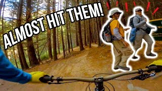
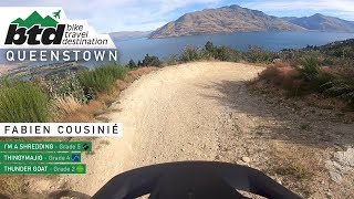
Sweet singletrack, some steeper sections, optional drops and awesome turns...Thingymajig has a bit of everything. Whip it wide on the final tabletop to impress everyone at the mid-way clearing.
source: Skyline Queenstown
Traditionally Indigenous Territory
More Stats for Thingymajig mountain bike trail trail
-
Altitude change-459 ft
-
Altitude min1,999 ft
-
Altitude max2,461 ft
-
Altitude start2,458 ft
-
Altitude end1,998 ft
-
Grade-17.6%
-
Grade max-78.3%
-
Grade min2.7%
-
Distance climb95 ft
-
Distance down2,316 ft
-
Distance flat194 ft
-
Avg time00:02:54
-
Avg reverse time00:09:01
- view trail stats
close
3D
Trail Conditions
- Unknown
- Snow Groomed
- Snow Packed
- Snow Covered
- Snow Cover Partial
- Freeze/thaw Cycle
- Icy
- Prevalent Mud
- Wet
- Variable
- Ideal
- Dry
- Very Dry
Trail Flow (Ridden Direction)
Trailforks scans users ridelogs to determine the most popular direction each trail is ridden. A good flowing trail network will have most trails flowing in a single direction according to their intension.
The colour categories are based on what percentage of riders are riding a trail in its intended direction.
- > 96%
- > 90%
- > 80%
- > 70%
- > 50%
- < 50%
- bi-directional trail
- no data
Trail Last Ridden
Trailforks scans ridelogs to determine the last time a trail was ridden.
- < 2 days
- < 1 week
- < 2 weeks
- < 1 month
- < 6 months
- > 6 months
Trail Ridden Direction
The intended direction a trail should be ridden.
- Downhill Only
- Downhill Primary
- Both Directions
- Uphill Primary
- Uphill Only
- One Direction
Contribute Details
Colors indicate trail is missing specified detail.
- Description
- Photos
- Description & Photos
- Videos
Trail Popularity ?
Trailforks scans ridelogs to determine which trails are ridden the most in the last 9 months.
Trails are compared with nearby trails in the same city region with a possible 25 colour shades.
Think of this as a heatmap, more rides = more kinetic energy = warmer colors.
- most popular
- popular
- less popular
- not popular
ATV/ORV/OHV Filter
Max Vehicle Width
inches
US Cell Coverage
Legend
Radar Time
x
Activity Recordings
Trailforks users anonymized public ridelogs from the past 6 months.
- mountain biking recent
- mountain biking (>6 month)
- hiking (1 year)
- moto (1 year)
Activity Recordings
Trailforks users anonymized public skilogs from the past 12 months.
- Downhill Ski
- Backcountry Ski
- Nordic Ski
- Snowmobile
Winter Trails
Warning
A routing network for winter maps does not exist. Selecting trails using the winter trails layer has been disabled.
x
Missing Trails
Most Popular
Least Popular
Trails are colored based on popularity. The more popular a trail is, the more red. Less popular trails trend towards green.
Jump Magnitude Heatmap
Heatmap of where riders jump on trails. Zoom in to see individual jumps, click circles to view jump details.
Trails Deemphasized
Trails are shown in grey.
Only show trails with NO bikes.
Save the current map location and zoom level as your default home location whenever this page is loaded.
Save
Directions to thingymajig trailhead
(-45.027730, 168.646170)
update trails status or condition
Thingymajig Trail Reports
view all reports »
Recent Ridelog Activity on Trail
Past Week
- 0 rides
6 Months
- 74 rides
- 21 miles avg distance
All
- 309 rides
- Last: Jul 5, 2025
Reviews / Comments
No reviews yet, be the first to write a review or ask a question.
Use trail reports to comment on trail conditions.
We hope you've been enjoying Trailforks!
Create a FREE account to view trail comments and much more.
Videos
more »
youtuber

3:52 |
1083 |
May 11, 2018 , Queenstown
Nearby Trails
- Rock Garden 358 ft
- Drop Garden 377 ft
- Lazy Vertigo 614 ft
- Beeched As 620 ft
- Shikaka 663 ft
- By nakinoah
& contributors
- #8265 - 3,984 views
- follow/subscribe
- login to download gpx or kml files.
You must enter a description before submitting.