
more stats
1,952 ft
Distance
-72 ft
Descent
00:06:21
Avg time
-72 ft
Altitude change
1,225 ft
Altitude min
1,297 ft
Altitude max
1,297 ft
Altitude start
1,227 ft
Altitude end
-3.7%
Grade
-11.5%
Grade max
3%
Grade min
20 ft
Distance climb
1,686 ft
Distance down
246 ft
Distance flat
00:06:21
Avg time

Thunder Chicken Details

  • Activities
    • Mountain Bike
    • E-Bike
  • Riding Area
    Thunder Chicken
    Springdale, Arkansas
  • Difficulty Rating
  • Local Popularity
    25 in Mountain Biking [+]
    • 5 in E-Biking
  • Global Ranking
    #117626 in Mountain Biking [+]
    • #140530 in E-Biking
  • State Ranking
    #726 in Mountain Biking · Arkansas [+]
    • #1,045 in E-Biking
  • Trail Type
    Machine Groomed
  • Bike Type
    DH, AM, DJ
  • Direction
    Downhill Only
    Popular Direction Shown
  • Climb Difficulty
    Green
  • Physical Rating
    Moderate
  • Season
    Jan-Dec
  • Dogs Allowed
    Yes
  • eBike Allowed
    Yes up to Class 1
  • TTFs on Trail
    Berm, Bridge, Drop, Jump, Gap Jump, Wallride
  • Year Opened
    2015

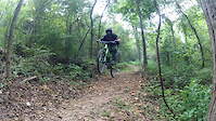
The trail that you probably came to this place for. Thunder Chicken All flow, all jumps, all drops, big jumps (at bottom), wallrides. This is awesome for arkansas. A piece of the big mountains that found its way to arkansas. Tips of advice once you get warmed up and familiar with this trail is to hit everything as fast as you can! Drops, wall rides, and jumps. Built by Progressive Trail Design. Got its name from what was originally going to be the arkansas baseball team now. The Naturals were going to be called the thunder chickens.

Access Info

Ride up the main up trail from the bottom of where all the trails connect. The main up trial will lead you up to the top right where it starts.

Tags
BermsBridgesDropsJumpsWallride
Trail Supporters
  • Progressive Trail Design
    Builder
Local Trail Association

Recent Activity on Trail

Past Week
  • 0 rides
  •  
6 Months
  • 2 rides
  • 9 miles avg distance
All
  • 23 rides
  • Last: Sep 13, 2026
c1c2c3c4
January
February
March
April
May
June
July
August
September
October
November
December
update trails status or condition

Thunder Chicken Trail Reports

statusdatedescription
Apr 23, 2025 @ 4:39pm
Apr 23, 2025
Trails in this area need to be removed from Trailforks. Trails are basically non-existent. Overgrown, washed out, downed trees and not rideable.
Jul 22, 2024 @ 9:57am
Jul 22, 2024
Closed until funding for repairs has been secured
Jul 22, 2024 @ 9:55am
Jul 22, 2024
Closed until funding for repairs is secured
Nov 18, 2023 @ 3:38am
Nov 18, 2023
trail needs major love
Jun 14, 2023 @ 5:08am
Jun 14, 2023
Very, very overgrown. There is big potential with lots of wood features and jumps, but it can't be ridden like that in it's current condition.
more »
Status:
on Apr 23, 2025
Avg: 4.26 (5 votes)
Your vote: 0

view (164)
close
      Directions to thunder-chicken trailhead (36.211640, -94.167130)

      Photos

      8 more »
      mtb
      806 |
      Jul 25, 2015 @ 1:51pm
      Jul 25, 2015
      mtb
      731 |
      Aug 17, 2015 @ 5:27pm
      Aug 17, 2015
      mtb
      606 |
      Aug 25, 2015 @ 11:11am
      Aug 25, 2015
      mtb
      582 |
      Aug 25, 2015 @ 11:11am
      Aug 25, 2015

      Videos

      1 more »
      Not Thunder Chicken
      mtb
      2:18 | 1063 | Aug 29, 2015 , Springdale
      4.6 ★★★★★
      5 Ratings
      5 ★ 60%
      4 ★ 40%
      3 ★
      2 ★
      1 ★

      5 Reviews & Comments

      n72qMR
      Just went to check it out and it’s unrideable, the wood features are all falling apart and the forest has reclaimed most of the trail. Really sucks because this was an awesome trail a couple years ago, I would get out there with a weed eater if that was the only problem but that won’t really help anymore.
      Frown
      bpsmpls bpsmpls
      Looks like these trails have not been maintained in what seems to be a season or two. I'd caution riding these trails until there is an update on continued work for them.
      blaircartwright
      There is a tree snapped over trail about 3/4 down, you might fit under it but it needs cut to be removed FYI

      We hope you've been enjoying Trailforks!

      Create a FREE account to view all trail reviews and much more.

      • By Hotrod4989 & contributors
      • #35866 - 14,586 views

      Frequently Asked Questions

      ▼ Where is Thunder Chicken located?
      Thunder Chicken is located in Thunder Chicken, Springdale, Arkansas, United States. It is part of the Thunder Chicken trail network. The trailhead is located at coordinates 36.21164, -94.16713.
      ▼ How hard is Thunder Chicken?
      Thunder Chicken is rated as Black Diamond difficulty. The physical rating is Moderate. The average grade is 3.7%. The climb difficulty is rated Green.
      ▼ What is the elevation gain for Thunder Chicken?
      The trail has 72 ft of elevation descent. The elevation ranges from 1,225 ft to 1,297 ft.
      ▼ Is Thunder Chicken a point to point trail?
      Yes, Thunder Chicken is a point to point trail. The direction is Downhill Only. The trail type is machine groomed.
      ▼ How long is Thunder Chicken?
      Thunder Chicken is 1,952 ft long. The trail type is machine groomed.
      ▼ Are dogs allowed on Thunder Chicken?
      Yes, dogs are allowed on Thunder Chicken. Please keep dogs on a leash where required and clean up after them.
      ▼ When is the best time of year to ride Thunder Chicken?
      Thunder Chicken is best visited during: Jan-Dec.
      ▼ How do I access Thunder Chicken? Where is the closest parking trailhead?
      The closest parking and trailhead locations to Thunder Chicken are: View all parking locations in the area.
      ▼ How long does it take to ride Thunder Chicken?
      Based on recorded activities, it takes an average of 3 minutes to ride Thunder Chicken. The trail is 1,952 ft long. Actual times will vary based on fitness level, conditions, and pace. View recent activity logs for more details.
      ▼ How busy is Thunder Chicken?
      Thunder Chicken is a less popular trail with lighter traffic. There have been 126 recorded activities on this trail. The trail has received 164 check-ins. View recent activity on this trail.

      Hit the Trail

      Open in App

      Get this trail on your phone instantly.

      open trail in app

      Download Trail

      Save to wishlist, Garmin & download.
      save the trail

      Find Related Routes

      Find routes and users activities that include this trail.
      find routes for this trail

      You must enter a description before submitting.