more stats
2.6 miles
Distance
165 ft
Climb
-385 ft
Descent
00:30:13
Avg time
-219 ft
Altitude change
1,079 ft
Altitude min
1,311 ft
Altitude max
1,302 ft
Altitude start
1,083 ft
Altitude end
-1.6%
Grade
-17.9%
Grade max
14.1%
Grade min
3,064 ft
Distance climb
1 mile
Distance down
4,826 ft
Distance flat
00:30:13
Avg time

Time Machine Details

  • Activities
    • Mountain Bike
    • Horse
    • Hike
    • Trail Running
  • Riding Area
    Red Hills Recreation Management Area
    Chinese Camp, California
  • Difficulty Rating
  • Local Popularity
    85 in Mountain Biking heatmap [+]
    • 5 in Trail Running
    • 55 in Hiking
    • 5 in Horseback
  • Global Ranking
    #14580 in Mountain Biking [+]
    • #398266 in Trail Running
    • #145845 in Hiking
    • #36999 in Horseback
  • State Ranking
    #368 in Mountain Biking · California [+]
    • #15,137 in Trail Running
    • #8,479 in Hiking
    • #2,654 in Horseback
  • Hiking SAC Scale
    T2 Mountain Hiking
  • Trail Type
    Singletrack
  • Direction
    Both Directions
  • Climb Difficulty
    Blue
  • Physical Rating
    Hard
  • Dogs Allowed
    Yes
  • eBike Allowed
  • Land Owner
    Bureau of Land Management

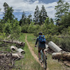
This is a fun out and back trail taking you to Hwy 108. There are a few steep, take your breath away climbs and a few techy sections (including dry creek crossings) scattered along the trail that might be considered advanced. This trail derives its name from a segment of the filming of "Back to the Future III", which took place at Red Hills, located near this trail.

Tags
Creek crossing

Local Trail Association

Traditionally Indigenous Territory

Recent Activity on Trail

Past Week
  • 0 rides
  •  
6 Months
  • 2 rides
  • 16 miles avg distance
All
  • 75 rides
  • Last: Jun 7, 2026
c1c2c3c4
January
February
March
April
May
June
July
August
September
October
November
December
update trails status or condition

Time Machine Trail Reports

statusdatedescription
Nov 5, 2026 @ 11:51am (America/Los_Angeles)
Nov 5, 2026
reporter Conditions are ideal at this time
Jun 16, 2026 @ 4:07pm (America/Los_Angeles)
Jun 16, 2026
reporter Trails are hard packed and dry with some dusty sections
Mar 17, 2026 @ 3:12pm (America/Los_Angeles)
Mar 17, 2026
reporter Condition's are ideal at this time
Feb 22, 2026 @ 5:17pm (America/Los_Angeles)
Feb 22, 2026
Damp and tacky, but a few wet and/or muddy sections. The segment by the train tracks is flooded (see pictures), I used the tracks to bypass.
Feb 20, 2026 @ 10:36am (America/Los_Angeles)
Feb 20, 2026
reporter Trail has wet, muddy sections after recent heavy rains (3.5+")
more »
Status:
on Nov 5, 2026
Ideal
Avg: 4.13 (3 votes)
Your vote: 0

view (184)
close
      Directions to time-machine-535435 trailhead (37.853700, -120.479280)

      Photos

      14 more »
      report
      mtb
      90 |
      Feb 22, 2026 @ 5:14pm
      Feb 22, 2026
      report
      mtb
      98 |
      Feb 22, 2026 @ 5:14pm
      Feb 22, 2026
      mtb
      84 |
      Feb 22, 2026 @ 5:15pm
      Feb 22, 2026
      report
      mtb
      96 |
      Jan 16, 2026 @ 5:33pm
      Jan 16, 2026

      Videos

      no videos have been added for Time Machine yet, add a video.

      Routes with this trail

      more »
      13 miles • 1,454 ft • 13 • Loop •
      Nice loop of the Red Hills northern region plus a trip out and back on the Time Machine trail. Riders can...
      4.7 ★★★★★
      3 Ratings
      5 ★ 67%
      4 ★ 33%
      3 ★
      2 ★
      1 ★

      1 Review & Comments

      Duffman81 Duffman81
      Could have been so much more, just when trail is getting fun there's a random feature that saps speed away. A few sections of flow but random sharp turns and unnecessary switchbacks ribs this trail of its potential.

      We hope you've been enjoying Trailforks!

      Create a FREE account to view all trail reviews and much more.

      • By Robhb209TF Pro RHATS & contributors
      • #535435 - 948 views

      Frequently Asked Questions

      ▼ Where is Time Machine located?
      Time Machine is located in Red Hills Recreation Management Area, Chinese Camp, California, United States. It is part of the Red Hills Recreation Management Area trail network. The trailhead is located at coordinates 37.8537, -120.47928.
      ▼ How hard is Time Machine?
      Time Machine is rated as Blue difficulty. The physical rating is Hard. The average grade is 1.6%. The climb difficulty is rated Blue.
      ▼ What is the elevation gain for Time Machine?
      Time Machine has 165 ft of elevation gain. The trail has 385 ft of elevation descent. The elevation ranges from 1,079 ft to 1,311 ft.
      ▼ Is Time Machine a point to point trail?
      Time Machine is not a point to point trail. The direction is Both Directions. The trail type is singletrack.
      ▼ How long is Time Machine?
      Time Machine is 2.6 miles long. The trail type is singletrack.
      ▼ Are dogs allowed on Time Machine?
      Yes, dogs are allowed on Time Machine. Please keep dogs on a leash where required and clean up after them.
      ▼ How do I access Time Machine? Where is the closest parking trailhead?
      The closest parking and trailhead locations to Time Machine are: View all parking locations in the area.
      ▼ How long does it take to ride Time Machine?
      Based on recorded activities, it takes an average of 30 minutes to ride Time Machine. The trail is 2.6 miles long. Actual times will vary based on fitness level, conditions, and pace. View recent activity logs for more details.
      ▼ How busy is Time Machine?
      Time Machine is a very popular trail. There have been 121 recorded activities on this trail. The trail has received 184 check-ins. View recent activity on this trail.

      Hit the Trail

      Open in App

      Get this trail on your phone instantly.

      open trail in app

      Download Trail

      Save to wishlist, Garmin & download.
      save the trail

      Find Related Routes

      Find routes and users activities that include this trail.
      find routes for this trail

      You must enter a description before submitting.