
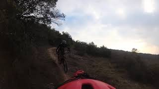

more stats
4,380 ft
Distance
-717 ft
Descent
00:05:40
Avg time
-717 ft
Altitude change
2,053 ft
Altitude min
2,770 ft
Altitude max
2,770 ft
Altitude start
2,054 ft
Altitude end
-16.4%
Grade
-48.1%
Grade max
-1.9%
Grade min
4,354 ft
Distance down
26 ft
Distance flat
00:05:40
Avg time

Topegana Details

  • Activities
    • Mountain Bike
    • E-Bike
    • Hike
    • Trail Running
  • Riding Area
    Badaia
    Vitoria
  • Difficulty Rating
  • Voted Difficulty
    Red (3 votes)
  • Local Popularity
    50 in Mountain Biking heatmap [+]
    • 75 in E-Biking
    • 5 in Trail Running
    • 5 in Hiking
  • Global Ranking
    #93084 in Mountain Biking [+]
    • #1518 in E-Biking
    • #298207 in Trail Running
    • #290472 in Hiking
  • National Ranking
    #6,682 in Mountain Biking · Spain [+]
    • #607 in E-Biking
    • #31,432 in Trail Running
    • #28,675 in Hiking
  • Hiking SAC Scale
    T1 Hiking
  • Trail Type
    Singletrack
  • Bike Type
    AM, XC
  • Direction
    Downhill Primary
    Popular Direction Shown
  • Climb Difficulty
    Black Diamond
  • Physical Rating
    Easy
  • Trail Visibility
    Always easy to follow
  • Dogs Allowed
    Yes
  • eBike Allowed
    Yes up to Class 1

Muy bonito sendero desde la cima de Undagana, de flow y disfrute para todos los públicos.

Tags

Recent Activity on Trail

Past Week
  • 0 rides
  •  
6 Months
  • 0 rides
  •  
All
  • 56 rides
  • Last: Mar 10, 2026
c1c2c3c4
January
February
March
April
May
June
July
August
September
October
November
December
update trails status or condition

Topegana Trail Reports

statusdatedescription
Oct 29, 2026 @ 3:28pm (Europe/Madrid)
Oct 29, 2026
Se ha formado una pequeña carcaba en la zona del paso estrecho pero x lo demad perfecto
Jan 11, 2026 @ 9:17am (Europe/Madrid)
Jan 11, 2026
reporter No he visto el problema mencionado en el reporte anterior, hay un paso delicado, que hoy estaba muy húmedo y resbaladizo, pero no me ha parecido...
Jun 15, 2025 @ 9:48am
Jun 15, 2025
El único paso complicado que hay está destrozado. Ya en el último año se había destrozado la linea original en la entrada porque se había...
Mar 9, 2025 @ 7:30am
Mar 9, 2025
reporter
Dec 3, 2024 @ 9:23am
Dec 3, 2024
more »
Status:
on Oct 29, 2026
Variable
Avg: 4.15 (8 votes)
Your vote: 0

view (301)
close
      Directions to topegana trailhead (42.910010, -2.783440)

      Photos

      5 more »
      mtb
      100 |
      Jan 14, 2023 @ 5:22am
      Jan 14, 2023
      mtb
      91 |
      Jan 14, 2023 @ 5:18am
      Jan 14, 2023
      mtb
      92 |
      Jan 14, 2023 @ 5:18am
      Jan 14, 2023
      report
      mtb
      74 |
      Nov 13, 2021 @ 9:32am
      Nov 13, 2021

      Videos

      1 more »
      Topegana; 18-04-21
      mtb
      4:58 | 343 | May 9, 2021 , Vitoria

      Routes with this trail

      more »
      ★ 3.5 • 21 miles • 5,259 ft • 22 • Loop •
      Vuelta con algunas de las bajadas más endureras de Badaia. Se puede recortar, pero completa es...
      4.3 ★★★★★
      8 Ratings
      5 ★ 38%
      4 ★ 50%
      3 ★ 13%
      2 ★
      1 ★

      4 Reviews & Comments

      antedilubiano
      Si te gustan los rectos baja por la pista por favor en caso contrario respeta el trazado de las sendas
      Gracias
      tantomontemontetanto tantomontemontetanto
      Yo le pondría entre azul y rojo. Buen piso, sin piedras. Senderón
      pablofil
      La senda está muy bien, para mi que la han hecho los mismos que Sua y Piporros.

      We hope you've been enjoying Trailforks!

      Create a FREE account to view all trail reviews and much more.

      • By AltavozTF Pro TFSPAIN & contributors
      • #409830 - 987 views

      Frequently Asked Questions

      ▼ Where is Topegana located?
      Topegana is located in Badaia, Vitoria, Spain. It is part of the Badaia trail network. The trailhead is located at coordinates 42.91001, -2.78344.
      ▼ How hard is Topegana?
      Topegana is rated as Blue difficulty. The physical rating is Easy. The average grade is 16.4%. The climb difficulty is rated Black Diamond.
      ▼ What is the elevation gain for Topegana?
      The trail has 717 ft of elevation descent. The elevation ranges from 2,053 ft to 2,770 ft.
      ▼ Is Topegana a point to point trail?
      Topegana is not a point to point trail. The direction is Downhill Primary. The trail type is singletrack.
      ▼ How long is Topegana?
      Topegana is 4,380 ft long. The trail type is singletrack.
      ▼ Are dogs allowed on Topegana?
      Yes, dogs are allowed on Topegana. Please keep dogs on a leash where required and clean up after them.
      ▼ When is the best time of year to ride Topegana?
      Based on activity log data, the most popular months to ride Topegana are:
      • March (5 activities)
      • November (5 activities)
      • December (4 activities)
      Check the reports page for current trail conditions.
      ▼ How do I access Topegana? Where is the closest parking trailhead?
      The closest parking and trailhead locations to Topegana are: View all parking locations in the area.
      ▼ How long does it take to ride Topegana?
      Based on recorded activities, it takes an average of 6 minutes to ride Topegana. The trail is 4,380 ft long. Actual times will vary based on fitness level, conditions, and pace. View recent activity logs for more details.
      ▼ How busy is Topegana?
      Topegana is a moderately popular trail. There have been 297 recorded activities on this trail. The trail has received 301 check-ins. View recent activity on this trail.

      Hit the Trail

      Open in App

      Get this trail on your phone instantly.

      open trail in app

      Download Trail

      Save to wishlist, Garmin & download.
      save the trail

      Find Related Routes

      Find routes and users activities that include this trail.
      find routes for this trail

      You must enter a description before submitting.

