more stats
1.8 miles
Distance
212 ft
Climb
-242 ft
Descent
00:15:50
Avg time
-32 ft
Altitude change
2,921 ft
Altitude min
3,085 ft
Altitude max
3,080 ft
Altitude start
3,048 ft
Altitude end
-0.3%
Grade
-22.7%
Grade max
28.4%
Grade min
3,566 ft
Distance climb
4,980 ft
Distance down
1,142 ft
Distance flat
00:15:50
Avg time

Toque (Technical) Details

  • Activities
    • Mountain Bike
    • E-Bike
    • Hike
    • Trail Running
  • Riding Area
    Da Burbs
    Las Vegas, Nevada
  • Difficulty Rating
  • Local Popularity
    75 in Mountain Biking [+]
    • 55 in E-Biking
    • 80 in Trail Running
    • 85 in Hiking
  • Global Ranking
    #89875 in Mountain Biking [+]
    • #50235 in Trail Running
    • #53796 in Hiking
  • Trail Type
    Singletrack
  • Direction
    Both Directions
  • Climb Difficulty
    Black Diamond
  • Physical Rating
    Hard
  • Dogs Allowed
    Yes
  • eBike Allowed
  • Land Owner
    Bureau of Land Management: Red Rock & Sloan Canyon Field Office

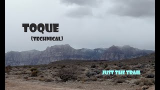
The second part of Toque labeled a black diamond, this trail will test your skill with a bike. The trail gets very close to the suburbs and there are several little goat trails that you can escape on. Punchy rocky climbs and a few pedal strikes will get you around the mountain or provide a full tech loop when you include No Dab.

Local Trail Association

Recent Activity on Trail

Past Week
  • 0 rides
  •  
6 Months
  • 7 rides
  • 6 miles avg distance
All
  • 153 rides
  • Last: Jun 17, 2026
c1c2c3c4
January
February
March
April
May
June
July
August
September
October
November
December
update trails status or condition

Toque (Technical) Trail Reports

statusdatedescription
Aug 2, 2023 @ 9:11pm
Aug 2, 2023
major washout near the business park.
Jan 2, 2023 @ 3:37am
Jan 2, 2023
Some sections sketchy from rain washout.
Apr 24, 2022 @ 7:15am
Apr 24, 2022
Apr 13, 2022 @ 7:15am
Apr 13, 2022
Sep 7, 2021 @ 7:17am
Sep 7, 2021
more »
Status:
on Aug 2, 2023
Variable
Avg: 3.61 (8 votes)
Your vote: 0

view (1,397)
close
3D
Trail Conditions
  • Unknown
  • Snow Groomed
  • Snow Packed
  • Snow Covered
  • Snow Cover Partial
  • Freeze/thaw Cycle
  • Icy
  • Prevalent Mud
  • Wet
  • Variable
  • Ideal
  • Dry
  • Very Dry
Trail Flow (Ridden Direction)
Trailforks scans users ridelogs to determine the most popular direction each trail is ridden. A good flowing trail network will have most trails flowing in a single direction according to their intension.
The colour categories are based on what percentage of riders are riding a trail in its intended direction.
  • > 96%
  • > 90%
  • > 80%
  • > 70%
  • > 50%
  • < 50%
  • bi-directional trail
  • no data
Trail Last Ridden
Trailforks scans ridelogs to determine the last time a trail was ridden.
  • < 2 days
  • < 1 week
  • < 2 weeks
  • < 1 month
  • < 6 months
  • > 6 months
Trail Ridden Direction
The intended direction a trail should be ridden.
  • Downhill Only
  • Downhill Primary
  • Both Directions
  • Uphill Primary
  • Uphill Only
  • One Direction
Contribute Details
Colors indicate trail is missing specified detail.
  • Description
  • Photos
  • Description & Photos
  • Videos
Trail Popularity ?
Trailforks scans ridelogs to determine which trails are ridden the most in the last 9 months. Trails are compared with nearby trails in the same city region with a possible 25 colour shades. Think of this as a heatmap, more rides = more kinetic energy = warmer colors.
  • most popular
  • popular
  • less popular
  • not popular
ATV/ORV/OHV Filter
Max Vehicle Width
inches
US Cell Coverage
Legend
cell carrier legend

Radar Time
Activity Recordings
Trailforks uses anonymized public activity data. ?
Activity Recordings
Trailforks uses anonymized public activity data. ?
Personal Heatmap
Activity Types
all / none
Options
2
Date range month
Winter Trails
Warning A routing network for winter maps does not exist. Selecting trails using the winter trails layer has been disabled.
Missing Trails
Most Popular
Least Popular
Trails are colored based on popularity. The more popular a trail is, the more red. Less popular trails trend towards green.
Jump Magnitude Heatmap
Heatmap of where riders jump on trails. Zoom in to see individual jumps, click circles to view jump details.
BC Backroad Status

Service Road Atlas is a free to use, community-driven service for viewing and creating reports on the numerous back-country service roads around B.C. and Alberta.

map legend
Slope Aspect
Direction the slope faces
Flat N NE E SE S SW W NW
Trails Deemphasized
Trails are shown in grey.
disable
Only show trails with no bike usage.
Enable
Suggested Layers
Based on selected activity type

    Save the current map location and zoom level as your default home location whenever this page is loaded.

    Save
        Directions to toque-technical trailhead (36.219270, -115.339170)

        Photos

        10 more »
        230 |
        Apr 21, 2019 @ 10:08pm
        Apr 21, 2019
        165 |
        Apr 1, 2019 @ 11:51am
        Apr 1, 2019
        133 |
        Apr 1, 2019 @ 11:51am
        Apr 1, 2019
        137 |
        Apr 1, 2019 @ 11:50am
        Apr 1, 2019

        Videos

        3 more »
        Toque (technical) MTB Trail. Da' Burbs...
        25:36 | 289 | Jan 14, 2023 , Las Vegas
        youtuber Biking No Dab & Toque (technical), Las...
        4:51 | 1170 | Dec 14, 2019 , Las Vegas
        The Burbs Pt 2 (with CRASH)  - Toque -  Las...
        4:55 | 752 | Dec 9, 2018 , Las Vegas

        Routes with this trail

        12 miles 1,994 ft 8 Loop
        This is a route of some of the more interesting trails in the northern regions of "Da Burbs" region.
        1.0 12 miles 1,877 ft 15
        Close to town get out of dodge. Challenging, fun, great blood pumper.

        Reviews / Comments

        No reviews yet, be the first to write a review or ask a question.
        Use trail reports to comment on trail conditions.


        We hope you've been enjoying Trailforks!

        Create a FREE account to view trail comments and much more.

        • By toddTF Pro Trailforks & contributors
        • #157458 - 2,442 views

        Frequently Asked Questions About Toque (Technical)

        Where is Toque (Technical) located?
        Toque (Technical) is located in Da Burbs, Las Vegas, Nevada, United States. It is part of the Da Burbs trail network. The trailhead is located at coordinates 36.21927, -115.33917.
        How hard is Toque (Technical)?
        Toque (Technical) is rated as Black Diamond difficulty. The physical rating is Hard. The average grade is 0.3%. The climb difficulty is rated Black Diamond.
        What is the elevation gain for Toque (Technical)?
        Toque (Technical) has 212 ft of elevation gain. The trail has 242 ft of elevation descent. The elevation ranges from 2,921 ft to 3,085 ft.
        Is Toque (Technical) a point to point trail?
        Toque (Technical) is not a point to point trail. The direction is Both Directions. The trail type is singletrack.

        Hit the Trail

        Open in App

        Get this trail on your phone instantly.
        open trail in app

        Download Trail

        Save to wishlist, Garmin & download.
        save the trail

        Find Related Routes

        Find routes and users activities that include this trail.
        find routes for this trail

        You must enter a description before submitting.