
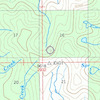
more stats
3.5 miles
Distance
626 ft
Climb
-854 ft
Descent
01:36:59
Avg time
-228 ft
Altitude change
6,427 ft
Altitude min
7,283 ft
Altitude max
6,655 ft
Altitude start
6,427 ft
Altitude end
-1.2%
Grade
-49.3%
Grade max
30.7%
Grade min
2 miles
Distance climb
2 miles
Distance down
351 ft
Distance flat
01:36:59
Avg time

Monarch Creek Trail Details

  • Activities
    • Mountain Bike
    • Winter Fat Bike
    • Horse
    • Hike
    • Trail Running
    • Snowshoe
  • Riding Area
    Little Blackfoot
    Elliston, Montana
  • Ref Number
    #362
  • Difficulty Rating
  • Local Popularity
    70 in Mountain Biking [+]
    • 5 in Trail Running
    • 5 in Hiking
    • 5 in Horseback
    • 5 in Snowshoeing
    • 5 in Winter Fat Biking
  • Global Ranking
    #228773 in Mountain Biking [+]
    • #367918 in Trail Running
    • #316701 in Hiking
    • #26714 in Horseback
    • #23974 in Snowshoeing
    • #35306 in Winter Fat Biking
  • State Ranking
    #2,047 in Mountain Biking · Montana [+]
    • #4,011 in Trail Running
    • #3,760 in Hiking
    • #1,235 in Horseback
    • #734 in Snowshoeing
    • #1,050 in Winter Fat Biking
  • Hiking SAC Scale
    T1 Hiking
  • Trail Type
    Singletrack
  • Bike Type
    AM, XC, Fat
  • Direction
    Both Directions
    Popular Direction Shown
  • Climb Difficulty
    Black Diamond
  • Physical Rating
    Hard
  • Dogs Allowed
    Yes
  • Land Owner

East end is steep with big water bars. Trail levels out for a while after joining with Larabee Gulch Trail then drops through a couple switchbacks and some sweet gravelly/sandy singletrack to Blackfoot Meadows.

Tags
MeadowRiver or creekSandy

Trail Supporters

Local Trail Association

Traditionally Indigenous Territory

Recent Activity on Trail

Past Week
  • 0 rides
  •  
6 Months
  • 1 rides
  • 12 miles avg distance
All
  • 11 rides
  • Last: Aug 20, 2026
update trails status or condition

Monarch Creek Trail Trail Reports

statusdatedescription
Jul 7, 2025 @ 1:08pm
Jul 7, 2025
Tons of downed trees. You can carry your bike over them but there’s probably 40+
Oct 26, 2024 @ 11:48am
Oct 26, 2024
A few trees down, but mostly riding well.
Aug 8, 2023 @ 3:11pm
Aug 8, 2023
Like the prior report stated.Quite a few down trees until you get to the high point then it is clear.
Jul 23, 2023 @ 10:08am
Jul 23, 2023
Significant trees down in first 1.5/2 miles of trail from the blackfoot meadows trail. Lots of them and kinda washed out tread in spots as well. ...
Jul 24, 2022 @ 7:23am
Jul 24, 2022
trees down from the start
more »
Status:
on Jul 7, 2025
Dry
no votes yet
Your vote: 0

view (24)
close
      Directions to monarch-creek-trail-123657 trailhead (46.386570, -112.452740)

      Photos

      6 more »
      mtb
      44 |
      Aug 24, 2025 @ 3:15pm
      Aug 24, 2025
      mtb
      57 |
      Jul 7, 2025 @ 1:10pm
      Jul 7, 2025
      mtb
      63 |
      Jul 7, 2025 @ 1:10pm
      Jul 7, 2025
      mtb
      81 |
      Jul 7, 2025 @ 1:10pm
      Jul 7, 2025

      Videos

      no videos have been added for Monarch Creek Trail yet, add a video.

      2 Reviews & Comments

      loamwhisperer420 loamwhisperer420
      The east end is a brutally steep 20 minute hike-a-bike up to the Larabee junction.
      Coldsmokeskier
      Lot of trees down in the first 1.5+miles coming from the blackfoot meadows trail as of 7/23/23 dry and loose, but still very fun

      We hope you've been enjoying Trailforks!

      Create a FREE account to view all trail reviews and much more.

      • By wyomontTF Pro & contributors
      • #123657 - 1,663 views

      Frequently Asked Questions

      ▼ Where is Monarch Creek Trail located?
      Monarch Creek Trail is located in Little Blackfoot, Elliston, Montana, United States. It is part of the Little Blackfoot trail network. The trailhead is located at coordinates 46.38657, -112.45274.
      ▼ How hard is Monarch Creek Trail?
      Monarch Creek Trail is rated as Blue difficulty. The physical rating is Hard. The average grade is 1.2%. The climb difficulty is rated Black Diamond.
      ▼ What is the elevation gain for Monarch Creek Trail?
      Monarch Creek Trail has 626 ft of elevation gain. The trail has 854 ft of elevation descent. The elevation ranges from 6,427 ft to 7,283 ft.
      ▼ Is Monarch Creek Trail a point to point trail?
      Monarch Creek Trail is not a point to point trail. The direction is Both Directions. The trail type is singletrack.
      ▼ How long is Monarch Creek Trail?
      Monarch Creek Trail is 3.5 miles long. The trail type is singletrack.
      ▼ Are dogs allowed on Monarch Creek Trail?
      Yes, dogs are allowed on Monarch Creek Trail. Please keep dogs on a leash where required and clean up after them.
      ▼ How do I access Monarch Creek Trail? Where is the closest parking trailhead?
      The closest parking and trailhead locations to Monarch Creek Trail are: View all parking locations in the area.
      ▼ How long does it take to ride Monarch Creek Trail?
      Based on recorded activities, it takes an average of 1 hour 37 minutes to ride Monarch Creek Trail. The trail is 3.5 miles long. Actual times will vary based on fitness level, conditions, and pace. View recent activity logs for more details.
      ▼ How busy is Monarch Creek Trail?
      Monarch Creek Trail is a very popular trail. There have been 23 recorded activities on this trail. The trail has received 24 check-ins. View recent activity on this trail.

      Hit the Trail

      Open in App

      Get this trail on your phone instantly.

      open trail in app

      Download Trail

      Save to wishlist, Garmin & download.
      save the trail

      Find Related Routes

      Find routes and users activities that include this trail.
      find routes for this trail

      You must enter a description before submitting.


