
more stats
1,270 ft
Distance
7 ft
Climb
-169 ft
Descent
00:03:23
Avg time
-162 ft
Altitude change
391 ft
Altitude min
562 ft
Altitude max
562 ft
Altitude start
400 ft
Altitude end
-12.8%
Grade
-41.4%
Grade max
6.1%
Grade min
236 ft
Distance climb
1,030 ft
Distance down
00:03:23
Avg time

Traitor Details

  • Activities
    • Mountain Bike
    • E-Bike
    • Hike
    • Trail Running
  • Riding Area
  • Difficulty Rating
  • Voted Difficulty
    Black (1 vote)
  • Local Popularity
    30 in Mountain Biking heatmap [+]
    • 45 in E-Biking
    • 5 in Trail Running
    • 5 in Hiking
  • Global Ranking
    #158106 in Mountain Biking [+]
    • #121355 in E-Biking
    • #328407 in Trail Running
    • #316140 in Hiking
  • National Ranking
    #15,150 in Mountain Biking · Spain [+]
    • #27,364 in E-Biking
    • #35,048 in Trail Running
    • #31,696 in Hiking
  • Trail Type
    Singletrack
  • Bike Type
    DH, AM, XC
  • Direction
    Downhill Only
    Popular Direction Shown
  • Physical Rating
    Moderate
  • Dogs Allowed
    Yes
  • eBike Allowed
    Yes up to Class 1
  • TTFs on Trail
    Rock Garden

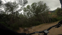
Short but great fun descent, mix of dirt and rocks with some good turns at the bottom.

Tags
Rock gardens

Recent Activity on Trail

Past Week
  • 0 rides
  •  
6 Months
  • 1 rides
  • 16 miles avg distance
All
  • 18 rides
  • Last: Jul 31, 2026
update trails status or condition

Traitor Trail Reports

Status:
on Jul 11, 2026
Variable
Avg: 3.99 (2 votes)
Your vote: 0

view (197)
close
      Directions to traitor trailhead (41.311900, 1.971290)

      Photos

      No photos have been added for Traitor yet, add a photo.

      Videos

      1 more »
      Traitor Single Track
      ebike
      0:49 | 137 | Dec 27, 2020 , Gavá

      Routes with this trail

      more »
      25 miles • 3,633 ft • 27 • Loop •
      Ruta circular con algunas de las mejores trialeras y senderos de la zona. Bosques, vistas, flow...
      4.0 ★★★★★
      2 Ratings
      5 ★ 50%
      4 ★
      3 ★ 50%
      2 ★
      1 ★

      4 Reviews & Comments

      Jordigp
      Esta impracticable, destrozada por las pasadas lluvias y muy sucia de no pasar nadie
      JulienFox
      Just took that one on Saturday ! The top is definitely Black !
      neibolhood
      En mi opinión, y no soy ningún máquina bajando, roja es su nivel, cortita y divertida

      We hope you've been enjoying Trailforks!

      Create a FREE account to view all trail reviews and much more.

      • By Kasmith123 & contributors
      • #88551 - 1,098 views

      Frequently Asked Questions

      ▼ Where is Traitor located?
      Traitor is located in Baix Llobregat Sud, Gavá, Spain. It is part of the Baix Llobregat Sud trail network. The trailhead is located at coordinates 41.3119, 1.97129.
      ▼ How hard is Traitor?
      Traitor is rated as Red difficulty. The physical rating is Moderate. The average grade is 12.8%.
      ▼ What is the elevation gain for Traitor?
      Traitor has 7 ft of elevation gain. The trail has 169 ft of elevation descent. The elevation ranges from 391 ft to 562 ft.
      ▼ Is Traitor a point to point trail?
      Yes, Traitor is a point to point trail. The direction is Downhill Only. The trail type is singletrack.
      ▼ How long is Traitor?
      Traitor is 1,270 ft long. The trail type is singletrack.
      ▼ Are dogs allowed on Traitor?
      Yes, dogs are allowed on Traitor. Please keep dogs on a leash where required and clean up after them.
      ▼ How do I access Traitor? Where is the closest parking trailhead?
      The closest parking and trailhead locations to Traitor are: View all parking locations in the area.
      ▼ How long does it take to ride Traitor?
      Based on recorded activities, it takes an average of 3 minutes to ride Traitor. The trail is 1,270 ft long. Actual times will vary based on fitness level, conditions, and pace. View recent activity logs for more details.
      ▼ How busy is Traitor?
      Traitor is a less popular trail with lighter traffic. There have been 198 recorded activities on this trail. The trail has received 197 check-ins. View recent activity on this trail.

      Hit the Trail

      Open in App

      Get this trail on your phone instantly.

      open trail in app

      Download Trail

      Save to wishlist, Garmin & download.
      save the trail

      Find Related Routes

      Find routes and users activities that include this trail.
      find routes for this trail

      You must enter a description before submitting.

