more stats
1,158 ft
Distance
-212 ft
Descent
00:01:47
Avg time
-212 ft
Altitude change
1,705 ft
Altitude min
1,917 ft
Altitude max
1,917 ft
Altitude start
1,706 ft
Altitude end
-18.3%
Grade
-35.9%
Grade max
-7.9%
Grade min
1,158 ft
Distance down
00:01:47
Avg time

Upper Cookies Details

  • Activities
    • Mountain Bike
    • E-Bike
    • Gravel Bike
    • Winter Fat Bike
    • Hike
    • Trail Running
  • Riding Area
    Westridge-Canyonback
    Santa Monica, California
  • Difficulty Rating
  • Local Popularity
    55 in Mountain Biking [+]
    • 65 in E-Biking
    • 45 in Trail Running
    • 5 in Hiking
    • 5 in Winter Fat Biking
    • 30 in Gravel Biking
  • Global Ranking
    #127887 in Mountain Biking [+]
    • #107285 in E-Biking
    • #154133 in Trail Running
    • #328611 in Hiking
    • #34486 in Winter Fat Biking
    • #14974 in Gravel Biking
  • State Ranking
    #4,759 in Mountain Biking · California [+]
    • #2,283 in E-Biking
    • #8,027 in Trail Running
    • #14,065 in Hiking
    • #721 in Winter Fat Biking
    • #1,114 in Gravel Biking
  • Trail Type
    Singletrack
  • Bike Type
    DH, AM, XC, Fat, Gravel
  • Direction
    Downhill Primary
    Popular Direction Shown
  • Trail Visibility
    Sometimes hard to follow

Short steep switchback trail connecting Farmer's Ridge to Dirt Mulholland and the rest of Cookies. There is one spot where you thread the needle between two trees that may be tough for +800mm bars.

Tags
Faint trail
Local Trail Association
Traditionally Indigenous Territory

Recent Activity on Trail

Past Week
  • 0 rides
  •  
6 Months
  • 13 rides
  • 90 miles avg distance
All
  • 94 rides
  • Last: Oct 12, 2026
c1c2c3c4
January
February
March
April
May
June
July
August
September
October
November
December
update trails status or condition

Upper Cookies Trail Reports

statusdatedescription
Feb 8, 2026 @ 6:03am (America/Los_Angeles)
Feb 8, 2026
Some new lines added, great quick ride. Some hikers coming up on weekends so be careful
Jan 20, 2026 @ 3:35pm (America/Los_Angeles)
Jan 20, 2026
Thanks for the new lines! I missed the switchback cut, will hit it next time
Jan 18, 2026 @ 5:58am (America/Los_Angeles)
Jan 18, 2026
Amazing shape and as the previous post, love how they made a right turn to avoid the pedal smashing tree route
Jan 12, 2026 @ 12:06am (America/Los_Angeles)
Jan 12, 2026
Perfect and thanks to whoever recently cleared and dug a go around to the narrow tree split. Entrance is kind of hard to find now with the...
Sep 24, 2025 @ 4:42am (America/Los_Angeles)
Sep 24, 2025
All clear, no issues. Thank you for the trail work!
more »
Status:
on Feb 8, 2026
Ideal
Avg: 3.76 (3 votes)
Your vote: 0

view (852)
close
      Directions to upper-cookies trailhead (34.128860, -118.536860)

      Photos

      No photos have been added for Upper Cookies yet, add a photo.

      Videos

      1 more »
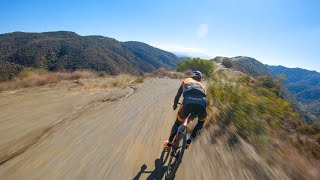
      Training Ride with Payson McElveen (Cookie,...
      mtb
      56:51 | 211 | Jul 5, 2022 , Santa Monica
      3.4 ★★★★★
      3 Ratings
      5 ★ 33%
      4 ★ 33%
      3 ★
      2 ★
      1 ★ 33%

      3 Reviews & Comments

      JoshuaRWXLo1
      Fun easier than bottom of cookies has some exposure and some switchbacks and the tree split can be tough but overall fun to do before cookies
      Patbarraza
      Super overgrown! Could barely find the trail underneath the brush and grass.

      We hope you've been enjoying Trailforks!

      Create a FREE account to view all trail reviews and much more.

      • By ersz & contributors
      • #81878 - 2,191 views

      Frequently Asked Questions

      ▼ Where is Upper Cookies located?
      Upper Cookies is located in Westridge-Canyonback, Santa Monica, California, United States. It is part of the Westridge-Canyonback trail network. The trailhead is located at coordinates 34.12886, -118.53686.
      ▼ How hard is Upper Cookies?
      Upper Cookies is rated as Black Diamond difficulty. The average grade is 18.3%.
      ▼ What is the elevation gain for Upper Cookies?
      The trail has 212 ft of elevation descent. The elevation ranges from 1,705 ft to 1,917 ft.
      ▼ Is Upper Cookies a point to point trail?
      Upper Cookies is not a point to point trail. The direction is Downhill Primary. The trail type is singletrack.
      ▼ How long is Upper Cookies?
      Upper Cookies is 1,158 ft long. The trail type is singletrack.
      ▼ Are dogs allowed on Upper Cookies?
      There is no information about dogs being allowed on Upper Cookies. Check with local trail managers or the trail page for the latest access rules.
      ▼ When is the best time of year to ride Upper Cookies?
      Based on activity log data, the most popular months to ride Upper Cookies are:
      • March (7 activities)
      • October (7 activities)
      • January (6 activities)
      Check the reports page for current trail conditions.
      ▼ How do I access Upper Cookies? Where is the closest parking trailhead?
      The closest parking and trailhead locations to Upper Cookies are: View all parking locations in the area.
      ▼ How long does it take to ride Upper Cookies?
      Based on recorded activities, it takes an average of 2 minutes to ride Upper Cookies. The trail is 1,158 ft long. Actual times will vary based on fitness level, conditions, and pace. View recent activity logs for more details.
      ▼ How busy is Upper Cookies?
      Upper Cookies is a moderately popular trail. There have been 854 recorded activities on this trail. The trail has received 852 check-ins. View recent activity on this trail.

      Hit the Trail

      Open in App

      Get this trail on your phone instantly.

      open trail in app

      Download Trail

      Save to wishlist, Garmin & download.
      save the trail

      Find Related Routes

      Find routes and users activities that include this trail.
      find routes for this trail

      You must enter a description before submitting.