more stats
728 ft
Distance
-90 ft
Descent
00:01:04
Avg time
-90 ft
Altitude change
1,288 ft
Altitude min
1,379 ft
Altitude max
1,379 ft
Altitude start
1,289 ft
Altitude end
-12.4%
Grade
-36.5%
Grade max
-4%
Grade min
728 ft
Distance down
00:01:04
Avg time

Upper Exodus Details

  • Activities
    • Mountain Bike
  • Riding Area
    Mountain Creek Resort
    Vernon, New Jersey
  • Difficulty Rating
  • Voted Difficulty
    Double Black Diamond (1 vote)
  • Local Popularity
    75 in Mountain Biking
  • Global Ranking
    #39749 in Mountain Biking
  • Trail Type
    Singletrack
  • Bike Type
    DH, AM
  • Direction
    Downhill Only
    Popular Direction Shown
  • Physical Rating
    Hard
  • Trail Visibility
    Sometimes hard to follow
  • Season
    Late Spring & Summer
  • Alpine Trail
    Yes
  • eBike Allowed
  • TTFs on Trail
    Drop, Ladder Bridge, Rock Face, Rock Garden, Skinny, Other
  • Land Owner

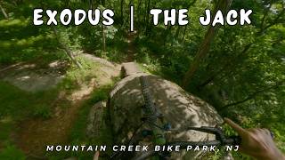
Short trail with steep/rough rock gardens, blind wooden skinnies, and steep rock rolls. Look before you ride and make sure you pick a line. There are multiple paths down this trail as it splits a few times and allows for some routes to be easier and harder than others.

Access Info

Head down towards bushwack and just continue to go straight along the right side towards the wooden skinnies.

Disclaimer

CANNOT BE RIDDEN BLIND

Bike Park

Traditionally Indigenous Territory

Recent Activity on Trail

Past Week
  • 10 rides
  • 18 miles average
6 Months
  • 96 rides
  • 24 miles avg distance
All
  • 903 rides
  • Last: Jul 1, 2026
c1c2c3c4
January
February
March
April
May
June
July
August
September
October
November
December
Status:
on Jun 6, 2026
Dry
Avg: 3.92 (8 votes)
Your vote: 0

view (12,206)
close
3D
Trail Conditions
  • Unknown
  • Snow Groomed
  • Snow Packed
  • Snow Covered
  • Snow Cover Partial
  • Freeze/thaw Cycle
  • Icy
  • Prevalent Mud
  • Wet
  • Variable
  • Ideal
  • Dry
  • Very Dry
Trail Flow (Ridden Direction)
Trailforks scans users ridelogs to determine the most popular direction each trail is ridden. A good flowing trail network will have most trails flowing in a single direction according to their intension.
The colour categories are based on what percentage of riders are riding a trail in its intended direction.
  • > 96%
  • > 90%
  • > 80%
  • > 70%
  • > 50%
  • < 50%
  • bi-directional trail
  • no data
Trail Last Ridden
Trailforks scans ridelogs to determine the last time a trail was ridden.
  • < 2 days
  • < 1 week
  • < 2 weeks
  • < 1 month
  • < 6 months
  • > 6 months
Trail Ridden Direction
The intended direction a trail should be ridden.
  • Downhill Only
  • Downhill Primary
  • Both Directions
  • Uphill Primary
  • Uphill Only
  • One Direction
Contribute Details
Colors indicate trail is missing specified detail.
  • Description
  • Photos
  • Description & Photos
  • Videos
Trail Popularity ?
Trailforks scans ridelogs to determine which trails are ridden the most in the last 9 months. Trails are compared with nearby trails in the same city region with a possible 25 colour shades. Think of this as a heatmap, more rides = more kinetic energy = warmer colors.
  • most popular
  • popular
  • less popular
  • not popular
ATV/ORV/OHV Filter
Max Vehicle Width
inches
US Cell Coverage
Legend
cell carrier legend

Radar Time
Activity Recordings
Trailforks uses anonymized public activity data. ?
Activity Recordings
Trailforks uses anonymized public activity data. ?
Personal Heatmap
Activity Types
all / none
Options
2
Date range month
Winter Trails
Warning A routing network for winter maps does not exist. Selecting trails using the winter trails layer has been disabled.
Missing Trails
Most Popular
Least Popular
Trails are colored based on popularity. The more popular a trail is, the more red. Less popular trails trend towards green.
Jump Magnitude Heatmap
Heatmap of where riders jump on trails. Zoom in to see individual jumps, click circles to view jump details.
BC Backroad Status

Service Road Atlas is a free to use, community-driven service for viewing and creating reports on the numerous back-country service roads around B.C. and Alberta.

map legend
Slope Aspect
Direction the slope faces
Flat N NE E SE S SW W NW
Trails Deemphasized
Trails are shown in grey.
disable
Only show trails with no bike usage.
Enable
Suggested Layers
Based on selected activity type

    Save the current map location and zoom level as your default home location whenever this page is loaded.

    Save
        Directions to upper-exodus trailhead (41.180560, -74.502610)

        Photos

        24 more »
        325 |
        Aug 7, 2020 @ 5:33pm
        Aug 7, 2020
        685 |
        May 7, 2012 @ 7:21pm
        May 7, 2012
        101 |
        Aug 7, 2020 @ 5:34pm
        Aug 7, 2020
        499 |
        Jun 3, 2006 @ 6:21am
        Jun 3, 2006

        Videos

        3 more »
        youtuber Exodus | The Jack / Mountain Creek Bike Park,...
        5:03 | 16 | Jun 22, 2026 , Vernon
        Diablo Freeride Park 2011.05.07
        3:28 | 216 | May 22, 2011 , Vernon
        Diablo 'Exodus-waterboy?'
        5:38 | 209 | Jul 29, 2010 , Vernon

        1 Review & Comments


        We hope you've been enjoying Trailforks!

        Create a FREE account to view trail comments and much more.

        • By DownhillR3 MCBP & contributors
        • #28533 - 2,488 views

        Frequently Asked Questions About Upper Exodus

        Where is Upper Exodus located?
        Upper Exodus is located in Mountain Creek Resort, Vernon, New Jersey, United States. It is part of the Mountain Creek Resort trail network. The trailhead is located at coordinates 41.18056, -74.50261.
        How hard is Upper Exodus?
        Upper Exodus is rated as Double Black Diamond difficulty. The physical rating is Hard. The average grade is 12.4%.
        What is the elevation gain for Upper Exodus?
        The trail has 28 m of elevation descent. The elevation ranges from 393 m to 420 m.
        Is Upper Exodus a point to point trail?
        Yes, Upper Exodus is a point to point trail. The direction is Downhill Only. The trail type is singletrack.

        Hit the Trail

        Open in App

        Get this trail on your phone instantly.
        open trail in app

        Download Trail

        Save to wishlist, Garmin & download.
        save the trail

        Find Related Routes

        Find routes and users activities that include this trail.
        find routes for this trail

        You must enter a description before submitting.