2.3 miles
Distance
34 ft
Climb
-322 ft
Descent
00:15:41
Avg time
Supporters, Builders, Maintainers & Land Managers of Upper Flume Trail

  • USFS
    Land Manager

Upper Flume Details

  • Activities
    • Mountain Bike
    • Hike
    • Trail Running
  • Riding Area
    Breckenridge
    , Colorado
  • Difficulty Rating
  • Trail Type
    Singletrack
  • Direction
    Both Directions
    Popular in reverse
  • Season
    Summer
  • Dogs Allowed
    Yes
  • Global Ranking
    #39699 in Mountain Biking [+]
    • #80102 in Hiking
  • Local Popularity
    85 in Mountain Biking [+]
    • 85 in Trail Running
    • 50 in Hiking

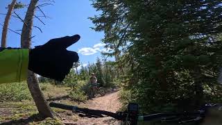
The trail follows the flume for 2 miles, passing Mike's Trail on the left at mile 1.5 and crossing Golden Age Drive at mile 1.8. Trail begins a mild climb away from the flume passing Slalom Singletrack Trail on the right at mile 2.4, and the Middle Flume Trail on the left at mile 2.8. Shortly after the Middle Flume Trail junction the trail rejoins the flume and continues another 1/2 mile to its terminus on the gravel Gold Run Road.

Local Trail Association
Traditionally Indigenous Territory
More Stats for Upper Flume mountain bike trail trail
  • Altitude change
    -288 ft
  • Altitude min
    9,598 ft
  • Altitude max
    9,885 ft
  • Altitude start
    9,885 ft
  • Altitude end
    9,596 ft
  • Grade
    -2.3%
  • Grade max
    -28.6%
  • Grade min
    5.8%
  • Distance climb
    3,520 ft
  • Distance down
    1 mile
  • Distance flat
    2,871 ft
  • Avg time
    00:15:41
  • Avg reverse time
    00:24:34
  • view trail stats
Status:
on Nov 21, 2022
Snow Covered
Avg: 3.85 (6 votes)
Your vote: 0

view (1,208)
close
3D
Trail Conditions
  • Unknown
  • Snow Groomed
  • Snow Packed
  • Snow Covered
  • Snow Cover Inadequate
  • Freeze/thaw Cycle
  • Icy
  • Prevalent Mud
  • Wet
  • Variable
  • Ideal
  • Dry
  • Very Dry
Trail Flow (Ridden Direction)
Trailforks scans users ridelogs to determine the most popular direction each trail is ridden. A good flowing trail network will have most trails flowing in a single direction according to their intension.
The colour categories are based on what percentage of riders are riding a trail in its intended direction.
  • > 96%
  • > 90%
  • > 80%
  • > 70%
  • > 50%
  • < 50%
  • bi-directional trail
  • no data
Trail Last Ridden
Trailforks scans ridelogs to determine the last time a trail was ridden.
  • < 2 days
  • < 1 week
  • < 2 weeks
  • < 1 month
  • < 6 months
  • > 6 months
Trail Ridden Direction
The intended direction a trail should be ridden.
  • Downhill Only
  • Downhill Primary
  • Both Directions
  • Uphill Primary
  • Uphill Only
  • One Direction
Contribute Details
Colors indicate trail is missing specified detail.
  • Description
  • Photos
  • Description & Photos
  • Videos
Trail Popularity ?
Trailforks scans ridelogs to determine which trails are ridden the most in the last 9 months. Trails are compared with nearby trails in the same city region with a possible 25 colour shades. Think of this as a heatmap, more rides = more kinetic energy = warmer colors.
  • most popular
  • popular
  • less popular
  • not popular
ATV/ORV/OHV Filter
Max Vehicle Width
inches

Radar Time
x Activity Recordings
Trailforks users anonymized public ridelogs from the past 6 months.
  • mountain biking recent
  • mountain biking (>6 month)
  • hiking (1 year)
  • moto (1 year)
Activity Recordings
Trailforks users anonymized public skilogs from the past 12 months.
  • Downhill Ski
  • Backcountry Ski
  • Nordic Ski
  • Snowmobile
Jump Magnitude Heatmap
Heatmap of where riders jump on trails. Zoom in to see individual jumps, click circles to view jump details.
Trails Deemphasized
Trails are shown in grey.
disable
Only show trails with NO bikes.
enable

Save the current map location and zoom level as your default home location whenever this page is loaded.

Save
      Directions to upper-flume trailhead (39.508460, -106.031270)
      update trails status or condition

      Upper Flume Trail Reports

      statusdatedescription
      Nov 21, 2022 @ 4:00am
      Nov 21, 2022
      reporter
      May 28, 2022 @ 11:22am
      May 28, 2022
      reporter
      May 12, 2022 @ 4:28am
      May 12, 2022
      reporter Report from Town of Breck conditions page
      Apr 11, 2022 @ 7:19pm
      Apr 11, 2022
      reporter Unknown conditions. Please update when ridden. Please stay off muddy trails.
      Mar 11, 2022 @ 10:08am
      Mar 11, 2022
      reporter Significant snowfall on 3/9
      view all reports »

      Recent Ridelog Activity on Trail

      Past Week
      • 0 rides
      •  
      6 Months
      • 42 rides
      • 12 miles avg distance
      All
      • 1,138 rides
      • Last: Feb 17, 2023

      Photos

      more »
      49 |
      Aug 26, 2019 @ 11:59am
      Aug 26, 2019
      46 |
      Aug 26, 2019 @ 11:59am
      Aug 26, 2019
      47 |
      Aug 26, 2019 @ 11:59am
      Aug 26, 2019
      48 |
      Aug 26, 2019 @ 11:58am
      Aug 26, 2019

      Routes with this trail

      more »
      titledistance
      Jimmy's Loop18 miles
      Breck Tour (alternate to firecracker)23 miles
      Jump Loops13 miles
      Best of Breck15 miles

      1 Review & Comments

      • + 0
      briananacker (Oct 23, 2020 at 8:44)
      Rode as a descent. Surprising lack of descending.
      [Reply]


      Login or Sign Up to Comment

      Videos

      no videos have been added for Upper Flume yet, add a video.
      • subscribe
      • flag
      • login to download gpx or kml files.