more stats
1,493 ft
Distance
-398 ft
Descent
00:08:29
Avg time
-398 ft
Altitude change
963 ft
Altitude min
1,361 ft
Altitude max
1,361 ft
Altitude start
961 ft
Altitude end
-26.7%
Grade
-40.8%
Grade max
-6.8%
Grade min
1,493 ft
Distance down
00:08:29
Avg time

Upper Roach Hit Details

  • Activities
    • Mountain Bike
    • E-Bike
  • Riding Area
    Cypress Mountain
    West Vancouver, British Columbia
  • AKA
    Roach Hit
  • Difficulty Rating
  • Voted Difficulty
    Double Black Diamond (3 votes)
  • Local Popularity
    85 in Mountain Biking [+]
    • 55 in E-Biking
  • Global Ranking
    #24395 in Mountain Biking [+]
    • #40252 in E-Biking
  • Trail Type
    Singletrack
  • Bike Type
    DH
  • Dogs Allowed
    Yes
  • eBike Allowed
  • TTFs on Trail
    Drop, Jump, Gap Jump, Rock Face
  • Ride in Rain
    Yes
  • Land Owner
    BPP

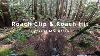
Top half is natural and rugged, with some janky tech and an optional drop off a boulder. Lower half below SLT is more flowy with several gap jumps.

Access Info

Accessed off BLT after Roach Clip

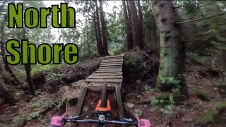
This trail is unsanctioned.

Recent Activity on Trail

Past Week
  • 3 rides
  • 22 miles average
6 Months
  • 46 rides
  • 10 miles avg distance
All
  • 495 rides
  • Last: Jun 1, 2026
c1c2c3c4
January
February
March
April
May
June
July
August
September
October
November
December
update trails status or condition

Upper Roach Hit Trail Reports

statusdatedescription
Apr 8, 2026 @ 7:26pm (America/Vancouver)
Apr 8, 2026
reporter
Jan 4, 2026 @ 11:26pm (America/Vancouver)
Jan 4, 2026
reporter Roach Hit now exits to Eagle Lake Rd for 2026 due to construction on Mountain Path
Dec 11, 2025 @ 6:52pm (America/Vancouver)
Dec 11, 2025
reporter Bottom half of jump line down to the creek is reopened. Work will continue on this section and above through the winter, please keep an eye out....
Nov 17, 2025 @ 1:58pm (America/Vancouver)
Nov 17, 2025
reporter Last ~100m expected to be permanently closed as early as December 1st for clear-cutting followed by Upper Mountain Path construction. A reroute to...
Nov 7, 2025 @ 8:10am (America/Vancouver)
Nov 7, 2025
Section down to the creek gap remains closed - the ride over to wutang is fairly straightforward
more »
Status:
on Apr 8, 2026
Variable
Avg: 4.26 (36 votes)
Your vote: 0

view (1,787)
close
3D
Trail Conditions
  • Unknown
  • Snow Groomed
  • Snow Packed
  • Snow Covered
  • Snow Cover Partial
  • Freeze/thaw Cycle
  • Icy
  • Prevalent Mud
  • Wet
  • Variable
  • Ideal
  • Dry
  • Very Dry
Trail Flow (Ridden Direction)
Trailforks scans users ridelogs to determine the most popular direction each trail is ridden. A good flowing trail network will have most trails flowing in a single direction according to their intension.
The colour categories are based on what percentage of riders are riding a trail in its intended direction.
  • > 96%
  • > 90%
  • > 80%
  • > 70%
  • > 50%
  • < 50%
  • bi-directional trail
  • no data
Trail Last Ridden
Trailforks scans ridelogs to determine the last time a trail was ridden.
  • < 2 days
  • < 1 week
  • < 2 weeks
  • < 1 month
  • < 6 months
  • > 6 months
Trail Ridden Direction
The intended direction a trail should be ridden.
  • Downhill Only
  • Downhill Primary
  • Both Directions
  • Uphill Primary
  • Uphill Only
  • One Direction
Contribute Details
Colors indicate trail is missing specified detail.
  • Description
  • Photos
  • Description & Photos
  • Videos
Trail Popularity ?
Trailforks scans ridelogs to determine which trails are ridden the most in the last 9 months. Trails are compared with nearby trails in the same city region with a possible 25 colour shades. Think of this as a heatmap, more rides = more kinetic energy = warmer colors.
  • most popular
  • popular
  • less popular
  • not popular
ATV/ORV/OHV Filter
Max Vehicle Width
inches
US Cell Coverage
Legend
cell carrier legend

Radar Time
Activity Recordings
Trailforks uses anonymized public activity data. ?
Activity Recordings
Trailforks uses anonymized public activity data. ?
Personal Heatmap
Activity Types
all / none
Options
2
Date range month
Winter Trails
Warning A routing network for winter maps does not exist. Selecting trails using the winter trails layer has been disabled.
Missing Trails
Most Popular
Least Popular
Trails are colored based on popularity. The more popular a trail is, the more red. Less popular trails trend towards green.
Jump Magnitude Heatmap
Heatmap of where riders jump on trails. Zoom in to see individual jumps, click circles to view jump details.
BC Backroad Status

Service Road Atlas is a free to use, community-driven service for viewing and creating reports on the numerous back-country service roads around B.C. and Alberta.

map legend
Slope Aspect
Direction the slope faces
Flat N NE E SE S SW W NW
Trails Deemphasized
Trails are shown in grey.
disable
Only show trails with no bike usage.
Enable
Suggested Layers
Based on selected activity type

    Save the current map location and zoom level as your default home location whenever this page is loaded.

    Save
        Directions to upper-roach-hit trailhead (49.356210, -123.223600)

        Photos

        85 more »
        1,296 |
        Oct 29, 2015 @ 1:06am
        Oct 29, 2015
        1,649 |
        Jun 24, 2014 @ 12:28pm
        Jun 24, 2014
        692 |
        Apr 9, 2018 @ 7:38pm
        Apr 9, 2018
        1,339 |
        Oct 29, 2015 @ 1:07am
        Oct 29, 2015

        Videos

        29 more »
        Roach Clip into Roach Hit | Cypress Mountain
        4:54 | 47 | Mar 9, 2026 , West Vancouver
        youtuber Raw Lap Down Roach Hit, Cypress MTN!!!
        2:33 | 153 | Feb 11, 2025 , West Vancouver
        youtuber Shredding with Rafi the trail dog and the Boys!
        7:49 | 167 | Nov 19, 2023 , West Vancouver
        youtuber Most INSANE Moments of 2022! (Pt. 6) -...
        16:45 | 212 | Apr 15, 2023 , West Vancouver

        Trail Lists

        Routes with this trail

        5 miles 1,443 ft 9 Loop
        This is a great pedal loop featuring the easier technical trails. The climb is up the fairly steep grade...
        4 miles 431 ft 11 Shuttled
        This is one of our favorite routes on the North Shore and is featured in Freehub Magazine's Sea to Sky...

        7 Reviews & Comments


        We hope you've been enjoying Trailforks!

        Create a FREE account to view trail comments and much more.

        • #281 - 12,508 views

        Frequently Asked Questions About Upper Roach Hit

        Where is Upper Roach Hit located?
        Upper Roach Hit is located in Cypress Mountain, West Vancouver, British Columbia, Canada. It is part of the Cypress Mountain trail network. The trailhead is located at coordinates 49.35621, -123.2236.
        How hard is Upper Roach Hit?
        Upper Roach Hit is rated as Double Black Diamond difficulty. The average grade is 26.7%.
        What is the elevation gain for Upper Roach Hit?
        The trail has 398 ft of elevation descent. The elevation ranges from 963 ft to 1,361 ft.
        How long is Upper Roach Hit?
        Upper Roach Hit is 1,493 ft long. The trail type is singletrack.

        Hit the Trail

        Open in App

        Get this trail on your phone instantly.
        open trail in app

        Download Trail

        Save to wishlist, Garmin & download.
        save the trail

        Find Related Routes

        Find routes and users activities that include this trail.
        find routes for this trail

        You must enter a description before submitting.