
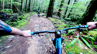
more stats
3,360 ft
Distance
-417 ft
Descent
00:03:49
Avg time
-417 ft
Altitude change
1,334 ft
Altitude min
1,751 ft
Altitude max
1,751 ft
Altitude start
1,335 ft
Altitude end
-12.4%
Grade
-29.7%
Grade max
-2.4%
Grade min
3,360 ft
Distance down
00:03:49
Avg time

Upper Tube Details

  • Activities
    • Mountain Bike
    • E-Bike
    • Gravel Bike
    • Horse
    • Hike
    • Trail Running
    • Dirtbike/Moto
    • Observed Trials
  • Riding Area
    B&K
    Roberts Creek, British Columbia
  • Difficulty Rating
  • Local Popularity
    55 in Mountain Biking heatmap [+]
    • 80 in E-Biking
    • 75 in Trail Running
    • 60 in Hiking
    • 95 in Dirtbiking
    • 5 in Horseback
    • 5 in Observed Trials
    • 5 in Gravel Biking
  • Global Ranking
    #115528 in Mountain Biking [+]
    • #108364 in E-Biking
    • #111646 in Trail Running
    • #123269 in Hiking
    • #4308 in Dirtbiking
    • #4616 in Horseback
    • #1031 in Observed Trials
    • #32552 in Gravel Biking
  • Provincial Ranking
    #5,977 in Mountain Biking · British Columbia [+]
    • #5,345 in E-Biking
    • #6,314 in Trail Running
    • #6,715 in Hiking
    • #1,609 in Dirtbiking
    • #164 in Horseback
    • #543 in Observed Trials
    • #1,552 in Gravel Biking
  • Hiking SAC Scale
    T1 Hiking
  • Trail Type
    Doubletrack
  • Bike Type
    AM, XC, Gravel
  • Direction
    Downhill Primary[+]
    • Downhill Primary for Gravel Biking
  • Physical Rating
    Moderate
  • Dogs Allowed
    Yes
  • eBike Allowed
    Yes up to Class 1
  • Ride in Rain
    Yes

A nice, flowy downhill blast. Bermed corners make for a quick descend. A fair distance from other trails, but makes a nice circuit with trails lower down the mountain.

Tags
BermsFlowy

Local Trail Association

Traditionally Indigenous Territory

Recent Activity on Trail

Past Week
  • 0 rides
  •  
6 Months
  • 6 rides
  • 13 miles avg distance
All
  • 267 rides
  • Last: Sep 20, 2026
c1c2c3c4
January
February
March
April
May
June
July
August
September
October
November
December
update trails status or condition

Upper Tube Trail Reports

statusdatedescription
Jun 19, 2025 @ 2:22pm
Jun 19, 2025
May 2, 2023 @ 3:01pm
May 2, 2023
fast flowy berms. in good shape. a few loose rocks and some mucky spots but otherwise, Let 'er rip
May 2, 2023 @ 11:56am
May 2, 2023
She’s runnin’! Berms are in good shape.
Oct 6, 2022 @ 1:47pm
Oct 6, 2022
quite possibly the sweetest, flowiest, fastest Blue trail in the b&k area. beautiful work by the coast mountain trail bike association
Jul 2, 2022 @ 10:00pm
Jul 2, 2022
more »
Status:
on Jun 19, 2025
Ideal
Avg: 4 (12 votes)
Your vote: 0

view (720)
close
      Directions to upper-tube trailhead (49.469763, -123.629928)

      Photos

      1 more »
      mtb
      85 |
      May 2, 2023 @ 3:06pm
      May 2, 2023

      Videos

      4 more »
      Tubes in :60
      mtb
      0:00 | 191 | Apr 9, 2020 , Roberts Creek
      Coastal Fall // Callum Cameron
      mtb
      0:26 | 1106 | Oct 14, 2016 , Roberts Creek
      Tubes
      mtb
      0:16 | 414 | Nov 20, 2010 , Roberts Creek
      Upper Tube
      mtb
      0:12 | 1166 | Jun 15, 2012 , Roberts Creek

      Routes with this trail

      more »
      12 miles • 1,900 ft • 19 •
      This is just a nice afternoon ride that is easily accessible from Roberts Creek
      20 miles • 2,909 ft • 58 • Point to Point •
      The morning half to sechelt
      4.0 ★★★★★
      12 Ratings
      5 ★ 25%
      4 ★ 58%
      3 ★ 8%
      2 ★ 8%
      1 ★

      8 Reviews & Comments

      Sweetloo
      Rode upper tube yesterday..dry obviously but let those fingers rest from your levers and let the bike loose...fast and flowy with some bumps and humps, some Knolls to fly off with speed....fun enduro track.
      Ppulcher Ppulcher
      Fun fun fun reported from this easterner!
      TurboH
      This is one kilometre of smile. What a delight! Started in the snow and literally 'flowed' through sunlight patches of forest and naturally banked corners with too many bunnyhop objects to mention. Unfortunately, Lower Tube is the ugly sister of Upper and although twice as long not much more than a rubble chute. Still, more than worth the climb from sea level.

      We hope you've been enjoying Trailforks!

      Create a FREE account to view all trail reviews and much more.

      • By BCpovTF Pro & contributors
      • #2995 - 3,894 views

      Frequently Asked Questions

      ▼ Where is Upper Tube located?
      Upper Tube is located in B&K, Roberts Creek, British Columbia, Canada. It is part of the B&K trail network. The trailhead is located at coordinates 49.46976, -123.62993.
      ▼ How hard is Upper Tube?
      Upper Tube is rated as Blue difficulty. The physical rating is Moderate. The average grade is 12.4%.
      ▼ What is the elevation gain for Upper Tube?
      The trail has 417 ft of elevation descent. The elevation ranges from 1,334 ft to 1,751 ft.
      ▼ Is Upper Tube a point to point trail?
      Upper Tube is not a point to point trail. The direction is Downhill Primary. The trail type is doubletrack.
      ▼ How long is Upper Tube?
      Upper Tube is 3,360 ft long. The trail type is doubletrack.
      ▼ Are dogs allowed on Upper Tube?
      Yes, dogs are allowed on Upper Tube. Please keep dogs on a leash where required and clean up after them.
      ▼ How do I access Upper Tube? Where is the closest parking trailhead?
      The closest parking and trailhead locations to Upper Tube are: View all parking locations in the area.
      ▼ How long does it take to ride Upper Tube?
      Based on recorded activities, it takes an average of 4 minutes to ride Upper Tube. The trail is 3,360 ft long. Actual times will vary based on fitness level, conditions, and pace. View recent activity logs for more details.
      ▼ How busy is Upper Tube?
      Upper Tube is a moderately popular trail. There have been 694 recorded activities on this trail. The trail has received 720 check-ins. View recent activity on this trail.

      Hit the Trail

      Open in App

      Get this trail on your phone instantly.

      open trail in app

      Download Trail

      Save to wishlist, Garmin & download.
      save the trail

      Find Related Routes

      Find routes and users activities that include this trail.
      find routes for this trail

      You must enter a description before submitting.

