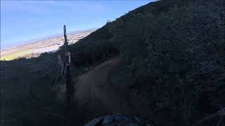


more stats
2.4 miles
Distance
537 ft
Climb
-591 ft
Descent
00:30:55
Avg time
-54 ft
Altitude change
1,216 ft
Altitude min
1,399 ft
Altitude max
1,271 ft
Altitude start
1,216 ft
Altitude end
-0.424%
Grade
-31.63%
Grade max
28.894%
Grade min
1 mile
Distance climb
1 mile
Distance down
1,794 ft
Distance flat
00:30:55
Avg time

Upper X Details

  • Activities
    • Mountain Bike
    • Hike
    • Trail Running
  • Riding Area
    951 Trails
    Murrieta, California
  • Difficulty Rating
  • Voted Difficulty
    Black Diamond (1 vote)
  • Local Popularity
    50 in Mountain Biking [+]
    • 95 in Trail Running
    • 5 in Hiking
  • Global Ranking
    #106981 in Mountain Biking [+]
    • #106078 in Trail Running
    • #343849 in Hiking
  • State Ranking
    #3,778 in Mountain Biking · California [+]
    • #5,145 in Trail Running
    • #14,638 in Hiking
  • Trail Type
    Singletrack
  • Direction
    Both Directions
  • Climb Difficulty
    Black Diamond
  • Physical Rating
    Hard
  • Dogs Allowed
    Yes

No community description for Upper X trail has been added yet!

AI Generated Description

Upper X is a 2 mile moderately popular black diamond difficulty singletrack trail located near Murrieta California. This mountain bike primary trail can be used both directions and has a hard overall physical rating with a 537 ft black diamond climb. On average it takes 30 minutes to complete this trail.

Tags

Local Trail Association

Traditionally Indigenous Territory

Recent Activity on Trail

Past Week
  • 1 rides
  • 10 miles average
6 Months
  • 4 rides
  • 8 miles avg distance
All
  • 73 rides
  • Last: Oct 28, 2026
c1c2c3c4
January
February
March
April
May
June
July
August
September
October
November
December
update trails status or condition

Upper X Trail Reports

statusdatedescription
Sep 27, 2026 @ 6:14am (America/Tijuana)
Sep 27, 2026
Trail is running really good. Big Big props to the builders and maintaines. Berms cook and drainage everywhere. So sick!
Oct 29, 2023 @ 8:53am
Oct 29, 2023
The southern half of the trail has had lots of great trail work done, cleaning up the turns, and brushing the trail. The north side is still a bit...
Sep 20, 2023 @ 6:43am
Sep 20, 2023
A bit overgrown but it seems to have had some work done recently (brush trimmings in trail). Some. Loose dirt sections from trail work needs some...
Apr 2, 2023 @ 5:40pm
Apr 2, 2023
Pretty good conditions even slightly wet, vegetation into trail.
Sep 16, 2022 @ 8:06am
Sep 16, 2022
Overall I think the trail is in great shape, did not have issues with brush, and the trail is very well built.
more »
Status:
on Sep 27, 2026
Variable
Avg: 3.99 (3 votes)
Your vote: 0

view (495)
close
      Directions to upper-x trailhead (33.501530, -117.178490)

      Photos

      27 more »
      mtb
      83 |
      Apr 25, 2026 @ 6:29pm
      Apr 25, 2026
      mtb
      78 |
      Oct 29, 2023 @ 1:51pm
      Oct 29, 2023
      mtb
      112 |
      Sep 16, 2022 @ 3:18pm
      Sep 16, 2022
      mtb
      89 |
      Sep 16, 2022 @ 3:18pm
      Sep 16, 2022

      Videos

      2 more »
      MTB Riding UnKnown Name Trail | Eagles Nest...
      mtb
      34:59 | 70 | Jan 24, 2026 , Murrieta
      youtuber MTB Riding Upper X | X Trails | Temecula, CA |...
      mtb
      21:15 | 456 | Jan 16, 2023 , Murrieta
      4.0 ★★★★★
      3 Ratings
      5 ★ 33%
      4 ★ 33%
      3 ★ 33%
      2 ★
      1 ★

      3 Reviews & Comments

      paterjo paterjo
      Upper X is a really well built and well taken care of trail, my hat off to the trail builder! Mix of some steep climbs but most of the trail is fairly ridable and I recommend riding from the South to the North and then take Trail X back. Slight savings in climbing and allows you to hit more of the trail features. Someone also has taken time to build some really cool steel sculptures along the trail.
      bigchipero
      trail needs a little trim, lots of branches and shrubs wanting to scrape up yer arms and legs so be sure to wear gloves and long sleeves!
      localrider88
      Very fun trail . Much the same as lower x. All single track . Definitely blue not black diamond. Well maintained with multiple bridges

      We hope you've been enjoying Trailforks!

      Create a FREE account to view all trail reviews and much more.

      • By toddTF Pro Trailforks & contributors
      • #118522 - 3,017 views

      Frequently Asked Questions

      ▼ Where is Upper X located?
      Upper X is located in 951 Trails, Murrieta, California, United States. It is part of the 951 Trails trail network. The trailhead is located at coordinates 33.50153, -117.17849.
      ▼ How hard is Upper X?
      Upper X is rated as Black Diamond difficulty. The physical rating is Hard. The average grade is 0.424%. The climb difficulty is rated Black Diamond.
      ▼ What is the elevation gain for Upper X?
      Upper X has 537 ft of elevation gain. The trail has 591 ft of elevation descent. The elevation ranges from 1,216 ft to 1,399 ft.
      ▼ Is Upper X a point to point trail?
      Upper X is not a point to point trail. The direction is Both Directions. The trail type is singletrack.
      ▼ How long is Upper X?
      Upper X is 2.4 miles long. The trail type is singletrack.
      ▼ Are dogs allowed on Upper X?
      Yes, dogs are allowed on Upper X. Please keep dogs on a leash where required and clean up after them.
      ▼ How do I access Upper X? Where is the closest parking trailhead?
      The closest parking and trailhead locations to Upper X are: View all parking locations in the area.
      ▼ How long does it take to ride Upper X?
      Based on recorded activities, it takes an average of 31 minutes to ride Upper X. The trail is 2.4 miles long. Actual times will vary based on fitness level, conditions, and pace. View recent activity logs for more details.
      ▼ How busy is Upper X?
      Upper X is a moderately popular trail. There have been 425 recorded activities on this trail. The trail has received 495 check-ins. View recent activity on this trail.

      Hit the Trail

      Open in App

      Get this trail on your phone instantly.

      open trail in app

      Download Trail

      Save to wishlist, Garmin & download.
      save the trail

      Find Related Routes

      Find routes and users activities that include this trail.
      find routes for this trail

      You must enter a description before submitting.