more stats
3.2 miles
Distance
499 ft
Climb
-502 ft
Descent
00:26:40
Avg time
-5 ft
Altitude change
858 ft
Altitude min
1,031 ft
Altitude max
866 ft
Altitude start
860 ft
Altitude end
-0%
Grade
-32.1%
Grade max
23.1%
Grade min
1 mile
Distance climb
1 mile
Distance down
2,963 ft
Distance flat
00:26:40
Avg time

Van Michael Details

  • Activities
    • Mountain Bike
    • E-Bike
    • Hike
    • Trail Running
  • Riding Area
    Blankets Creek
    Woodstock, Georgia
  • Difficulty Rating
  • Voted Difficulty
    Blue (1 vote)
  • Local Popularity
    90 in Mountain Biking [+]
    • 95 in E-Biking
    • 75 in Trail Running
    • 75 in Hiking
  • Global Ranking
    #1926 in Mountain Biking [+]
    • #1059 in E-Biking
    • #14806 in Trail Running
    • #80653 in Hiking
  • Hiking SAC Scale
    T1 Hiking
  • Trail Type
    Singletrack
  • Bike Type
    AM, XC
  • Direction
    Both Directions
  • Climb Difficulty
    Blue
  • Physical Rating
    Moderate
  • Trail Visibility
    Always easy to follow
  • Dogs Allowed
    Yes
  • eBike Allowed
    Yes up to Class 1
  • TTFs on Trail
    Berm, Jump, Gap Jump, Log Ride, Rock Garden, Other
  • Land Owner
    Cherokee Recreation and Parks Authority

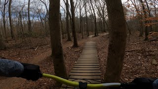
3.4 Miles (Advanced) Van Michael Trail brings the amplitude. This machine-cut trail is relatively smooth but sweeps up and down several peaks on the west side of the park. Switchback and berm turns abound and a good speed can be maintained on VMT by the fit rider. Technical features are limited primarily to some rocky sections near the infamous “Kevorkian Pass.” There is also a really nice log ride carved out of a single fallen tree. If you’re from the “you have to go up to get down” school, this is your trail.

Trail Supporters
  • Sponsor
Local Trail Association

Recent Activity on Trail

Past Week
  • 10 rides
  • 12 miles average
6 Months
  • 208 rides
  • 13 miles avg distance
All
  • 1,986 rides
  • Last: Jun 15, 2026
c1c2c3c4
January
February
March
April
May
June
July
August
September
October
November
December
Status:
on Apr 5, 2026
Ideal
Avg: 4.28 (26 votes)
Your vote: 0

view (19,751)
close
3D
Trail Conditions
  • Unknown
  • Snow Groomed
  • Snow Packed
  • Snow Covered
  • Snow Cover Partial
  • Freeze/thaw Cycle
  • Icy
  • Prevalent Mud
  • Wet
  • Variable
  • Ideal
  • Dry
  • Very Dry
Trail Flow (Ridden Direction)
Trailforks scans users ridelogs to determine the most popular direction each trail is ridden. A good flowing trail network will have most trails flowing in a single direction according to their intension.
The colour categories are based on what percentage of riders are riding a trail in its intended direction.
  • > 96%
  • > 90%
  • > 80%
  • > 70%
  • > 50%
  • < 50%
  • bi-directional trail
  • no data
Trail Last Ridden
Trailforks scans ridelogs to determine the last time a trail was ridden.
  • < 2 days
  • < 1 week
  • < 2 weeks
  • < 1 month
  • < 6 months
  • > 6 months
Trail Ridden Direction
The intended direction a trail should be ridden.
  • Downhill Only
  • Downhill Primary
  • Both Directions
  • Uphill Primary
  • Uphill Only
  • One Direction
Contribute Details
Colors indicate trail is missing specified detail.
  • Description
  • Photos
  • Description & Photos
  • Videos
Trail Popularity ?
Trailforks scans ridelogs to determine which trails are ridden the most in the last 9 months. Trails are compared with nearby trails in the same city region with a possible 25 colour shades. Think of this as a heatmap, more rides = more kinetic energy = warmer colors.
  • most popular
  • popular
  • less popular
  • not popular
ATV/ORV/OHV Filter
Max Vehicle Width
inches
US Cell Coverage
Legend
cell carrier legend

Radar Time
Activity Recordings
Trailforks uses anonymized public activity data. ?
Activity Recordings
Trailforks uses anonymized public activity data. ?
Personal Heatmap
Activity Types
all / none
Options
2
Date range month
Winter Trails
Warning A routing network for winter maps does not exist. Selecting trails using the winter trails layer has been disabled.
Missing Trails
Most Popular
Least Popular
Trails are colored based on popularity. The more popular a trail is, the more red. Less popular trails trend towards green.
Jump Magnitude Heatmap
Heatmap of where riders jump on trails. Zoom in to see individual jumps, click circles to view jump details.
BC Backroad Status

Service Road Atlas is a free to use, community-driven service for viewing and creating reports on the numerous back-country service roads around B.C. and Alberta.

map legend
Slope Aspect
Direction the slope faces
Flat N NE E SE S SW W NW
Trails Deemphasized
Trails are shown in grey.
disable
Only show trails with no bike usage.
Enable
Suggested Layers
Based on selected activity type

    Save the current map location and zoom level as your default home location whenever this page is loaded.

    Save
        Directions to van-michael trailhead (34.161300, -84.545010)

        Photos

        46 more »
        56 |
        Feb 20, 2025 @ 12:21pm
        Feb 20, 2025
        148 |
        Aug 27, 2022 @ 6:28pm
        Aug 27, 2022
        128 |
        Aug 27, 2022 @ 6:26pm
        Aug 27, 2022
        83 |
        Aug 27, 2022 @ 6:25pm
        Aug 27, 2022

        Videos

        7 more »
        youtuber Riding Van Michael Loop :||: Blankets Creek Part 1
        12:59 | 771 | Oct 1, 2018 , Woodstock
        My Girlfriend’s Perspective on Shredding...
        0:00 | 24 | Jan 21, 2026 , Woodstock
        POV - Van Michael - Blankets Creek -...
        24:19 | 309 | Dec 26, 2020 , Woodstock
        youtuber Riding Up Hurl Hill At Blankets Creek Georgia
        3:51 | 800 | Oct 1, 2018 , Woodstock

        Routes with this trail

        5.0 9 miles 783 ft 4 Loop Race
        12 miles 1,303 ft 9 Loop Race
        Blankets Creek Dirty 15/30 race
        4.0 14 miles 1,469 ft 20 Race
        The Mountain Bike Race loop will be approximately 14.5 miles and include most of the trails at Blankets...

        6 Reviews & Comments


        We hope you've been enjoying Trailforks!

        Create a FREE account to view trail comments and much more.

        • By toddTF Pro Trailforks & contributors
        • #15743 - 6,334 views

        Frequently Asked Questions About Van Michael

        Where is Van Michael located?
        Van Michael is located in Blankets Creek, Woodstock, Georgia, United States. It is part of the Blankets Creek trail network. The trailhead is located at coordinates 34.1613, -84.54501.
        How hard is Van Michael?
        Van Michael is rated as Blue difficulty. The physical rating is Moderate. The climb difficulty is rated Blue.
        What is the elevation gain for Van Michael?
        Van Michael has 499 ft of elevation gain. The trail has 502 ft of elevation descent. The elevation ranges from 858 ft to 1,031 ft.
        Is Van Michael a point to point trail?
        Van Michael is not a point to point trail. The direction is Both Directions. The trail type is singletrack.

        Hit the Trail

        Open in App

        Get this trail on your phone instantly.
        open trail in app

        Download Trail

        Save to wishlist, Garmin & download.
        save the trail

        Find Related Routes

        Find routes and users activities that include this trail.
        find routes for this trail

        You must enter a description before submitting.