

more stats
3,471 ft
Distance
662 ft
Climb
-52 ft
Descent
00:24:12
Avg time
610 ft
Altitude change
1,273 ft
Altitude min
1,883 ft
Altitude max
1,273 ft
Altitude start
1,883 ft
Altitude end
17.6%
Grade
-27.8%
Grade max
75.9%
Grade min
2,598 ft
Distance climb
574 ft
Distance down
295 ft
Distance flat
00:24:12
Avg time

楓櫃斗湖 Details

  • Activities
    • Mountain Bike
    • Gravel Bike
    • Hike
    • Trail Running
  • Riding Area
    Guan Yin Shan
    New Taipei City
  • Difficulty Rating
  • Local Popularity
    5 in Mountain Biking heatmap [+]
    • 85 in Trail Running
    • 5 in Hiking
    • 5 in Gravel Biking
  • Hiking SAC Scale
    T1 Hiking
  • Trail Type
    Doubletrack
  • Bike Type
    AM, XC, Gravel
  • Direction
    Both Directions
  • Climb Difficulty
    Blue
  • Physical Rating
    Extreme
  • Dogs Allowed
    Yes
  • TTFs on Trail
    Rock Garden

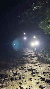
此路線非常陡,上坡不易,下坡必須非常小心控制。路上有許多健行者需要格外小心。
路線介紹短片:https://youtu.be/UM9BzcWn9PM

Tags
Rock gardens

Recent Activity on Trail

Past Week
  • 0 rides
  •  
6 Months
  • 0 rides
  •  
All
  • 0 rides
  • Last: Aug 20, 2023
update trails status or condition

楓櫃斗湖 Trail Reports

Status:
on Sep 2, 2025
Dry
no votes yet
Your vote: 0

view (27)
close
      Directions to view-310178 trailhead (25.132190, 121.420810)

      Photos

      6 more »
      mtb
      67 |
      Feb 29, 2024 @ 2:26am
      Feb 29, 2024
      mtb
      58 |
      Feb 29, 2024 @ 2:26am
      Feb 29, 2024
      mtb
      61 |
      Feb 29, 2024 @ 2:26am
      Feb 29, 2024
      report
      ebike
      73 |
      Dec 29, 2022 @ 12:16am
      Dec 29, 2022

      Videos

      2 more »
      觀音山也有MTB路線? - 風櫃斗湖
      mtb
      8:43 | 336 | Jan 28, 2021 , New Taipei City
      ⛰️硬漢嶺
      mtb
      0:00 | 24 | Feb 29, 2024 , New Taipei City

      1 Review & Comments

      Josehu
      濕滑時不建議前往,連ebike 都很難騎上去,下坡要注意煞車控制,避免鎖死打滑!

      We hope you've been enjoying Trailforks!

      Create a FREE account to view all trail reviews and much more.

      • By claudedoreTF Pro & contributors
      • #310178 - 664 views

      Frequently Asked Questions

      ▼ Where is 楓櫃斗湖 located?
      楓櫃斗湖 is located in Guan Yin Shan, New Taipei City, Taiwan. It is part of the Guan Yin Shan trail network. The trailhead is located at coordinates 25.13219, 121.42081.
      ▼ What is the elevation gain for 楓櫃斗湖?
      楓櫃斗湖 has 662 ft of elevation gain. The trail has 52 ft of elevation descent. The elevation ranges from 1,273 ft to 1,883 ft.
      ▼ Is 楓櫃斗湖 a point to point trail?
      楓櫃斗湖 is not a point to point trail. The direction is Both Directions. The trail type is doubletrack.
      ▼ How long is 楓櫃斗湖?
      楓櫃斗湖 is 3,471 ft long. The trail type is doubletrack.
      ▼ Are dogs allowed on 楓櫃斗湖?
      Yes, dogs are allowed on 楓櫃斗湖. Please keep dogs on a leash where required and clean up after them.
      ▼ How do I access 楓櫃斗湖? Where is the closest parking trailhead?
      The closest parking and trailhead locations to 楓櫃斗湖 are: View all parking locations in the area.
      ▼ How long does it take to ride 楓櫃斗湖?
      Based on recorded activities, it takes an average of 17 minutes to ride 楓櫃斗湖. The trail is 3,471 ft long. Actual times will vary based on fitness level, conditions, and pace. View recent activity logs for more details.
      ▼ How busy is 楓櫃斗湖?
      楓櫃斗湖 is a less popular trail with lighter traffic. There have been 21 recorded activities on this trail. The trail has received 27 check-ins. View recent activity on this trail.

      Hit the Trail

      Open in App

      Get this trail on your phone instantly.

      open trail in app

      Download Trail

      Save to wishlist, Garmin & download.
      save the trail

      Find Related Routes

      Find routes and users activities that include this trail.
      find routes for this trail

      You must enter a description before submitting.

