more stats
4.9 miles
Distance
32 ft
Climb
-2,171 ft
Descent
00:47:30
Avg time
-2,139 ft
Altitude change
2,549 ft
Altitude min
4,687 ft
Altitude max
4,687 ft
Altitude start
2,549 ft
Altitude end
-8.2%
Grade
-53.8%
Grade max
7.3%
Grade min
1,086 ft
Distance climb
4 miles
Distance down
2,359 ft
Distance flat
00:47:30
Avg time

Синяк Details

  • Activities
    • Mountain Bike
    • E-Bike
    • Hike
    • Trail Running
  • Riding Area
    Иремель
    Тюлюк
  • Difficulty Rating
  • Local Popularity
    5 in Mountain Biking [+]
    • 5 in E-Biking
    • 5 in Trail Running
    • 5 in Hiking
  • Global Ranking
    #186640 in Mountain Biking [+]
    • #185771 in E-Biking
    • #231822 in Trail Running
    • #221928 in Hiking
  • National Ranking
    #515 in Mountain Biking · Russia [+]
    • #954 in E-Biking
    • #176 in Trail Running
    • #150 in Hiking
  • Trail Type
    Singletrack
  • Bike Type
    DH, AM
  • Direction
    Downhill Only
  • Dogs Allowed
    Yes
  • eBike Allowed
    Yes up to Class 1

Самый длинный трейл на Иремеле. Спуск по пешеходной тропе с плато до туалетной поляны( в сторону села Николаевка).
По сложности синий во второй половине зеленый.

Access Info

Возврат по пути спуска(если вы планируете вернуться в Тюлюк

Tags

Trail Supporters

Recent Activity on Trail

Past Week
  • 0 rides
  •  
6 Months
  • 0 rides
  •  
All
  • 0 rides
  • Last: Aug 29, 2020
update trails status or condition

Синяк Trail Reports

no reports have been added for Синяк yet, add a trail report.
Trail reports are used to indicate a trails current condition and inform builders and other users about any issues on a trail.
Status:
Avg: 4.13 (1 votes)
Your vote: 0

view (0)
close
      Directions to view-320799 trailhead (54.520820, 58.831350)

      Photos

      5 more »
      mtb
      122 |
      Aug 31, 2020 @ 12:02am
      Aug 31, 2020
      mtb
      96 |
      Aug 31, 2020 @ 12:02am
      Aug 31, 2020
      mtb
      109 |
      Aug 31, 2020 @ 12:02am
      Aug 31, 2020
      mtb
      128 |
      Aug 31, 2020 @ 12:02am
      Aug 31, 2020

      Videos

      1 more »
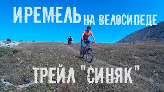
      Трейл 'Синяк'
      mtb
      22:48 | 196 | Sep 14, 2020 , Тюлюк
      5.0 ★★★★★
      1 Ratings
      5 ★ 100%
      4 ★
      3 ★
      2 ★
      1 ★

      Reviews / Comments

      No reviews yet, be the first to write a review or ask a question.
      Use trail reports to comment on trail conditions.


      We hope you've been enjoying Trailforks!

      Create a FREE account to view all trail reviews and much more.

      • By babayka & contributors
      • #320799 - 630 views

      Frequently Asked Questions

      ▼ Where is Синяк located?
      Синяк is located in Иремель, Тюлюк, Russia. It is part of the Иремель trail network. The trailhead is located at coordinates 54.52082, 58.83135.
      ▼ How hard is Синяк?
      Синяк is rated as Blue difficulty. The average grade is 8.2%.
      ▼ What is the elevation gain for Синяк?
      Синяк has 32 ft of elevation gain. The trail has 2,171 ft of elevation descent. The elevation ranges from 2,549 ft to 4,687 ft.
      ▼ Is Синяк a point to point trail?
      Yes, Синяк is a point to point trail. The direction is Downhill Only. The trail type is singletrack.
      ▼ How long is Синяк?
      Синяк is 4.9 miles long. The trail type is singletrack.
      ▼ Are dogs allowed on Синяк?
      Yes, dogs are allowed on Синяк. Please keep dogs on a leash where required and clean up after them.
      ▼ How long does it take to ride Синяк?
      Based on recorded activities, it takes an average of 48 minutes to ride Синяк. The trail is 4.9 miles long. Actual times will vary based on fitness level, conditions, and pace. View recent activity logs for more details.
      ▼ How busy is Синяк?
      Синяк is a less popular trail with lighter traffic. There have been 1 recorded activities on this trail. View recent activity on this trail.

      Hit the Trail

      Open in App

      Get this trail on your phone instantly.

      open trail in app

      Download Trail

      Save to wishlist, Garmin & download.
      save the trail

      Find Related Routes

      Find routes and users activities that include this trail.
      find routes for this trail

      You must enter a description before submitting.