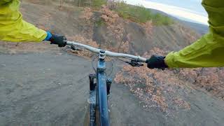
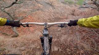

more stats
1,568 ft
Distance
-353 ft
Descent
00:04:34
Avg time
-354 ft
Altitude change
500 ft
Altitude min
854 ft
Altitude max
854 ft
Altitude start
502 ft
Altitude end
-22.6%
Grade
-50.6%
Grade max
-2.6%
Grade min
1,545 ft
Distance down
00:04:34
Avg time

Лом Details

  • Activities
    • Mountain Bike
    • E-Bike
  • Riding Area
  • Difficulty Rating
  • Local Popularity
    85 in Mountain Biking heatmap [+]
    • 90 in E-Biking
  • Global Ranking
    #4562 in Mountain Biking [+]
    • #19043 in E-Biking
  • National Ranking
    #4 in Mountain Biking · Ukraine [+]
    • #30 in E-Biking
  • Trail Type
    Singletrack
  • Bike Type
    DH, AM
  • Direction
    Downhill Only
    Popular Direction Shown
  • Climb Difficulty
    Green
  • Physical Rating
    Moderate
  • Trail Visibility
    Always easy to follow
  • Dogs Allowed
    Yes
  • eBike Allowed
    Yes up to Class 1
  • Year Opened
    2021

Немножко краснополянского уклона в Алуште.

Tags

Trail Supporters

Recent Activity on Trail

Past Week
  • 1 rides
  • 31 miles average
6 Months
  • 1 rides
  • 31 miles avg distance
All
  • 13 rides
  • Last: Nov 7, 2026
update trails status or condition

Лом Trail Reports

Status:
on Apr 9, 2023
Ideal
Avg: 4.26 (5 votes)
Your vote: 0

view (590)
close
      Directions to view-387695 trailhead (44.714470, 34.401130)

      Photos

      No photos have been added for Лом yet, add a photo.

      Videos

      2 more »
      Алушта - Лом v.2
      mtb
      0:25 | 205 | Feb 6, 2021 , Alushta
      Алушта - Лом
      mtb
      0:57 | 179 | Jan 15, 2021 , Alushta
      4.6 ★★★★★
      5 Ratings
      5 ★ 80%
      4 ★
      3 ★ 20%
      2 ★
      1 ★

      2 Reviews & Comments

      astim astim
      Успел стать одним из моих любимых трейлов в Алуште, удобно расположен, можно вечерком после работы закрутить за полчаса, более интенсивный относительно других на Лучистом, с хорошим уклоном на большей части, без прогонов/перегонов по полкам, надо постоянно что-то делать, съезжалка правда немного пугает до сих пор, но после нее прям вууух бам-бам-бам и по мини-каньону с лужеречкой на дне, кайф, напоминает трейл Корона, который тоже огонь, но тут меньше поворачивать, больше вниз. Новичкам наверное не стоит на него ехать, вместо него можно съехать основную траекторию Забора, там тоже кайфовый сыпушный нырок на финише к плошмяку у ручья, а если на старт добрались то скатить Кнут, хотя тот тоже немного в красноту, ну или Пряник, если совсем простой нужен. Спасибо за трейл )

      We hope you've been enjoying Trailforks!

      Create a FREE account to view all trail reviews and much more.

      • By Jahtaka TBRU & contributors
      • #387695 - 605 views

      Frequently Asked Questions

      ▼ Where is Лом located?
      Лом is located in Лучистые трейлы, Alushta, Ukraine. It is part of the Лучистые трейлы trail network. The trailhead is located at coordinates 44.71447, 34.40113.
      ▼ How hard is Лом?
      Лом is rated as Red difficulty. The physical rating is Moderate. The average grade is 22.6%. The climb difficulty is rated Green.
      ▼ What is the elevation gain for Лом?
      The trail has 353 ft of elevation descent. The elevation ranges from 500 ft to 854 ft.
      ▼ Is Лом a point to point trail?
      Yes, Лом is a point to point trail. The direction is Downhill Only. The trail type is singletrack.
      ▼ How long is Лом?
      Лом is 1,568 ft long. The trail type is singletrack.
      ▼ Are dogs allowed on Лом?
      Yes, dogs are allowed on Лом. Please keep dogs on a leash where required and clean up after them.
      ▼ How long does it take to ride Лом?
      Based on recorded activities, it takes an average of 5 minutes to ride Лом. The trail is 1,568 ft long. Actual times will vary based on fitness level, conditions, and pace. View recent activity logs for more details.
      ▼ How busy is Лом?
      Лом is a very popular trail. There have been 561 recorded activities on this trail. The trail has received 590 check-ins. View recent activity on this trail.

      Hit the Trail

      Open in App

      Get this trail on your phone instantly.

      open trail in app

      Download Trail

      Save to wishlist, Garmin & download.
      save the trail

      Find Related Routes

      Find routes and users activities that include this trail.
      find routes for this trail

      You must enter a description before submitting.