
more stats
3,852 ft
Distance
347 ft
Climb
-235 ft
Descent
00:22:32
Avg time
112 ft
Altitude change
1,106 ft
Altitude min
1,306 ft
Altitude max
1,106 ft
Altitude start
1,217 ft
Altitude end
2.9%
Grade
-69.3%
Grade max
110.5%
Grade min
1,319 ft
Distance climb
1,112 ft
Distance down
1,417 ft
Distance flat
00:22:32
Avg time

猴山岳 Details

  • Activities
    • Hike
    • Mountain Bike
    • Trail Running
  • Riding Area
  • Difficulty Rating
  • Local Popularity
    5 in Mountain Biking heatmap [+]
    • 55 in Trail Running
    • 5 in Hiking
  • Global Ranking
    #379178 in Mountain Biking [+]
    • #174674 in Trail Running
    • #167021 in Hiking
  • National Ranking
    #159 in Mountain Biking · Taiwan [+]
    • #87 in Trail Running
    • #146 in Hiking
  • Hiking SAC Scale
    T1 Hiking
  • Trail Type
    Singletrack
  • Bike Type
    AM, XC
  • Direction
    Both Directions
    Popular Direction Shown
  • Climb Difficulty
    Green
  • Physical Rating
    Easy
  • Dogs Allowed
    Yes

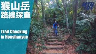
入口由新光路二段74巷「泰元農場」旁階梯進入,初段300公尺之內部分需牽行。中後段皆可騎行,需注意此地常年潮溼,地面較為濕滑。後面可續接「茶山古道」至炮子崙聚落。
路線段片:https://youtu.be/3ILmkRMPKbM

Tags

Recent Activity on Trail

Past Week
  • 0 rides
  •  
6 Months
  • 0 rides
  •  
All
  • 0 rides
  • Last: Sep 15, 2023
update trails status or condition

猴山岳 Trail Reports

statusdatedescription
Jan 13, 2024 @ 3:03am
Jan 13, 2024
more »
Status:
on Jan 13, 2024
Wet
no votes yet
Your vote: 0

view (5)
close
      Directions to view-469100 trailhead (24.983630, 121.599440)

      Photos

      No photos have been added for 猴山岳 yet, add a photo.

      Videos

      1 more »
      猴山岳也有登山車路線?
      mtb
      13:39 | 256 | Sep 30, 2021 , Taipei

      Reviews / Comments

      No reviews yet, be the first to write a review or ask a question.
      Use trail reports to comment on trail conditions.


      We hope you've been enjoying Trailforks!

      Create a FREE account to view all trail reviews and much more.

      • By claudedoreTF Pro & contributors
      • #469100 - 790 views

      Frequently Asked Questions

      ▼ Where is 猴山岳 located?
      猴山岳 is located in Maokong Gondola Trails 貓空, Taipei, Taiwan. It is part of the Maokong Gondola Trails 貓空 trail network. The trailhead is located at coordinates 24.98363, 121.59944.
      ▼ How hard is 猴山岳?
      猴山岳 is rated as Blue difficulty. The physical rating is Easy. The average grade is 2.9%. The climb difficulty is rated Green.
      ▼ What is the elevation gain for 猴山岳?
      猴山岳 has 347 ft of elevation gain. The trail has 235 ft of elevation descent. The elevation ranges from 1,106 ft to 1,306 ft.
      ▼ Is 猴山岳 a point to point trail?
      猴山岳 is not a point to point trail. The direction is Both Directions. The trail type is singletrack.
      ▼ How long is 猴山岳?
      猴山岳 is 3,852 ft long. The trail type is singletrack.
      ▼ Are dogs allowed on 猴山岳?
      Yes, dogs are allowed on 猴山岳. Please keep dogs on a leash where required and clean up after them.
      ▼ How long does it take to ride 猴山岳?
      The estimated time to ride 猴山岳 is approximately 23 minutes. The trail is 3,852 ft long. Actual times will vary based on fitness level, conditions, and pace.
      ▼ How busy is 猴山岳?
      猴山岳 is a less popular trail with lighter traffic. There have been 5 recorded activities on this trail. The trail has received 5 check-ins. View recent activity on this trail.

      Hit the Trail

      Open in App

      Get this trail on your phone instantly.

      open trail in app

      Download Trail

      Save to wishlist, Garmin & download.
      save the trail

      Find Related Routes

      Find routes and users activities that include this trail.
      find routes for this trail

      You must enter a description before submitting.

