
more stats
1.6 miles
Distance
347 ft
Climb
-907 ft
Descent
852 ft
High Point
-558 ft
Altitude change
68 ft
Altitude min
630 ft
Altitude start
72 ft
Altitude end
-6.4%
Grade
-61.4%
Grade max
84.3%
Grade min
2,694 ft
Distance climb
5,220 ft
Distance down
745 ft
Distance flat

刣狗寮山保線道 Details

  • Activities
    • Mountain Bike
    • Hike
    • Trail Running
  • Riding Area
  • Difficulty Rating
  • Local Popularity
    5 in Mountain Biking [+]
    • 5 in Trail Running
    • 5 in Hiking
  • Global Ranking
    #403149 in Mountain Biking [+]
    • #266136 in Trail Running
    • #238737 in Hiking
  • National Ranking
    #169 in Mountain Biking · Taiwan [+]
    • #180 in Trail Running
    • #285 in Hiking
  • Trail Type
    Singletrack
  • Direction
    Both Directions
  • Climb Difficulty
    Green
  • Physical Rating
    Easy
  • Trail Visibility
    Always easy to follow
  • Dogs Allowed
    Yes
  • eBike Allowed

瑞士山莊瑞松路 152 巷 56 號登山口需扛車上山,也可以在這個登山口之前,從瑞松路最後一個回頭彎頂點的保線道進入,保線道登山口無需扛車,可以牽車步行。1 K 左右的垂直攀升需扛車。

This trail is unsanctioned.

Tags

Recent Activity on Trail

Past Week
  • 0 rides
  •  
6 Months
  • 0 rides
  •  
All
  • 0 rides
  •  
update trails status or condition

... Trail Reports

no reports have been added for 刣狗寮山保線道 yet, add a trail report.
Trail reports are used to indicate a trails current condition and inform builders and other users about any issues on a trail.
Status:
no votes yet
Your vote: 0

view (0)
close
      Directions to view-723908 trailhead (25.110470, 121.649020)

      Photos

      No photos have been added for 刣狗寮山保線道 yet, add a photo.

      Videos

      1 more »
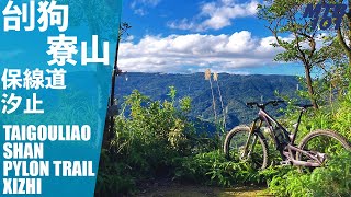
      汐止刣狗寮山保線道
      mtb
      14:55 | 318 | Jan 23, 2024 , New Taipei City

      Reviews / Comments

      No reviews yet, be the first to write a review or ask a question.
      Use trail reports to comment on trail conditions.


      We hope you've been enjoying Trailforks!

      Create a FREE account to view all trail reviews and much more.

      • #723908 - 413 views

      Frequently Asked Questions

      ▼ Where is 刣狗寮山保線道 located?
      刣狗寮山保線道 is located in New Taipei City, Taiwan. It is part of the New Taipei City trail network. The trailhead is located at coordinates 25.11047, 121.64902.
      ▼ How hard is 刣狗寮山保線道?
      刣狗寮山保線道 is rated as Green difficulty. The physical rating is Easy. The average grade is 6.4%. The climb difficulty is rated Green.
      ▼ What is the elevation gain for 刣狗寮山保線道?
      刣狗寮山保線道 has 347 ft of elevation gain. The trail has 907 ft of elevation descent. The elevation ranges from 68 ft to 852 ft.
      ▼ Is 刣狗寮山保線道 a point to point trail?
      刣狗寮山保線道 is not a point to point trail. The direction is Both Directions. The trail type is singletrack.
      ▼ How long is 刣狗寮山保線道?
      刣狗寮山保線道 is 1.6 miles long. The trail type is singletrack.
      ▼ Are dogs allowed on 刣狗寮山保線道?
      Yes, dogs are allowed on 刣狗寮山保線道. Please keep dogs on a leash where required and clean up after them.
      ▼ How busy is 刣狗寮山保線道?
      刣狗寮山保線道 is a less popular trail with lighter traffic. View recent activity on this trail.

      Hit the Trail

      Open in App

      Get this trail on your phone instantly.

      open trail in app

      Download Trail

      Save to wishlist, Garmin & download.
      save the trail

      Find Related Routes

      Find routes and users activities that include this trail.
      find routes for this trail

      You must enter a description before submitting.

