2,709 ft
Distance
2 ft
Climb
-625 ft
Descent
00:05:11
Avg time
Wada - upper part Details
-
Activities
- Mountain Bike
-
Riding AreaVipavska dolina
Ajdovščina -
Difficulty Rating
-
Voted DifficultyBlue (1 vote)
-
Trail TypeSingletrack
-
Bike TypeDH, AM, XC
-
DirectionDownhill OnlyPopular direction shown
-
Physical RatingModerate
-
Dogs AllowedYes
-
eBike Allowed
-
Ride in RainYes
-
Global Ranking#22196 in Mountain Biking
-
Local Popularity70 in Mountain Biking
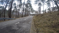
No description for Wada - upper part trail has been added yet!
Wada - upper part is a highly rated 826 m popular blue singletrack trail located near Ajdovščina. This mountain bike only trail can be used downhill only and has a moderate overall physical rating. On average it takes 5 minutes to complete this trail.
More Stats for Wada - upper part mountain bike trail trail
-
Altitude change-623 ft
-
Altitude min1,843 ft
-
Altitude max2,466 ft
-
Altitude start2,466 ft
-
Altitude end1,843 ft
-
Grade-22.995%
-
Grade max-44.321%
-
Grade min1.316%
-
Distance climb142 ft
-
Distance down2,568 ft
-
Avg time00:05:11
-
Avg reverse time00:12:12
- view trail stats
close
-
Layers w
- Map Content
- More Layers
- Pro
- Pro
- Pro
- Pro
- Pro
- Pro
- Pro
- Pro
-
Upgrade to

3D
Trail Conditions
- Unknown
- Snow Groomed
- Snow Packed
- Snow Covered
- Snow Cover Partial
- Freeze/thaw Cycle
- Icy
- Prevalent Mud
- Wet
- Variable
- Ideal
- Dry
- Very Dry
Trail Flow (Ridden Direction)
Trailforks scans users ridelogs to determine the most popular direction each trail is ridden. A good flowing trail network will have most trails flowing in a single direction according to their intension.
The colour categories are based on what percentage of riders are riding a trail in its intended direction.
The colour categories are based on what percentage of riders are riding a trail in its intended direction.
- > 96%
- > 90%
- > 80%
- > 70%
- > 50%
- < 50%
- bi-directional trail
- no data
Trail Last Ridden
Trailforks scans ridelogs to determine the last time a trail was ridden.
- < 2 days
- < 1 week
- < 2 weeks
- < 1 month
- < 6 months
- > 6 months
Trail Ridden Direction
The intended direction a trail should be ridden.
- Downhill Only
- Downhill Primary
- Both Directions
- Uphill Primary
- Uphill Only
- One Direction
Contribute Details
Colors indicate trail is missing specified detail.
- Description
- Photos
- Description & Photos
- Videos
Trail Popularity ?
Trailforks scans ridelogs to determine which trails are ridden the most in the last 9 months.
Trails are compared with nearby trails in the same city region with a possible 25 colour shades.
Think of this as a heatmap, more rides = more kinetic energy = warmer colors.
- most popular
- popular
- less popular
- not popular
ATV/ORV/OHV Filter
Max Vehicle Width
inches
US Cell Coverage
Legend

Radar Time
x
Activity Recordings
Trailforks users anonymized public ridelogs from the past 6 months.
- mountain biking recent
- mountain biking (>6 month)
- hiking (1 year)
- moto (1 year)
Activity Recordings
Trailforks users anonymized public skilogs from the past 12 months.
- Downhill Ski
- Backcountry Ski
- Nordic Ski
- Snowmobile
Winter Trails
Warning
A routing network for winter maps does not exist. Selecting trails using the winter trails layer has been disabled.
x
Missing Trails
Most Popular
Least Popular
Trails are colored based on popularity. The more popular a trail is, the more red. Less popular trails trend towards green.
Jump Magnitude Heatmap
Heatmap of where riders jump on trails. Zoom in to see individual jumps, click circles to view jump details.
Trails Deemphasized
Trails are shown in grey.
Only show trails with NO bikes.
Save the current map location and zoom level as your default home location whenever this page is loaded.
Save
Directions to wada-upper-part trailhead
(45.937170, 13.869640)
update trails status or condition
Wada - upper part Trail Reports
view all reports »
Recent Ridelog Activity on Trail
Past Week
- 0 rides
6 Months
- 50 rides
- 14 miles avg distance
All
- 490 rides
- Last: May 5, 2024

We hope you've been enjoying Trailforks!
Create a FREE account to view trail comments and much more.
Videos
more »

9:01 |
452 |
Oct 6, 2019 , Ajdovščina

10:43 |
351 |
Feb 19, 2019 , Ajdovščina
2:52 |
252 |
Feb 21, 2017 , Ajdovščina
Nearby Trails
- Fonza Access 709 ft
- Klavdija 787 ft
- Fonza 1,286 ft
- Wada - Bottom Part 3,898 ft
- Resistance 1 mile
- By cravks & contributors
- #65509 - 3,648 views
- follow/subscribe
- login to download gpx or kml files.
You must enter a description before submitting.