
more stats
2.4 miles
Distance
892 ft
Climb
-42 ft
Descent
00:48:57
Avg time
850 ft
Altitude change
1,031 ft
Altitude min
1,912 ft
Altitude max
1,031 ft
Altitude start
1,881 ft
Altitude end
6.623%
Grade
-18.289%
Grade max
34.488%
Grade min
2 miles
Distance climb
1,206 ft
Distance down
00:48:57
Avg time

Wallace Trail Details

  • Activities
    • Mountain Bike
    • Hike
    • Trail Running
  • Riding Area
    Greenwood Furnace State Park
    Huntingdon, Pennsylvania
  • Difficulty Rating
  • Local Popularity
    80 in Mountain Biking [+]
    • 5 in Trail Running
    • 5 in Hiking
  • Global Ranking
    #127028 in Mountain Biking [+]
    • #337618 in Trail Running
    • #345156 in Hiking
  • State Ranking
    #1,830 in Mountain Biking · Pennsylvania [+]
    • #5,253 in Trail Running
    • #5,927 in Hiking
  • Trail Type
    Singletrack
  • Bike Type
    AM, XC
  • Direction
    Both Directions
    Popular Direction Shown
  • Climb Difficulty
    Blue
  • Physical Rating
    Moderate
  • Season
    Summer - Winter
  • Dogs Allowed
    Yes
  • Land Owner

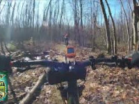
This trail starts as a logging road for the first 1/2 mile before the singletrack turns off to the left and continues climbing. This a 3 mile trail that connects to Telephone trail at the top before ending on Seeger Rd. (1100ft of elevation average grade of 6.6%

This is a good intermediate level trail that features short rocky sections and only requires medium technical skills.

I would not recommend using this trail in the early spring when as conditions are much wetter and you could be riding in run off areas from time to time. The best times to ride this trail are in mid to later summer and fall, when it will definitely be dryer.

Access Info

Head west out of the park on Broad Mtn Rd, which becomes Black Lick Rd, for an easy two mile warm up.

Tags
Rocky

Trail Supporters

  • http://nittanymba.org/
    since 1
    Maintainer

Local Trail Association

Traditionally Indigenous Territory

Recent Activity on Trail

Past Week
  • 0 rides
  •  
6 Months
  • 3 rides
  • 12 miles avg distance
All
  • 14 rides
  • Last: Sep 24, 2026
c1c2c3c4
January
February
March
April
May
June
July
August
September
October
November
December
update trails status or condition

Wallace Trail Trail Reports

statusdatedescription
May 25, 2024 @ 8:32am
May 25, 2024
Downed tree
Jun 26, 2023 @ 10:19am
Jun 26, 2023
DCNR has closed these trails temporarily for maintenance and the removal of some unsanctioned features.
Aug 20, 2020 @ 3:58am
Aug 20, 2020
Very narrow trail corridor on singletrack sections, overgrown vegetation. Looks like some work was being done in the higher elevations to cut...
Sep 10, 2017 @ 2:58pm
Sep 10, 2017
Multiple trees across path, still passable
Nov 22, 2014 @ 12:30pm
Nov 22, 2014
more »
Status:
on May 25, 2024
Dry
Avg: 3.39 (4 votes)
Your vote: 0

view (69)
close
      Directions to wallace-trail trailhead (40.651720, -77.788030)

      Photos

      No photos have been added for Wallace Trail yet, add a photo.

      Videos

      1 more »
      Long Decline Wallace Trail- Greenwood Furnace...
      mtb
      81 | Jun 7, 2025 , Huntingdon

      Routes with this trail

      ★ 4.0 • 13 miles • 1,434 ft • 11 • Loop •
      Greenwood Furnace 13 For a beginner this is about a 3hr loop. This is a good intermediate loop that...
      26 miles • 3,296 ft • 19 • Loop •
      Peep, Pig Pile, Ross Trail This is a challenging 26 mile loop with some fun downhills thrown in. It could...

      Trail Products

      2.5 ★★★★★
      4 Ratings
      5 ★
      4 ★ 25%
      3 ★ 25%
      2 ★ 25%
      1 ★ 25%

      2 Reviews & Comments

      Dionnefrancois
      Boring trail. Do not waste your time and energy on this trail.
      rmchirico rmchirico
      Good snowmobiling or gravel grinder trail until it turns to eroded single-track with many trees down across trail.

      We hope you've been enjoying Trailforks!

      Create a FREE account to view all trail reviews and much more.

      • By SaclydesdaleTF Pro NMBA & contributors
      • #21265 - 1,744 views

      Frequently Asked Questions

      ▼ Where is Wallace Trail located?
      Wallace Trail is located in Greenwood Furnace State Park, Huntingdon, Pennsylvania, United States. It is part of the Greenwood Furnace State Park trail network. The trailhead is located at coordinates 40.65172, -77.78803.
      ▼ How hard is Wallace Trail?
      Wallace Trail is rated as Blue difficulty. The physical rating is Moderate. The average grade is 6.623%. The climb difficulty is rated Blue.
      ▼ What is the elevation gain for Wallace Trail?
      Wallace Trail has 892 ft of elevation gain. The trail has 42 ft of elevation descent. The elevation ranges from 1,031 ft to 1,912 ft.
      ▼ Is Wallace Trail a point to point trail?
      Wallace Trail is not a point to point trail. The direction is Both Directions. The trail type is singletrack.
      ▼ How long is Wallace Trail?
      Wallace Trail is 2.4 miles long. The trail type is singletrack.
      ▼ Are dogs allowed on Wallace Trail?
      Yes, dogs are allowed on Wallace Trail. Please keep dogs on a leash where required and clean up after them.
      ▼ When is the best time of year to ride Wallace Trail?
      Wallace Trail is best visited during: Summer - Winter.
      ▼ How do I access Wallace Trail? Where is the closest parking trailhead?
      The closest parking and trailhead locations to Wallace Trail are: View all parking locations in the area.
      ▼ How long does it take to ride Wallace Trail?
      Based on recorded activities, it takes an average of 49 minutes to ride Wallace Trail. The trail is 2.4 miles long. Actual times will vary based on fitness level, conditions, and pace. View recent activity logs for more details.
      ▼ How busy is Wallace Trail?
      Wallace Trail is a very popular trail. There have been 67 recorded activities on this trail. The trail has received 69 check-ins. View recent activity on this trail.

      Hit the Trail

      Open in App

      Get this trail on your phone instantly.

      open trail in app

      Download Trail

      Save to wishlist, Garmin & download.
      save the trail

      Find Related Routes

      Find routes and users activities that include this trail.
      find routes for this trail

      You must enter a description before submitting.

