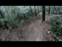
This trail is permanently closed/decommissioned
more stats
1.3 miles
Distance
388 ft
Climb
-478 ft
Descent
00:16:32
Avg time
-90 ft
Altitude change
316 ft
Altitude min
627 ft
Altitude max
621 ft
Altitude start
531 ft
Altitude end
-57.047%
Grade max
62.593%
Grade min
2,402 ft
Distance climb
2,981 ft
Distance down
1,730 ft
Distance flat
00:16:32
Avg time

WCCTT Details

  • Activities
    • Mountain Bike
  • Riding Area
    Whitford Forest
    Cambridge
  • Difficulty Rating
  • Local Popularity
    5 in Mountain Biking
  • Trail Type
    Singletrack
  • Bike Type
    AM
  • Direction
    Downhill Primary
    Popular Direction Shown
  • Physical Rating
    Moderate
  • Dogs Allowed
    Yes
  • Year Opened
    2014

Fantastic flowing fast single track leading into a winding uphill or alternatively into the second half of Charging Pig. One of the best tracks in the forest.

Access Info

This trail is in a private forest. Please join PCBC (http://www.pcbc.co.nz) for access and maps.

Trail Supporters
Local Trail Association
  • trail association logo
  • Please consider joining or donating to the local trail association to support
    trail development & maintenance.

Recent Activity on Trail

Past Week
  • 0 rides
  •  
6 Months
  • 0 rides
  •  
All
  • 7 rides
  • Last: Apr 21, 2019
update trails status or condition

WCCTT Trail Reports

statusdatedescription
Mar 2, 2018 @ 11:01am
Mar 2, 2018
reporter WCCTT has been cleared. On the down there is a fallen tree with a short ride-around. There are significant trees down at the bottom and the...
Apr 10, 2015 @ 3:37pm
Apr 10, 2015
No Access to WCCTT. This will remain so for the near future. Please stay out.
Jan 27, 2015 @ 2:08pm
Jan 27, 2015
The forestry road gate is still closed. Trucks are running so please stay out unless you are sure it is clear. Trucks have been seen running on...
Dec 28, 2014 @ 8:38pm
Dec 28, 2014
Forestry Road is still closed with a gate but access is available during this festive period. Track is dry with a new extension put high of the...
Nov 23, 2014 @ 8:46am
Nov 23, 2014
The forestry access road to WCCTT is currently closed. The bottom part of the trail is a swamp.
more »
Status:
on Mar 2, 2018
Unknown
Avg: 4.13 (1 votes)
Your vote: 0

view (144)
close
      Directions to wcctt trailhead (-36.944270, 175.016810)

      Photos

      20 more »
      mtb
      44 |
      Apr 26, 2025 @ 2:39am
      Apr 26, 2025
      mtb
      48 |
      Apr 26, 2025 @ 2:34am
      Apr 26, 2025
      mtb
      652 |
      Apr 16, 2015 @ 2:23am
      Apr 16, 2015
      mtb
      641 |
      Apr 16, 2015 @ 2:23am
      Apr 16, 2015

      Videos

      1 more »
      THTC Product Testing
      mtb
      0:51 | 443 | Jun 4, 2014 , Cambridge
      5.0
      1 Ratings
      5 100%
      4
      3
      2
      1

      1 Review & Comments

      TimmyAnd
      Trail disappears at bottom. Overgrown with many trees down at bottom part. Top half is ok but need to push back up. Or can go to wcct then climb ocer many fallen trees and again push back up... bit of repair work needed.

      We hope you've been enjoying Trailforks!

      Create a FREE account to view all trail reviews and much more.

      • By Callumw45TF Pro & contributors
      • #17325 - 2,628 views

      Frequently Asked Questions

      Where is WCCTT located?
      WCCTT is located in Whitford Forest, Cambridge, New Zealand. It is part of the Whitford Forest trail network. The trailhead is located at coordinates -36.94427, 175.01681.
      How hard is WCCTT?
      WCCTT is rated as Blue difficulty. The physical rating is Moderate.
      What is the elevation gain for WCCTT?
      WCCTT has 388 ft of elevation gain. The trail has 478 ft of elevation descent. The elevation ranges from 316 ft to 627 ft.
      Is WCCTT a point to point trail?
      WCCTT is not a point to point trail. The direction is Downhill Primary. The trail type is singletrack.
      How long is WCCTT?
      WCCTT is 1.3 miles long. The trail type is singletrack.
      Are dogs allowed on WCCTT?
      Yes, dogs are allowed on WCCTT. Please keep dogs on a leash where required and clean up after them.
      How do I access WCCTT? Where is the closest parking trailhead?
      The closest parking and trailhead locations to WCCTT are: View all parking locations in the area.
      How long does it take to ride WCCTT?
      The estimated time to ride WCCTT is approximately 17 minutes. The trail is 1.3 miles long. Actual times will vary based on fitness level, conditions, and pace.
      How busy is WCCTT?
      WCCTT is a less popular trail with lighter traffic. There have been 143 recorded activities on this trail. The trail has received 144 check-ins. View recent activity on this trail.

      Hit the Trail

      Open in App

      Get this trail on your phone instantly.

      open trail in app

      Download Trail

      Save to wishlist, Garmin & download.
      save the trail

      Find Related Routes

      Find routes and users activities that include this trail.
      find routes for this trail

      You must enter a description before submitting.