
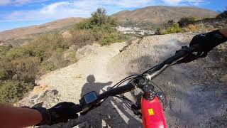
more stats
1,850 ft
Distance
-351 ft
Descent
00:03:11
Avg time
-351 ft
Altitude change
3,205 ft
Altitude min
3,556 ft
Altitude max
3,556 ft
Altitude start
3,205 ft
Altitude end
-19%
Grade
-75.7%
Grade max
-1.9%
Grade min
1,850 ft
Distance down
00:03:11
Avg time

Wejar Details

  • Activities
    • Mountain Bike
    • E-Bike
    • Gravel Bike
    • Hike
    • Trail Running
  • Riding Area
  • Ref Number
    3
  • Difficulty Rating
  • Local Popularity
    80 in Mountain Biking heatmap [+]
    • 85 in E-Biking
    • 5 in Trail Running
    • 75 in Hiking
    • 5 in Gravel Biking
  • Global Ranking
    #202893 in Mountain Biking [+]
    • #86576 in E-Biking
    • #377711 in Trail Running
    • #128374 in Hiking
    • #51704 in Gravel Biking
  • National Ranking
    #20,742 in Mountain Biking · Spain [+]
    • #17,283 in E-Biking
    • #41,756 in Trail Running
    • #8,887 in Hiking
    • #2,122 in Gravel Biking
  • Hiking SAC Scale
    T3 Demanding Mountain Hiking
  • Trail Type
    Singletrack
  • Bike Type
    AM, XC, Gravel
  • Direction
    Downhill Only
    Popular Direction Shown
  • Physical Rating
    Moderate
  • Trail Visibility
    Always easy to follow
  • Dogs Allowed
    Yes
  • eBike Allowed
    Yes up to Class 1

Sin ciclar pero con rastros de calor y track de otras plataformas...se agradece comentario si la ciclas, Gracias

Tags

Recent Activity on Trail

Past Week
  • 0 rides
  •  
6 Months
  • 11 rides
  • 25.0 km avg distance
All
  • 68 rides
  • Last: Oct 11, 2026
c1c2c3c4
January
February
March
April
May
June
July
August
September
October
November
December
update trails status or condition

Wejar Trail Reports

statusdatedescription
Jun 24, 2024 @ 5:48am
Jun 24, 2024
reporter
Jun 5, 2024 @ 12:21am
Jun 5, 2024
Como las otras dos, deteriorada por la erosión pero disfrutona
May 17, 2023 @ 7:55am
May 17, 2023
more »
Status:
on Jun 24, 2024
Very Dry
Avg: 4 (1 votes)
Your vote: 0

view (478)
close
      Directions to wejar-600339 trailhead (37.150250, -3.440630)

      Photos

      No photos have been added for Wejar yet, add a photo.

      Videos

      1 more »
      LOS ROMANTICOS RUTA 4 CENTRO BTT GÜEJAR SIERRA
      mtb
      7:42 | 214 | Jan 11, 2023 , My City

      Routes with this trail

      more »
      19 miles • 5,320 ft • 10 • Loop •
      Ruta aprovechando parte de las bajadas de la zona, intentando maximizar el trazado dentro de la distancia...
      6 miles • 1,762 ft • 3 • Loop •
      Preciosa ruta , con una primera parte de subida por asfalto y toda la bajada por una trialera que quita el...
      12 miles • 3,531 ft • 9 • Point to Point •
      Ruta creada para llevar un solo sentido de la marcha, intentando enlazar bajadas con la mayor lógica...
      4.0 ★★★★★
      1 Ratings
      5 ★
      4 ★ 100%
      3 ★
      2 ★
      1 ★

      3 Reviews & Comments

      ViktordgvNwL
      Voy a comentar la ruta desde la gasolinera Repsol hasta el puente al lado del pantano: Buen sitio, quizás demasiada cuesta. Parece una ruta con mucho flow, pero frenar tanto lo estropea todo. Lo he hecho con bici eléctrica convencional de enduro y con bici de enduro normal, la eléctrica por el peso recalentó los frenos demasiado. En general agradable sitio, tiene emoción. Ojo con la vuelta si no tiene nadie para recogerle en coche. Incluso con la bici eléctrica cuesta jajaja. Por la carretera son casi 7 km con una pendiente de hasta 19%. Con la bici eléctrica 25 min, con la de enduro 1h10min. La ruta no vale para subir, por lo menos a mí me pareció demasiado.
      pelutxin
      Bonita bajada, pero un poco deteriorada por la erosión. Aún así se disfruta haciéndola por los flancos y aprovechando peraltes
      DominikQxVS3T
      Nice trail that can be easily accessed. Not very flowy, and it has a few tough sections. I would rate it more red than blue.

      We hope you've been enjoying Trailforks!

      Create a FREE account to view all trail reviews and much more.

      • By CrisjacaTF Pro & contributors
      • #600339 - 424 views

      Frequently Asked Questions

      ▼ Where is Wejar located?
      Wejar is located in Güéjar Sierra, Spain. It is part of the Güéjar Sierra trail network. The trailhead is located at coordinates 37.15025, -3.44063.
      ▼ How hard is Wejar?
      Wejar is rated as Blue difficulty. The physical rating is Moderate. The average grade is 19%.
      ▼ What is the elevation gain for Wejar?
      The trail has 351 ft of elevation descent. The elevation ranges from 3,205 ft to 3,556 ft.
      ▼ Is Wejar a point to point trail?
      Yes, Wejar is a point to point trail. The direction is Downhill Only. The trail type is singletrack.
      ▼ How long is Wejar?
      Wejar is 1,850 ft long. The trail type is singletrack.
      ▼ Are dogs allowed on Wejar?
      Yes, dogs are allowed on Wejar. Please keep dogs on a leash where required and clean up after them.
      ▼ When is the best time of year to ride Wejar?
      Based on activity log data, the most popular months to ride Wejar are:
      • June (19 activities)
      • October (9 activities)
      • August (8 activities)
      Check the reports page for current trail conditions.
      ▼ How long does it take to ride Wejar?
      Based on recorded activities, it takes an average of 3 minutes to ride Wejar. The trail is 1,850 ft long. Actual times will vary based on fitness level, conditions, and pace. View recent activity logs for more details.
      ▼ How busy is Wejar?
      Wejar is a very popular trail. There have been 339 recorded activities on this trail. The trail has received 478 check-ins. View recent activity on this trail.

      Hit the Trail

      Open in App

      Get this trail on your phone instantly.

      open trail in app

      Download Trail

      Save to wishlist, Garmin & download.
      save the trail

      Find Related Routes

      Find routes and users activities that include this trail.
      find routes for this trail

      You must enter a description before submitting.

