more stats
4,052 ft
Distance
142 ft
Climb
-132 ft
Descent
00:16:23
Avg time
9 ft
Altitude change
1,607 ft
Altitude min
1,719 ft
Altitude max
1,607 ft
Altitude start
1,614 ft
Altitude end
0.2%
Grade
-31%
Grade max
33.9%
Grade min
1,522 ft
Distance climb
2,047 ft
Distance down
482 ft
Distance flat
00:16:23
Avg time

Werpil Details

  • Activities
    • Mountain Bike
    • E-Bike
  • Riding Area
  • Ref Number
    #5
  • Difficulty Rating
  • Local Popularity
    95 in Mountain Biking [+]
    • 90 in E-Biking
  • Global Ranking
    #31499 in Mountain Biking [+]
    • #18508 in E-Biking
  • Trail Type
    Singletrack
  • Direction
    One Direction
  • Climb Difficulty
    Black Diamond
  • Dogs Allowed
    Yes
  • eBike Allowed
    Yes up to Class 1
  • TTFs on Trail
    Rock Face, Rock Garden
  • Ride in Rain
    Yes

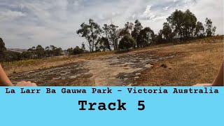
A steep and technical climb up a narrow hand-crafted track to the northern knoll is rewarded with outstanding views across the Harcourt Valley and beyond. The knoll is a great place to enjoy a break among the huge natural rock outcrops. You may also catch a glimpse of a werpil (wedge-tailed eagle) soaring on the thermals. The challenging but playful descent features extensive granite rock-gardens and chutes that make the most of the natural terrain. Please keep to the trail alignment to avoid contact with the moss beds on the granite slabs.

Access Info

Access via Girra (Trail 2) or the Northern Trail Hub

Local Trail Association
Traditionally Indigenous Territory

Recent Activity on Trail

Past Week
  • 0 rides
  •  
6 Months
  • 0 rides
  •  
All
  • 178 rides
  • Last: Nov 11, 2019
c1c2c3c4
January
February
March
April
May
June
July
August
September
October
November
December
update trails status or condition

Werpil Trail Reports

statusdatedescription
Mar 3, 2026 @ 6:26pm (Australia/Melbourne)
Mar 2, 2026
Park closed due to bushfire damage. https://lalarrbagauwa.com.au/
Sep 23, 2024 @ 6:54pm
Sep 23, 2024
Awesome view once you get to the top
Jul 30, 2024 @ 4:39am
Jul 30, 2024
rocky, gnarly but great at the top
Jul 10, 2024 @ 7:23pm
Jul 10, 2024
Really tough up hill, had to get off and walk a couple of sections but the view at the top is awesome. Coming down on the rocks is slippery but a...
May 19, 2024 @ 2:45am
May 19, 2024
Good on an E-Bike with some technical climbing and descending. It’s a rough slog on an analog bike though.
more »
Status:
on Mar 3, 2026
Avg: 3.91 (6 votes)
Your vote: 0

view (3,445)
close
3D
Trail Conditions
  • Unknown
  • Snow Groomed
  • Snow Packed
  • Snow Covered
  • Snow Cover Partial
  • Freeze/thaw Cycle
  • Icy
  • Prevalent Mud
  • Wet
  • Variable
  • Ideal
  • Dry
  • Very Dry
Trail Flow (Ridden Direction)
Trailforks scans users ridelogs to determine the most popular direction each trail is ridden. A good flowing trail network will have most trails flowing in a single direction according to their intension.
The colour categories are based on what percentage of riders are riding a trail in its intended direction.
  • > 96%
  • > 90%
  • > 80%
  • > 70%
  • > 50%
  • < 50%
  • bi-directional trail
  • no data
Trail Last Ridden
Trailforks scans ridelogs to determine the last time a trail was ridden.
  • < 2 days
  • < 1 week
  • < 2 weeks
  • < 1 month
  • < 6 months
  • > 6 months
Trail Ridden Direction
The intended direction a trail should be ridden.
  • Downhill Only
  • Downhill Primary
  • Both Directions
  • Uphill Primary
  • Uphill Only
  • One Direction
Contribute Details
Colors indicate trail is missing specified detail.
  • Description
  • Photos
  • Description & Photos
  • Videos
Trail Popularity ?
Trailforks scans ridelogs to determine which trails are ridden the most in the last 9 months. Trails are compared with nearby trails in the same city region with a possible 25 colour shades. Think of this as a heatmap, more rides = more kinetic energy = warmer colors.
  • most popular
  • popular
  • less popular
  • not popular
ATV/ORV/OHV Filter
Max Vehicle Width
inches
US Cell Coverage
Legend
cell carrier legend

Radar Time
Activity Recordings
Trailforks uses anonymized public activity data. ?
Activity Recordings
Trailforks uses anonymized public activity data. ?
Personal Heatmap
Activity Types
all / none
Options
2
Date range month
Winter Trails
Warning A routing network for winter maps does not exist. Selecting trails using the winter trails layer has been disabled.
Missing Trails
Most Popular
Least Popular
Trails are colored based on popularity. The more popular a trail is, the more red. Less popular trails trend towards green.
Jump Magnitude Heatmap
Heatmap of where riders jump on trails. Zoom in to see individual jumps, click circles to view jump details.
BC Backroad Status

Service Road Atlas is a free to use, community-driven service for viewing and creating reports on the numerous back-country service roads around B.C. and Alberta.

map legend
Slope Aspect
Direction the slope faces
Flat N NE E SE S SW W NW
Trails Deemphasized
Trails are shown in grey.
disable
Only show trails with no bike usage.
Enable
Suggested Layers
Based on selected activity type

    Save the current map location and zoom level as your default home location whenever this page is loaded.

    Save
        Directions to werpil trailhead (-36.988580, 144.291660)

        Photos

        18 more »
        127 |
        Jul 31, 2019 @ 6:35am
        Jul 31, 2019
        95 |
        Mar 6, 2019 @ 7:00am
        Mar 6, 2019
        79 |
        Mar 15, 2021 @ 9:27pm
        Mar 15, 2021
        85 |
        Nov 29, 2019 @ 10:14pm
        Nov 29, 2019

        Videos

        2 more »
        youtuber La Larr Ba Gauwa Park - #5 Werpil
        7:20 | 74 | Sep 13, 2025 , Castlemaine
        youtuber ⚰️ Coffin Drop CRASH ???????? MTB Fail #shorts
        0:32 | 658 | Feb 8, 2021 , Castlemaine

        Routes with this trail

        2.0 17 miles 2,689 ft 16
        All trails in the Harcourt MTB area minus to black runs roughly in order

        Reviews / Comments

        No reviews yet, be the first to write a review or ask a question.
        Use trail reports to comment on trail conditions.


        We hope you've been enjoying Trailforks!

        Create a FREE account to view trail comments and much more.

        • By ebax & contributors
        • #122520 - 1,640 views

        Frequently Asked Questions About Werpil

        Where is Werpil located?
        Werpil is located in La Larr Ba Gauwa MTB Park, Castlemaine, Australia. It is part of the La Larr Ba Gauwa MTB Park trail network. The trailhead is located at coordinates -36.98858, 144.29166.
        How hard is Werpil?
        Werpil is rated as Black Diamond difficulty. The average grade is 0.2%. The climb difficulty is rated Black Diamond.
        What is the elevation gain for Werpil?
        Werpil has 142 ft of elevation gain. The trail has 132 ft of elevation descent. The elevation ranges from 1,607 ft to 1,719 ft.
        Is Werpil a point to point trail?
        Yes, Werpil is a point to point trail. The direction is One Direction. The trail type is singletrack.

        Hit the Trail

        Open in App

        Get this trail on your phone instantly.
        open trail in app

        Download Trail

        Save to wishlist, Garmin & download.
        save the trail

        Find Related Routes

        Find routes and users activities that include this trail.
        find routes for this trail

        You must enter a description before submitting.