
more stats
2,792 ft
Distance
4 ft
Climb
-547 ft
Descent
00:10:24
Avg time
-544 ft
Altitude change
965 ft
Altitude min
1,508 ft
Altitude max
1,508 ft
Altitude start
965 ft
Altitude end
-19.5%
Grade
-71.4%
Grade max
4.4%
Grade min
52 ft
Distance climb
2,356 ft
Distance down
364 ft
Distance flat
00:10:24
Avg time

Wolferine Details

  • Activities
    • Mountain Bike
  • Riding Area
    Caberston
    Innerleithen
  • Difficulty Rating
  • Local Popularity
    80 in Mountain Biking heatmap
  • Global Ranking
    #3611 in Mountain Biking
  • National Ranking
    #84 in Mountain Biking · United Kingdom
  • Trail Type
    Singletrack
  • Bike Type
    AM, XC
  • Direction
    Downhill Only
    Popular Direction Shown
  • Climb Difficulty
    Black Diamond
  • Physical Rating
    Hard
  • Trail Visibility
    Always easy to follow
  • Dogs Allowed
    Yes
  • eBike Allowed
    Yes up to Class 1
  • TTFs on Trail
    Berm, Drop, Jump
  • Ride in Rain
    Yes
  • Year Opened
    2021
  • Land Owner
    FLS

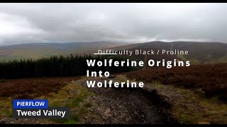
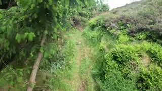
This is one of the more difficult trails on the hill. Starting off with technical rocks in the woods with steep chutes with decent catches. Then turns into more of a flow trail once it leaves the trees with big berms and a couple of jumps.

Access Info

Ride Wolferine Origins to get to this trail.

This trail is unsanctioned.

Disclaimer

This trail is very technical Compared to most of this hill, Ride at your own risk!

Tags
BermsDropsFlowyJumps

Trail Supporters

Recent Activity on Trail

Past Week
  • 0 rides
  •  
6 Months
  • 23 rides
  • 21 miles avg distance
All
  • 126 rides
  • Last: Nov 7, 2026
c1c2c3c4
January
February
March
April
May
June
July
August
September
October
November
December
update trails status or condition

Wolferine Trail Reports

statusdatedescription
Sep 16, 2025 @ 10:34am (America/Vancouver)
Sep 16, 2025
All good. Looks like work being done on "that" section as there is some building gear lying around. Still awesome though.
Feb 9, 2025 @ 9:57am
Feb 9, 2025
Slippy on the rocks. Couple of corners are a bit too janky for me
Nov 14, 2024 @ 12:03pm
Nov 14, 2024
Prevalent mud over rocks in the drop out section but to be expected for the time of year.
Aug 17, 2024 @ 12:15pm
Aug 17, 2024
Running good! A wee bit loose in certain bits of the upper forest but all rideable.
Jan 26, 2024 @ 9:50am
Jan 26, 2024
reporter
more »
Status:
on Sep 16, 2025
Variable
Avg: 4.39 (4 votes)
Your vote: 0

view (1,262)
close
      Directions to wolferine trailhead (55.654220, -3.036320)

      Photos

      8 more »
      mtb
      96 |
      May 23, 2026 @ 1:03pm
      May 23, 2026
      mtb
      98 |
      May 23, 2026 @ 5:02am
      May 23, 2026
      mtb
      197 |
      Oct 28, 2023 @ 12:44am
      Oct 28, 2023
      mtb
      235 |
      Oct 28, 2023 @ 12:44am
      Oct 28, 2023

      Videos

      3 more »
      youtuber Wolferine - Golfie 2024
      mtb
      10:20 | 570 | Aug 23, 2024 , Innerleithen
      NEARLY CIRCUMSIZED MYSELF ON THIS TRAIL |...
      mtb
      8:26 | 256 | May 20, 2024 , Innerleithen
      Wolferine Full run Golfie
      mtb
      5:17 | 406 | Oct 28, 2023 , Innerleithen
      5.0 ★★★★★
      4 Ratings
      5 ★ 100%
      4 ★
      3 ★
      2 ★
      1 ★

      2 Reviews & Comments

      Trickydicky1
      Dusty! Steep and techy in the trees. Fast and flowing at the bottom. Committing at points. Significantly harder in wet conditions I'd reckon.
      RikMid RikMid
      Aptly named, on the final flowy bit Wolferine tore the sidewall on my rear tyre! a Maxxis DHR2

      We hope you've been enjoying Trailforks!

      Create a FREE account to view all trail reviews and much more.

      • #696892 - 1,532 views

      Frequently Asked Questions

      ▼ Where is Wolferine located?
      Wolferine is located in Caberston, Innerleithen, United Kingdom. It is part of the Caberston trail network. The trailhead is located at coordinates 55.65422, -3.03632.
      ▼ How hard is Wolferine?
      Wolferine is rated as Proline difficulty. The physical rating is Hard. The average grade is 19.5%. The climb difficulty is rated Black Diamond.
      ▼ What is the elevation gain for Wolferine?
      Wolferine has 4 ft of elevation gain. The trail has 547 ft of elevation descent. The elevation ranges from 965 ft to 1,508 ft.
      ▼ Is Wolferine a point to point trail?
      Yes, Wolferine is a point to point trail. The direction is Downhill Only. The trail type is singletrack.
      ▼ How long is Wolferine?
      Wolferine is 2,792 ft long. The trail type is singletrack.
      ▼ Are dogs allowed on Wolferine?
      Yes, dogs are allowed on Wolferine. Please keep dogs on a leash where required and clean up after them.
      ▼ How do I access Wolferine? Where is the closest parking trailhead?
      The closest parking and trailhead locations to Wolferine are: View all parking locations in the area.
      ▼ How long does it take to ride Wolferine?
      Based on recorded activities, it takes an average of 10 minutes to ride Wolferine. The trail is 2,792 ft long. Actual times will vary based on fitness level, conditions, and pace. View recent activity logs for more details.
      ▼ How busy is Wolferine?
      Wolferine is a very popular trail. There have been 1,252 recorded activities on this trail. The trail has received 1,262 check-ins. View recent activity on this trail.

      Hit the Trail

      Open in App

      Get this trail on your phone instantly.

      open trail in app

      Download Trail

      Save to wishlist, Garmin & download.
      save the trail

      Find Related Routes

      Find routes and users activities that include this trail.
      find routes for this trail

      You must enter a description before submitting.