


Open in App
Get this trail on your phone instantly.

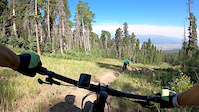
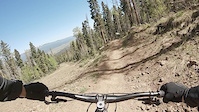
World Cup is named for the world cup race they ran on it. It is generally somewhat steep, fast, and rough with some big jumps.
It is accessed from Diesel just a bit from where Diesel starts off of Easy Street/the fire road. There is a sign on the right but if you're flying down Diesel it can be hard to see. Look for it after the first jump as you come up the next rise. After turning off Diesel, you go through a rooty and rocky section till you get to the start platform.
World cup can be broken down into three parts. Start platform to the first Easy Street underpass. From the Easy Street underpass to Transition. And from Transition to the finish.
First section: Start platform to Easy Street: This section is generally steep and rough. There are no mandatory drops or jumps. It is just seeing how fast you can make your bike go over rough and raw terrain. Look for chances to double up and skip over terrain. When in doubt go to the right. (generally the more rollable sections are on the right of the trail).
Section section: Easy Street to Transition: This continues like the above section for a short bit after passing under Easy Street. Rough, rocky, and rooty. But it quickly transitions into the section known as Facemelter. This is a straight shot down the ski piste. Nice and smooth at first you will easily hit 35 mph if you stay off the brakes. As it turns to the left onto the fire road though, it becomes rougher and rougher and that speed becomes a bit terrifying. as the trail merges with easy street you take a hard right onto a very steep bridge that empties into a rock garden. There is no fast way through the rock garden, but I recommend staying hard right and just skipping past the tree at the end. After this there are a couple of rocky bits, some small drops and a gap jump that (because of the root garden before it) is very difficult to clear. You'll come out onto Transition via a very steep corkscrew berm.
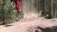
Third section: Transition to finish: This bit is mostly defined by the jumps. After crossing transition you'll encounter a bit of roughness, then a drop in the middle of a very steep right hand turn. Then a very fast section leading to a very large (no consequence) step up that leads to a root garden before a road gap (not big, maybe 6 feet but you have to get out 12-15 feet which can be hard given the rooty section above). Next up is a jump over a road (again not large but blind). And finally, after some relatively smooth bts of trail to the finish line jump, a 30+ foot double-ish table top.
Super fun trail

| c1 | c2 | c3 | c4 |
|---|---|---|---|
January | February | March | April |
May | June | July | August |
September | October | November | December |


Service Road Atlas is a free to use, community-driven service for viewing and creating reports on the numerous back-country service roads around B.C. and Alberta.
Save the current map location and zoom level as your default home location whenever this page is loaded.
Save
No reviews yet, be the first to write a review or ask a question.
Use trail reports to comment on trail conditions.
We hope you've been enjoying Trailforks!
Create a FREE account to view trail comments and much more.
 Trailforks & contributors
You must enter a description before submitting.

