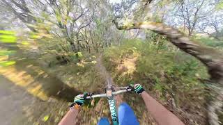

more stats
1.3 miles
Distance
72 ft
Climb
-543 ft
Descent
00:17:27
Avg time
-473 ft
Altitude change
2,023 ft
Altitude min
2,555 ft
Altitude max
2,555 ft
Altitude start
2,083 ft
Altitude end
-6.9%
Grade
-32%
Grade max
21%
Grade min
948 ft
Distance climb
1 mile
Distance down
89 ft
Distance flat
00:17:27
Avg time

Xagubide Details

  • Activities
    • Mountain Bike
    • E-Bike
    • Hike
    • Trail Running
  • Riding Area
    Aldaia
    Vitoria
  • Difficulty Rating
  • Local Popularity
    50 in Mountain Biking [+]
    • 65 in E-Biking
    • 5 in Trail Running
    • 5 in Hiking
  • Global Ranking
    #21908 in Mountain Biking [+]
    • #44980 in E-Biking
    • #359832 in Trail Running
    • #349354 in Hiking
  • National Ranking
    #998 in Mountain Biking · Spain [+]
    • #3,320 in E-Biking
    • #38,314 in Trail Running
    • #35,275 in Hiking
  • Trail Type
    Singletrack
  • Direction
    Downhill Only
    Popular Direction Shown
  • Physical Rating
    Moderate
  • Trail Visibility
    Sometimes hard to follow
  • Dogs Allowed
    Yes
  • eBike Allowed
  • Land Owner
    Etura-Ozaeta-Gebara-Larrea

Divertido y largo descenso que baja desde la cima del Aldaia hasta el barranco de Trxorrarana. Tiene tres partes bien diferencias. La primera por bosque que serpentea entre arboles, la segunda tras una pequeña subida y atravesar una valla, atraviesa un túnel de bosque y la tercera parte muy ratonera y con muchas curvas. Se puede combinar con la bajada de Txorrarana.

Tags
Faint trail
Local Trail Association

Recent Activity on Trail

Past Week
  • 0 rides
  •  
6 Months
  • 2 rides
  • 21 miles avg distance
All
  • 9 rides
  • Last: Sep 30, 2026
c1c2c3c4
January
February
March
April
May
June
July
August
September
October
November
December
update trails status or condition

Xagubide Trail Reports

Status:
on Sep 5, 2026
Dry
Avg: 4.39 (4 votes)
Your vote: 0

view (52)
close
      Directions to xagubide trailhead (42.907230, -2.476850)

      Photos

      1 more »
      mtb
      50 |
      Feb 3, 2023 @ 1:28pm
      Feb 3, 2023

      Videos

      1 more »
      Senda Xagubide
      mtb
      9:36 | 19 | Sep 5, 2026 , Vitoria
      5.0 ★★★★★
      4 Ratings
      5 ★ 100%
      4 ★
      3 ★
      2 ★
      1 ★

      4 Reviews & Comments

      MikelatsLlqZu0
      Se ha hecho un paso alternativo para esquivar el arbol
      MikelatsLlqZu0
      Hay un arbol grande caido en medio de la senda casi a lo ultimo
      tantomontemontetanto tantomontemontetanto
      Corroboro que es uno de los senderos divertidos que hay por toda la zona. Para subir y bajarlo varias veces. El paso de la valla es un paso elevado que hay tras una vieja pista que se cruza. Para una ebike algo complicado si pesa 30 kg con la otra batería y vas solo, jaja

      We hope you've been enjoying Trailforks!

      Create a FREE account to view all trail reviews and much more.

      • By trailforksTF Pro Trailforks & contributors
      • #385009 - 710 views

      Frequently Asked Questions

      ▼ Where is Xagubide located?
      Xagubide is located in Aldaia, Vitoria, Spain. It is part of the Aldaia trail network. The trailhead is located at coordinates 42.90723, -2.47685.
      ▼ How hard is Xagubide?
      Xagubide is rated as Blue difficulty. The physical rating is Moderate. The average grade is 6.9%.
      ▼ What is the elevation gain for Xagubide?
      Xagubide has 72 ft of elevation gain. The trail has 543 ft of elevation descent. The elevation ranges from 2,023 ft to 2,555 ft.
      ▼ Is Xagubide a point to point trail?
      Yes, Xagubide is a point to point trail. The direction is Downhill Only. The trail type is singletrack.
      ▼ How long is Xagubide?
      Xagubide is 1.3 miles long. The trail type is singletrack.
      ▼ Are dogs allowed on Xagubide?
      Yes, dogs are allowed on Xagubide. Please keep dogs on a leash where required and clean up after them.
      ▼ How do I access Xagubide? Where is the closest parking trailhead?
      The closest parking and trailhead locations to Xagubide are: View all parking locations in the area.
      ▼ How long does it take to ride Xagubide?
      Based on recorded activities, it takes an average of 17 minutes to ride Xagubide. The trail is 1.3 miles long. Actual times will vary based on fitness level, conditions, and pace. View recent activity logs for more details.
      ▼ How busy is Xagubide?
      Xagubide is a moderately popular trail. There have been 51 recorded activities on this trail. The trail has received 52 check-ins. View recent activity on this trail.

      Hit the Trail

      Open in App

      Get this trail on your phone instantly.

      open trail in app

      Download Trail

      Save to wishlist, Garmin & download.
      save the trail

      Find Related Routes

      Find routes and users activities that include this trail.
      find routes for this trail

      You must enter a description before submitting.