more stats
1.4 miles
Distance
20 ft
Climb
-434 ft
Descent
00:06:16
Avg time
-415 ft
Altitude change
493 ft
Altitude min
908 ft
Altitude max
908 ft
Altitude start
492 ft
Altitude end
-5.5%
Grade
-26.1%
Grade max
10.8%
Grade min
512 ft
Distance climb
1 mile
Distance down
1,332 ft
Distance flat
00:06:16
Avg time

Year 1 Details

  • Activities
    • Mountain Bike
    • E-Bike
    • Gravel Bike
  • Riding Area
    Murray Valley
    Dwellingup
  • Difficulty Rating
  • Local Popularity
    100 in Mountain Biking [+]
    • 100 in E-Biking
  • Global Ranking
    #26765 in Mountain Biking [+]
    • #2684 in E-Biking
  • Trail Type
    Singletrack
  • Bike Type
    DH, AM, XC, Fat, CX, Gravel
  • Direction
    One Direction[+]
    Popular Direction Shown
    • One Direction for E-Biking
    • One Direction for Gravel Biking
  • Physical Rating
    Easy
  • Trail Visibility
    Always easy to follow
  • Season
    All
  • Family Friendly
    Yes
  • Dogs Allowed
    Yes
  • eBike Allowed
    Yes up to Class 1
  • Year Opened
    2018
  • Land Owner

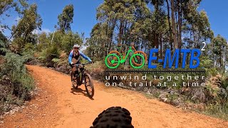
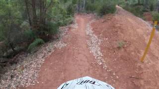
Year 1 is a 2.3km descending green trail suitable for beginners. The trail features open rolling grade reversals, large cambered turns and flowing features on wide smooth surface.

Access Info

The start of the trail is located near the shuttle drop off.

Local Trail Association
Traditionally Indigenous Territory

Recent Activity on Trail

Past Week
  • 0 rides
  •  
6 Months
  • 58 rides
  • 14 miles avg distance
All
  • 541 rides
  • Last: Jun 14, 2026
c1c2c3c4
January
February
March
April
May
June
July
August
September
October
November
December
update trails status or condition

Year 1 Trail Reports

statusdatedescription
Jun 12, 2026 @ 7:44pm (Australia/Perth)
Jun 12, 2026
Jun 10, 2026 @ 11:41pm (Australia/Perth)
Jun 10, 2026
Jun 4, 2026 @ 11:42pm (America/Los_Angeles)
Jun 4, 2026
Small tree across trail about 1/4 way down
Mar 28, 2026 @ 10:49am (Australia/Perth)
Mar 27, 2026
Great after cyclone rain has been through, lots of fallen tree branches tho
Jan 11, 2026 @ 8:09am (Australia/Perth)
Jan 10, 2026
Awesome trail For beginners wanting to go fast. Following the smooth parts is a great way to learn how to use the berms 👍👍👍
more »
Status:
on Jun 12, 2026
Ideal
Avg: 3.99 (4 votes)
Your vote: 0

view (4,682)
close
3D
Trail Conditions
  • Unknown
  • Snow Groomed
  • Snow Packed
  • Snow Covered
  • Snow Cover Partial
  • Freeze/thaw Cycle
  • Icy
  • Prevalent Mud
  • Wet
  • Variable
  • Ideal
  • Dry
  • Very Dry
Trail Flow (Ridden Direction)
Trailforks scans users ridelogs to determine the most popular direction each trail is ridden. A good flowing trail network will have most trails flowing in a single direction according to their intension.
The colour categories are based on what percentage of riders are riding a trail in its intended direction.
  • > 96%
  • > 90%
  • > 80%
  • > 70%
  • > 50%
  • < 50%
  • bi-directional trail
  • no data
Trail Last Ridden
Trailforks scans ridelogs to determine the last time a trail was ridden.
  • < 2 days
  • < 1 week
  • < 2 weeks
  • < 1 month
  • < 6 months
  • > 6 months
Trail Ridden Direction
The intended direction a trail should be ridden.
  • Downhill Only
  • Downhill Primary
  • Both Directions
  • Uphill Primary
  • Uphill Only
  • One Direction
Contribute Details
Colors indicate trail is missing specified detail.
  • Description
  • Photos
  • Description & Photos
  • Videos
Trail Popularity ?
Trailforks scans ridelogs to determine which trails are ridden the most in the last 9 months. Trails are compared with nearby trails in the same city region with a possible 25 colour shades. Think of this as a heatmap, more rides = more kinetic energy = warmer colors.
  • most popular
  • popular
  • less popular
  • not popular
ATV/ORV/OHV Filter
Max Vehicle Width
inches
US Cell Coverage
Legend
cell carrier legend

Radar Time
Activity Recordings
Trailforks uses anonymized public activity data. ?
Activity Recordings
Trailforks uses anonymized public activity data. ?
Personal Heatmap
Activity Types
all / none
Options
2
Date range month
Winter Trails
Warning A routing network for winter maps does not exist. Selecting trails using the winter trails layer has been disabled.
Missing Trails
Most Popular
Least Popular
Trails are colored based on popularity. The more popular a trail is, the more red. Less popular trails trend towards green.
Jump Magnitude Heatmap
Heatmap of where riders jump on trails. Zoom in to see individual jumps, click circles to view jump details.
BC Backroad Status

Service Road Atlas is a free to use, community-driven service for viewing and creating reports on the numerous back-country service roads around B.C. and Alberta.

map legend
Slope Aspect
Direction the slope faces
Flat N NE E SE S SW W NW
Trails Deemphasized
Trails are shown in grey.
disable
Only show trails with no bike usage.
Enable
Suggested Layers
Based on selected activity type

    Save the current map location and zoom level as your default home location whenever this page is loaded.

    Save
        Directions to year-1 trailhead (-32.780330, 116.083120)

        Photos

        No photos have been added for Year 1 yet, add a photo.

        Videos

        3 more »
        Year 1 - Murray Valley MTB Downhill
        8:21 | 218 | Nov 17, 2022 , Dwellingup
        WA Murray Valley Year1
        0:24 | 788 | Jan 4, 2020 , Dwellingup
        Year 1   The Green Downhill Murray Valley Trails
        8:42 | 1221 | Dec 23, 2019 , Dwellingup

        Routes with this trail

        15 miles 2,223 ft 9
        Route through Murray valley
        16 miles 2,030 ft 19 Loop
        Meet at the trailhead. All climbs are spaced out. Route ends at a point that allows various options to go...
        13 miles 1,550 ft 24 Loop
        20km loop Murray valley mix of easy and moderate trails

        2 Reviews & Comments


        We hope you've been enjoying Trailforks!

        Create a FREE account to view trail comments and much more.

        • By carlfox & contributors
        • #162865 - 3,332 views

        Frequently Asked Questions About Year 1

        Where is Year 1 located?
        Year 1 is located in Murray Valley, Dwellingup, Australia. It is part of the Murray Valley trail network. The trailhead is located at coordinates -32.78033, 116.08312.
        How hard is Year 1?
        Year 1 is rated as Green difficulty. The physical rating is Easy. The average grade is 5.5%.
        What is the elevation gain for Year 1?
        Year 1 has 20 ft of elevation gain. The trail has 434 ft of elevation descent. The elevation ranges from 493 ft to 908 ft.
        Is Year 1 a point to point trail?
        Yes, Year 1 is a point to point trail. The direction is One Direction. The trail type is singletrack.

        Hit the Trail

        Open in App

        Get this trail on your phone instantly.
        open trail in app

        Download Trail

        Save to wishlist, Garmin & download.
        save the trail

        Find Related Routes

        Find routes and users activities that include this trail.
        find routes for this trail

        You must enter a description before submitting.