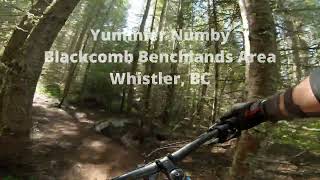


more stats
5,233 ft
Distance
446 ft
Climb
-92 ft
Descent
00:21:11
Avg time
354 ft
Altitude change
2,529 ft
Altitude min
2,897 ft
Altitude max
2,531 ft
Altitude start
2,884 ft
Altitude end
6.8%
Grade
-32.5%
Grade max
34.1%
Grade min
3,566 ft
Distance climb
751 ft
Distance down
873 ft
Distance flat
00:21:11
Avg time

Yummier Numby Details

  • Activities
    • Mountain Bike
    • E-Bike
    • Hike
    • Trail Running
  • Riding Area
    Whistler North
    Whistler, British Columbia
  • Difficulty Rating
  • Voted Difficulty
    Black Diamond (1 vote)
  • Local Popularity
    80 in Mountain Biking heatmap [+]
    • 80 in E-Biking
    • 70 in Trail Running
    • 60 in Hiking
  • Global Ranking
    #62339 in Mountain Biking [+]
    • #18576 in E-Biking
    • #123202 in Trail Running
    • #140517 in Hiking
  • Provincial Ranking
    #3,058 in Mountain Biking · British Columbia [+]
    • #1,240 in E-Biking
    • #6,992 in Trail Running
    • #8,115 in Hiking
  • Hiking SAC Scale
    T1 Hiking
  • Trail Type
    Singletrack
  • Bike Type
    AM, XC
  • Direction
    Uphill Primary
    Popular Direction Shown
  • Climb Difficulty
    Black Diamond
  • Physical Rating
    Moderate
  • Trail Visibility
    Always easy to follow
  • Dogs Allowed
    Yes
  • eBike Allowed
    Yes up to Class 1
  • TTFs on Trail
    Bridge, Rock Face
  • Ride in Rain
    Yes

New section of singletrack climb to bypass old skid road rock grind. Built by volunteers from Crankworx Freehub trail day, Whistler Waldorf School students, Comfortably Numb trail race/We Run Whistler, and WORCA volunteer trail nights.

Tags
BridgesRock slabs

Local Trail Association

Recent Activity on Trail

Past Week
  • 0 rides
  •  
6 Months
  • 181 rides
  • 13 miles avg distance
All
  • 1,051 rides
  • Last: Nov 1, 2026
c1c2c3c4
January
February
March
April
May
June
July
August
September
October
November
December
Status:
on Nov 3, 2026
Ideal
Avg: 3.86 (16 votes)
Your vote: 0

view (4,423)
close
      Directions to yummier-numby trailhead (50.126950, -122.926940)

      Photos

      17 more »
      mtb
      70 |
      Aug 19, 2025 @ 11:57am
      Aug 19, 2025
      mtb
      70 |
      Aug 19, 2025 @ 11:57am
      Aug 19, 2025
      mtb
      53 |
      Jun 29, 2024 @ 11:45pm
      Jun 29, 2024
      mtb
      67 |
      Jun 29, 2024 @ 11:45pm
      Jun 29, 2024

      Videos

      1 more »
      Yummier Numby at Whistler, BC
      mtb
      15:02 | 202 | Oct 21, 2023 , Whistler

      Routes with this trail

      more »
      ★ 5.0 • 5 miles • 1,213 ft • 6 • Point to Point •
      WORCA TOONIE Virtual Thriller Route for week of June 5-10, 2023. Start of route is just outside of the CRA...
      ★ 3.5 • 8 miles • 1,458 ft • 22 •
      A great Advanced XC loop with some technical climbs and descents. You will begin with a climb heading...
      7 miles • 1,361 ft • 10 •
      Liv and Ladies AllRide join forces to offer women an opportunity to gather for a social ride on the Lost...

      Trail Products

      3.8 ★★★★★
      16 Ratings
      5 ★ 50%
      4 ★ 19%
      3 ★ 6%
      2 ★ 13%
      1 ★ 13%

      6 Reviews & Comments

      Dogride Dogride
      @ben-hryciw thanks for the recent work on the ascent trail. smooths it out just enough to make it feel not as steep.
      pmhobson pmhobson
      This trail is a work of art. It's such engaging, but never overly difficult climbing. The builders found a way to take you to some of the forest's most interesting sections with making the alignment feel convoluted. The builders even took care to cross roots such that traction isn't that hard to find even in the wet.
      andybikehike
      Did these 'yummy numby' trails on my analog, HT mullet MTB climbing bike and will never do it again. E-MTB next time. This is a well built but long, often steep + frequently techie grunt. Piece o' cake for Squamish Whistler Enduro stars but for lesser mortals? .... incredible hiking trail though! Would actually be fun DH too.

      We hope you've been enjoying Trailforks!

      Create a FREE account to view all trail reviews and much more.

      • By flipfantasiaTF Pro WORCA & contributors
      • #185677 - 3,368 views

      Frequently Asked Questions

      ▼ Where is Yummier Numby located?
      Yummier Numby is located in Whistler North, Whistler, British Columbia, Canada. It is part of the Whistler North trail network. The trailhead is located at coordinates 50.12695, -122.92694.
      ▼ How hard is Yummier Numby?
      Yummier Numby is rated as Black Diamond difficulty. The physical rating is Moderate. The average grade is 6.8%. The climb difficulty is rated Black Diamond.
      ▼ What is the elevation gain for Yummier Numby?
      Yummier Numby has 446 ft of elevation gain. The trail has 92 ft of elevation descent. The elevation ranges from 2,529 ft to 2,897 ft.
      ▼ Is Yummier Numby a point to point trail?
      Yummier Numby is not a point to point trail. The direction is Uphill Primary. The trail type is singletrack.
      ▼ How long is Yummier Numby?
      Yummier Numby is 5,233 ft long. The trail type is singletrack.
      ▼ Are dogs allowed on Yummier Numby?
      Yes, dogs are allowed on Yummier Numby. Please keep dogs on a leash where required and clean up after them.
      ▼ How do I access Yummier Numby? Where is the closest parking trailhead?
      The closest parking and trailhead locations to Yummier Numby are: View all parking locations in the area.
      ▼ How long does it take to ride Yummier Numby?
      Based on recorded activities, it takes an average of 21 minutes to ride Yummier Numby. The trail is 5,233 ft long. Actual times will vary based on fitness level, conditions, and pace. View recent activity logs for more details.
      ▼ How busy is Yummier Numby?
      Yummier Numby is a very popular trail. There have been 4,519 recorded activities on this trail. The trail has received 4,423 check-ins. View recent activity on this trail.

      Hit the Trail

      Open in App

      Get this trail on your phone instantly.

      open trail in app

      Download Trail

      Save to wishlist, Garmin & download.
      save the trail

      Find Related Routes

      Find routes and users activities that include this trail.
      find routes for this trail

      You must enter a description before submitting.