


more stats
3.4 miles
Distance
90 ft
Climb
-1,523 ft
Descent
00:34:49
Avg time
-1,433 ft
Altitude change
10,914 ft
Altitude min
12,358 ft
Altitude max
12,357 ft
Altitude start
10,923 ft
Altitude end
-105.276%
Grade max
11.032%
Grade min
2,326 ft
Distance climb
3 miles
Distance down
2,104 ft
Distance flat
00:34:49
Avg time

Yuncaypata Details

  • Activities
    • Mountain Bike
    • Hike
    • Trail Running
  • Riding Area
  • Difficulty Rating
  • Local Popularity
    100 in Mountain Biking heatmap [+]
    • 5 in Trail Running
    • 5 in Hiking
  • Global Ranking
    #38879 in Mountain Biking [+]
    • #349111 in Trail Running
    • #337157 in Hiking
  • National Ranking
    #2 in Mountain Biking · Peru [+]
    • #56 in Trail Running
    • #59 in Hiking
  • Trail Type
    Singletrack
  • Bike Type
    DH, AM
  • Direction
    Downhill Primary
    Popular Direction Shown
  • Season
    All year long.
  • Dogs Allowed
    Yes
  • Ride in Rain
    Yes

This is a classic downhill ride around Cusco where locals riders have built some jumps and nice stunts. The start is at the Ccorao Pass (on the way to Pisac) and goes through the small village of Yuncaypata and ends down Cusco near the new mall. To get to the start of the trail you can take the local bus at Tullumayu Street and the ticket is around USD 2.00

Access Info

The start is at the Ccorao Pass (on the way to Pisac) and goes through the small village of Yuncaypata and ends down Cusco near the new mall. To get to the start of the trail you can take the local bus at Tullumayu Street and the ticket is around USD 2.00

Tags
Jumps

Traditionally Indigenous Territory

Recent Activity on Trail

Past Week
  • 0 rides
  •  
6 Months
  • 11 rides
  • 7 miles avg distance
All
  • 35 rides
  • Last: Sep 23, 2026
c1c2c3c4
January
February
March
April
May
June
July
August
September
October
November
December
update trails status or condition

Yuncaypata Trail Reports

statusdatedescription
Jun 29, 2021 @ 9:27am
Jun 29, 2021
Fine ride down the stairs into town and to the town square!
May 25, 2019 @ 7:06am
May 25, 2019
Jul 6, 2017 @ 1:41pm
Jul 6, 2017
At some points of this trail, the terrain is super dry and with lots of loose rocks. Be careful not to slide and crash! At the jumps there is a...
more »
Status:
on Jun 29, 2021
Dry
Avg: 4.09 (4 votes)
Your vote: 0

view (172)
close
      Directions to yuncaypata trailhead (-13.488517, -71.935867)

      Photos

      31 more »
      mtb
      48 |
      Oct 13, 2026 @ 11:55pm
      Oct 13, 2026
      mtb
      382 |
      Nov 1, 2007 @ 5:40am
      Nov 1, 2007
      mtb
      470 |
      Dec 21, 2007 @ 6:02am
      Dec 21, 2007
      mtb
      278 |
      Apr 15, 2008 @ 2:48pm
      Apr 15, 2008

      Videos

      6 more »
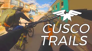
      youtuber Day One in Peru - Cusco Trails
      mtb
      9:17 | 657 | Aug 1, 2018 , Cusco
      Yuncaypata - Cusco Explorinka
      mtb
      3:24 | 92 | Jul 18, 2021 , Cusco
      Yuncaypata Trail, Cusco, Peru
      mtb
      2:56 | 254 | Dec 24, 2010 , Cusco
      Slip on training
      mtb
      0:54 | 300 | Jun 30, 2014 , Cusco
      4.3 ★★★★★
      4 Ratings
      5 ★ 25%
      4 ★ 75%
      3 ★
      2 ★
      1 ★

      2 Reviews & Comments

      skepsis3
      Did an awesome shuttle run with Buho Tours. Great enduro style single track with plenty of steep loose areas and alternate jump lines
      jkor jkor
      Quick & sweet descent into Cusco. (A little bit like a Ledgeview ride, for around here I suppose?0

      We hope you've been enjoying Trailforks!

      Create a FREE account to view all trail reviews and much more.

      • By inkasadventures & contributors
      • #23836 - 3,911 views

      Frequently Asked Questions

      ▼ Where is Yuncaypata located?
      Yuncaypata is located in Cusco, Peru. It is part of the Cusco trail network. The trailhead is located at coordinates -13.48852, -71.93587.
      ▼ How hard is Yuncaypata?
      Yuncaypata is rated as Blue difficulty.
      ▼ What is the elevation gain for Yuncaypata?
      Yuncaypata has 90 ft of elevation gain. The trail has 1,523 ft of elevation descent. The elevation ranges from 10,914 ft to 12,358 ft.
      ▼ Is Yuncaypata a point to point trail?
      Yuncaypata is not a point to point trail. The direction is Downhill Primary. The trail type is singletrack.
      ▼ How long is Yuncaypata?
      Yuncaypata is 3.4 miles long. The trail type is singletrack.
      ▼ Are dogs allowed on Yuncaypata?
      Yes, dogs are allowed on Yuncaypata. Please keep dogs on a leash where required and clean up after them.
      ▼ When is the best time of year to ride Yuncaypata?
      Based on activity log data, the most popular months to ride Yuncaypata are:
      • September (6 activities)
      • May (5 activities)
      • December (4 activities)
      Check the reports page for current trail conditions.
      ▼ How long does it take to ride Yuncaypata?
      Based on recorded activities, it takes an average of 35 minutes to ride Yuncaypata. The trail is 3.4 miles long. Actual times will vary based on fitness level, conditions, and pace. View recent activity logs for more details.
      ▼ How busy is Yuncaypata?
      Yuncaypata is a very popular trail. There have been 170 recorded activities on this trail. The trail has received 172 check-ins. View recent activity on this trail.

      Hit the Trail

      Open in App

      Get this trail on your phone instantly.

      open trail in app

      Download Trail

      Save to wishlist, Garmin & download.
      save the trail

      Find Related Routes

      Find routes and users activities that include this trail.
      find routes for this trail

      You must enter a description before submitting.

