Some of the best trails in Edmonton
- Mountain Bike
Login to see your progress towards riding all the trails and routes in this list.
Trails
| title | riding area | rating | distance | completed | |||
|---|---|---|---|---|---|---|---|
| 1 | 780-Flow | 659 ft | |||||
| 2 | Andre's Trail | 2,697 ft | |||||
| 3 | Ass Over Tea Kettle | 715 ft | |||||
| 4 | Bobsled | 794 ft | |||||
| 5 | 3,891 ft | ||||||
| 6 | Caddytrack | 2,269 ft | |||||
| 7 | Dirty Mattress | 694 ft | |||||
| 8 | Disciple 13 | 740 ft | |||||
| 9 | Flat Pete | 3,773 ft | |||||
| 10 | Flatter Pete | 4,980 ft | |||||
| 11 | Gold Digger | 4,898 ft | |||||
| 12 | Golf Course Trail | 1 mile | |||||
| 13 | Happy Ending | 1,365 ft | |||||
| 14 | Helen | 520 ft | |||||
| 15 | Higher Edukation | 1,362 ft | |||||
| 16 | Hoots Down Black | 1,558 ft | |||||
| 17 | Hoots Down Blue | 1,457 ft | |||||
| 18 | Hustler | 1 mile | |||||
| 19 | 1,929 ft | ||||||
| 20 | Kinnaird Killer | 858 ft | |||||
| 21 | 559 ft | ||||||
| 22 | Low Class | 436 ft | |||||
| 23 | Machete | 1,749 ft | |||||
| 24 | Moonraker | 2,552 ft | |||||
| 25 | 3,635 ft | ||||||
| 26 | Ray Gun | 3,566 ft | |||||
| 27 | Saskatoon Pie | 738 ft | |||||
| 28 | Selkirk Knights | 1 mile | |||||
| 29 | Sideline | 1,699 ft | |||||
| 30 | Six Shooter | 3,724 ft | |||||
| 31 | Slinky - Slumpy | 1,030 ft | |||||
| 32 | Snake Back | 794 ft | |||||
| 33 | Squeeze My Lemon | 915 ft | |||||
| 34 | Upper Caddytrack | 105 ft | |||||
| 35 | West Coast Trail | 1,545 ft |
Displaying 35
Videos
0:46 |
9 |
May 2, 2026
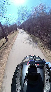
2:45 |
2 |
May 2, 2026
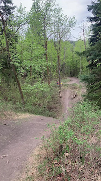
0:37 |
27 |
Feb 22, 2026
Recent Trail Reports
| status | trail | date | condition | |
|---|---|---|---|---|
| West Coast Trail | Jun 9, 2026 @ 3:52pm (America/Edmonton) 23 hours | view | ||
| Caddytrack | Jun 8, 2026 @ 8:34pm (America/Edmonton) 2 days | view | ||
| Hustler | Jun 7, 2026 @ 4:20pm (America/Edmonton) 3 days | view | ||
| Moonraker | Jun 6, 2026 @ 1:36pm (America/Edmonton) Jun 6, 2026 | view | ||
| Low Class | Jun 4, 2026 @ 6:05pm (America/Edmonton) Jun 4, 2026 | view |
Total Trails
35
Total Distance
15 miles
Total Descent
-2,407 ft
Total Climb
1,289 ft
close
-
Layers w
- Weather Layers
- Pro
- Pro
- Pro
- Pro
- Pro
- Pro
- More Layers
- Pro
- Pro
- Pro
- Pro
-
Upgrade to

3D
Trail Conditions
- Unknown
- Snow Groomed
- Snow Packed
- Snow Covered
- Snow Cover Partial
- Freeze/thaw Cycle
- Icy
- Prevalent Mud
- Wet
- Variable
- Ideal
- Dry
- Very Dry
Trail Flow (Ridden Direction)
Trailforks scans users ridelogs to determine the most popular direction each trail is ridden. A good flowing trail network will have most trails flowing in a single direction according to their intension.
The colour categories are based on what percentage of riders are riding a trail in its intended direction.
The colour categories are based on what percentage of riders are riding a trail in its intended direction.
- > 96%
- > 90%
- > 80%
- > 70%
- > 50%
- < 50%
- bi-directional trail
- no data
Trail Last Ridden
Trailforks scans ridelogs to determine the last time a trail was ridden.
- < 2 days
- < 1 week
- < 2 weeks
- < 1 month
- < 6 months
- > 6 months
Trail Ridden Direction
The intended direction a trail should be ridden.
- Downhill Only
- Downhill Primary
- Both Directions
- Uphill Primary
- Uphill Only
- One Direction
Contribute Details
Colors indicate trail is missing specified detail.
- Description
- Photos
- Description & Photos
- Videos
Trail Popularity ?
Trailforks scans ridelogs to determine which trails are ridden the most in the last 9 months.
Trails are compared with nearby trails in the same city region with a possible 25 colour shades.
Think of this as a heatmap, more rides = more kinetic energy = warmer colors.
- most popular
- popular
- less popular
- not popular
ATV/ORV/OHV Filter
Max Vehicle Width
inches
US Cell Coverage
Legend

Radar Time
Activity Recordings
Trailforks uses anonymized public activity data.
?
Activity Recordings
Trailforks uses anonymized public activity data.
?
Personal Heatmap
▶
Activity Types
all
/
none
▶
Options
2
Date range
month
–
Winter Trails
Warning
A routing network for winter maps does not exist. Selecting trails using the winter trails layer has been disabled.
Missing Trails
Most Popular
Least Popular
Trails are colored based on popularity. The more popular a trail is, the more red. Less popular trails trend towards green.
Jump Magnitude Heatmap
Heatmap of where riders jump on trails. Zoom in to see individual jumps, click circles to view jump details.
BC Backroad Status
![map legend]()
Service Road Atlas is a free to use, community-driven service for viewing and creating reports on the numerous back-country service roads around B.C. and Alberta.

Slope Aspect
Direction the slope faces
Trails Deemphasized
Trails are shown in grey.
Only show trails with no bike usage.
Suggested Layers
Based on selected activity type
Save the current map location and zoom level as your default home location whenever this page is loaded.
Save
Trail transparency
Average difficulty
Trails and Routes in List - Distance by Difficulty
Trails and Routes in List - Difficulty Totals
- By cam-rides-bikes

- #689 - 2,387 views