
| Type: |  Sight |
| Activities: |
|
-
44,725Checkins
-
42,428MTB
-
1,768Hike
-
0Moto
-
0Ski
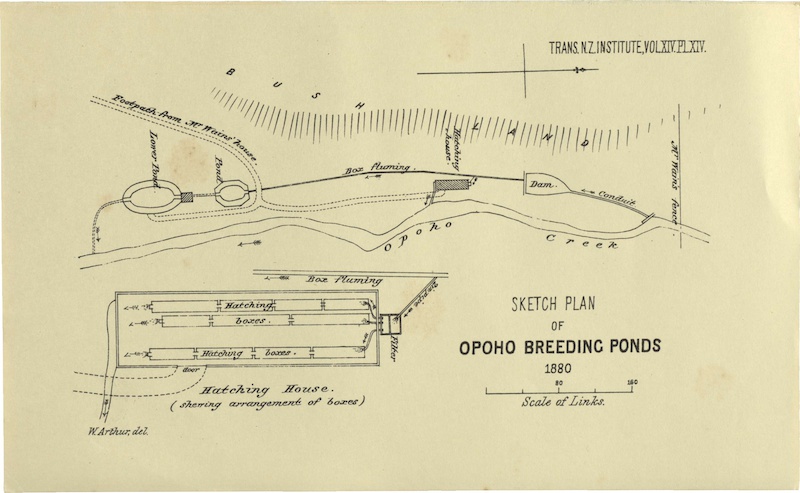
In 2010 Mountain Biking Otago (MBO) started construction of the Big Easy track, part of the Signal Hill MTB network and Three Peaks Trail. While building the track, the historic Opoho fish ponds were re-discovered. In association with the NZ Historic Places Trust and Fish and Game Otago, MBO has helped restore and safeguard this important part of NZ’s fishy history. \r\nDid you know the suburb of Opoho takes its name from this small stream, Opoho Creek (it is also known as Stony Creek)? The stream flows past Logan Park High School, but is diverted through culverts and then flows into the Water of Leith close to its outflow into the Otago Harbour. \r\nLike many of the small harbor streams, Opoho Creek is home to reclusive native fish, the Banded Kokopu (Galaxias fasciatus Gray, 1842). This member of the Galaxiidae family and its one of the five species that provide us with whitebait. The young are very good climbers and will often escape from buckets by clinging to and wriggling up the sides. Banded Kokopu commonly grow to over 20 cm. They feed on stream and terrestrial insects for their food, often by detecting the small ripples made by moths and flies that become stuck on the water surface of the pool.
close
3D
Trail Conditions
- Unknown
- Snow Groomed
- Snow Packed
- Snow Covered
- Snow Cover Partial
- Freeze/thaw Cycle
- Icy
- Prevalent Mud
- Wet
- Variable
- Ideal
- Dry
- Very Dry
Trail Flow (Ridden Direction)
Trailforks scans users activity logs to determine the most popular direction each trail is ridden. A good flowing trail network will have most trails flowing in a single direction according to their intension.
The colour categories are based on what percentage of users are riding a trail in its intended direction.
The colour categories are based on what percentage of users are riding a trail in its intended direction.
- > 96%
- > 90%
- > 80%
- > 70%
- > 50%
- < 50%
- bi-directional trail
- no data
Trail Last Used
Trailforks scans activity logs to determine the last time a trail was ridden.
- < 2 days
- < 1 week
- < 2 weeks
- < 1 month
- < 6 months
- > 6 months
Trail Ridden Direction
The intended direction a trail should be ridden.
- Downhill Only
- Downhill Primary
- Both Directions
- Uphill Primary
- Uphill Only
- One Direction
Contribute Details
Colors indicate trail is missing specified detail.
- Description
- Photos
- Description & Photos
- Videos
Trail Popularity ?
Trailforks scans activity logs to determine which trails are ridden the most in the last 9 months.
Trails are compared with nearby trails in the same city region with a possible 25 colour shades.
Think of this as a heatmap, more activities = more kinetic energy = warmer colors.
- most popular
- popular
- less popular
- not popular
ATV/ORV/OHV Filter
Max Vehicle Width
inches
US Cell Coverage
Legend

Radar Time
Activity Recordings
Trailforks uses anonymized public activity data.
?
Activity Recordings
Trailforks uses anonymized public activity data.
?
Winter Trails
Warning
A routing network for winter maps does not exist. Selecting trails using the winter trails layer has been disabled.
Missing Trails
Most Popular
Least Popular
Trails are colored based on popularity. The more popular a trail is, the more red. Less popular trails trend towards green.
Jump Magnitude Heatmap
Heatmap of where users jump on trails. Zoom in to see individual jumps, click circles to view jump details.
BC Backroad Status
![map legend]()
Service Road Atlas is a free to use, community-driven service for viewing and creating reports on the numerous back-country service roads around B.C. and Alberta.

Slope Aspect
Direction the slope faces
Trails Deemphasized
Trails are shown in grey.
Only show trails with no bike usage.
Suggested Layers
Based on selected activity type
Save the current map location and zoom level as your default home location whenever this page is loaded.
SaveAttached Trail
| trail name | difficulty | riding area |
|---|---|---|
| The Emersons Big Easy | Signal Hill |
Comments
We hope you've been enjoying Trailforks!
Create a FREE account to view POI comments and much more.
Other Points of Interest in Signal Hill
- Signal Hill Carpark Parking
- Bottom Jump TTF
- Kids Jump Area TTF
- Heckler's Corner TTF
- The Mistress Rock Drop TTF
- The Plateau Viewpoint
- Retaining Wall Drop TTF
- Student/Magnatron Finish Drop TTF
- By chrisanz MBO
- #6392