
close
3D
Trail Conditions
- Unknown
- Snow Groomed
- Snow Packed
- Snow Covered
- Snow Cover Partial
- Freeze/thaw Cycle
- Icy
- Prevalent Mud
- Wet
- Variable
- Ideal
- Dry
- Very Dry
Trail Flow (Ridden Direction)
Trailforks scans users activity logs to determine the most popular direction each trail is ridden. A good flowing trail network will have most trails flowing in a single direction according to their intension.
The colour categories are based on what percentage of users are riding a trail in its intended direction.
The colour categories are based on what percentage of users are riding a trail in its intended direction.
- > 96%
- > 90%
- > 80%
- > 70%
- > 50%
- < 50%
- bi-directional trail
- no data
Trail Last Used
Trailforks scans activity logs to determine the last time a trail was ridden.
- < 2 days
- < 1 week
- < 2 weeks
- < 1 month
- < 6 months
- > 6 months
Trail Ridden Direction
The intended direction a trail should be ridden.
- Downhill Only
- Downhill Primary
- Both Directions
- Uphill Primary
- Uphill Only
- One Direction
Contribute Details
Colors indicate trail is missing specified detail.
- Description
- Photos
- Description & Photos
- Videos
Trail Popularity ?
Trailforks scans activity logs to determine which trails are ridden the most in the last 9 months.
Trails are compared with nearby trails in the same city region with a possible 25 colour shades.
Think of this as a heatmap, more activities = more kinetic energy = warmer colors.
- most popular
- popular
- less popular
- not popular
ATV/ORV/OHV Filter
Max Vehicle Width
inches
US Cell Coverage
Legend

Radar Time
Activity Recordings
Trailforks uses anonymized public activity data.
?
Activity Recordings
Trailforks uses anonymized public activity data.
?
Winter Trails
Warning
A routing network for winter maps does not exist. Selecting trails using the winter trails layer has been disabled.
Missing Trails
Most Popular
Least Popular
Trails are colored based on popularity. The more popular a trail is, the more red. Less popular trails trend towards green.
Jump Magnitude Heatmap
Heatmap of where users jump on trails. Zoom in to see individual jumps, click circles to view jump details.
BC Backroad Status
![map legend]()
Service Road Atlas is a free to use, community-driven service for viewing and creating reports on the numerous back-country service roads around B.C. and Alberta.

Slope Aspect
Direction the slope faces
Trails Deemphasized
Trails are shown in grey.
Only show trails with no bike usage.
Suggested Layers
Based on selected activity type
Save the current map location and zoom level as your default home location whenever this page is loaded.
Save360 trails is a family friendly, multi-use trail system made for walkers, hikers, mountain biking and horse riders. Respect other users in while enjoying the 360 trails.
At the north end of the Key Peninsula lies 360 acres of land known as 360 Trails. The property includes trails which are accessible to walkers, equestrians and mountain bikers. The main trail is a large open loop that takes about an hour to walk and there are smaller trails that cut back and fourth in the woods that mingle with the main loop trail.
360 Trails is the location of many running and biking events each year. It is about 3.5 miles from the main stop light in Purdy to the 360 Trails parking area.
Excellent XC/light AM trails in the Gig Harbor area. Don't be fooled by the dirt road--several excellent trails in this park. The highlight is in the NW corner of the park--a nice flowy loop with some punchy climbs and optional jumps/features and a newly added jump line with some nice jumps. The trail list keeps growing thanks to the passion of a pair of local trail builders who head up the work. Drains extremely well for year-round riding, but gets pretty dry/dusty in the summer so be kind to the turns when things get dry,
At the north end of the Key Peninsula lies 360 acres of land known as 360 Trails. The property includes trails which are accessible to walkers, equestrians and mountain bikers. The main trail is a large open loop that takes about an hour to walk and there are smaller trails that cut back and fourth in the woods that mingle with the main loop trail.
360 Trails is the location of many running and biking events each year. It is about 3.5 miles from the main stop light in Purdy to the 360 Trails parking area.
Excellent XC/light AM trails in the Gig Harbor area. Don't be fooled by the dirt road--several excellent trails in this park. The highlight is in the NW corner of the park--a nice flowy loop with some punchy climbs and optional jumps/features and a newly added jump line with some nice jumps. The trail list keeps growing thanks to the passion of a pair of local trail builders who head up the work. Drains extremely well for year-round riding, but gets pretty dry/dusty in the summer so be kind to the turns when things get dry,
Primary Trail Type: Cross-Country
eBikes Allowed:
Yes
Land Status: Municipal Park
Land Manager: Key Pen Parks
 google parking directions plan a road trip here
 Access Info:
Note: Parking for 360 Trails is now located at Gateway Park.
10905 144th St. NW
Gig Harbor, WA 98329
10905 144th St. NW
Gig Harbor, WA 98329
Disclaimer:
Respect and be courteous of other people and user groups while riding at 360 trails, or you will lose access to this system!
Links
Trail info last updated
Region Supporters & Maintainers
![Key Pen Parks]()
Key Pen ParksSponsor

Activities Click to view
- Mountain Bike
59 trails
- E-Bike
9 trails
- Horse
28 trails
- Hike
44 trails
- Trail Running
43 trails
Region Details
- 8
- 24
- 22
- 3
- 2
Region Status
Open as of Aug 28, 2026
Stats
- Avg Trail Rating
- Trails (view details)
- 59
- Trails Mountain Bike
- 59
- Trails E-Bike
- 9
- Trails Gravel Bike
- 9
- Trails Adaptive Bike
- 4
- Trails Winter Fat Bike
- 2
- Trails Horse
- 28
- Trails Hike
- 44
- Trails Trail Running
- 43
- Total Distance
- 20 miles
- Total Descent
- 2,188 ft
- Total Vertical
- 173 ft
- Highest Trailhead
- 339 ft
- Reports
- 1,895
- Photos
- 66
- Completed Counter
- 35,768
Popular 360 Trails Mountain Biking Trails
• 90 ★ 4.1 • 3 miles • 286 ft • 1,632 •
Fun, flowy trail with berms, drops, doubles, and some optional skinnies/drops. A few nice punchy climbs make sure you get a workout.
• 90 ★ 4.0 • 2,159 ft • 2 ft • 1,428 •
Connector trail from the new lot at Gateway Park to 360 Trails. Two-way trail with an extra little loop that's one way downhill.
• 100 ★ 4.7 • 1,391 ft • 0 ft • 1,398 •
Fun advanced gap jump line. There are three lines at the start, this is the middle line.
• 100 ★ 4.6 • 1,237 ft • 0 ft • 1,260 •
Reasonably sized gap jumps. Nothing too big. There is a hip about half way down. If you can't ride the hip, stay to the right of the hip to maintain speed. There are three jump lines at the start, this is the one on the right.
• 85 ★ 4.7 • 1,869 ft • 30 ft • 1,216 •
Short but sweet... New machine-excavated trail with fun drops, berms, and tables. Mostly intermediate but with a couple bigger jumps/drops with options to ride around. Still getting groomed but it's definitely the new fun way back to...
• 90 ★ 4.5 • 4,213 ft • 118 ft • 1,168 •
A nice XC alternative to the road. Not very technical but good switchbacks and short punchy climbs to keep you on your toes.
• 95 ★ 4.6 • 1,007 ft • 0 ft • 1,162 •
When wet this is a puddle laden trail. Series of berms, small roots, and the like. Decent trail, a bit too tight to get real speed on it.
• 95 ★ 5.0 • 495 ft • 0 ft • 1,103 •
Short practice trail with tabletops, most with multiple lip options
360 Trails Mountain Bike Routes
★ 3.0 • 6 miles • 687 ft • 21 • Loop •
a little uphill, a little downhill with some technical xc thrown in. about 45 minutes if you're in decent...
5 miles • 444 ft • 10 • Race •
This is a tentative route for the Budu 2020 MTB race. This course was scouted and tested by volunteers,...
• 16 miles • 1,669 ft • 40 •
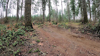
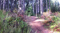
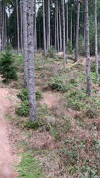
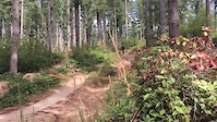
Photos of 360 Trails Mountain Bike
Videos of 360 Trails Mountain Bike


Recent Trail Reports
Activity Feed
| username | action | type | title | date |
|---|---|---|---|---|
| BethbTPwN | wishlist | region | activity #104126260 | Sep 19, 2026 @ 8:28am Sep 19, 2026 |
| gbunce | wishlist | route | activity #103457354 | Sep 9, 2026 @ 10:43pm Sep 9, 2026 |
| mtmpnw | ridden | trail | activity #103327897 | Sep 8, 2026 @ 2:03am Sep 8, 2026 |
| Stephlie | wishlist | trail | activity #103218697 | Sep 6, 2026 @ 1:52pm Sep 6, 2026 |
| RufinoRamos | add | report | activity #102544035 | Aug 28, 2026 @ 4:05pm Aug 28, 2026 |
Recent Comments
| username | type | title | comment | date |
|---|---|---|---|---|
| trail | This is called Pirates Trail, nobody has ever... | Aug 8, 2026 @ 6:44pm Aug 8, 2026 | ||
| trail | Just so you know half the photos arnt on... | May 30, 2026 @ 9:42pm May 30, 2026 | ||
| trail | The last gap seems to have a little more kick... | Apr 19, 2025 @ 10:40pm Apr 19, 2025 | ||
| trail | Actually easier to clean this than the blue... | Mar 26, 2025 @ 8:54pm Mar 26, 2025 | ||
| trail | Surprisingly flowy for a XC trail. Good fun | Mar 26, 2025 @ 8:53pm Mar 26, 2025 |
Nearby Areas
| name | distance | ||||
|---|---|---|---|---|---|
| McCormick Forest Park | 4 | 3.9 km | |||
| Key Central Forest | 6 | 4 km | |||
| McCormick Woods Trail System | 1 | 7.4 km | |||
| Frog Holler | 6 | 2 | 8.5 km | ||
| Banner Forest Heritage Park | 37 | 22 | 8.6 km |
Local Badges
-

Completionist17 awarded
Bike & Skill Parks
| name | type | city | rating |
|---|---|---|---|
| 360 Pump Track | skill park | Gig Harbor |
Local Products


Activity Type Stats
| activitytype | trails | distance | descent | descent distance | total vertical | rating | global rank | state rank | photos | reports | routes | activity logs |
|---|---|---|---|---|---|---|---|---|---|---|---|---|
| Mountain Bike | 59 | 20 miles | 2,188 ft | 9 miles | 174 ft | #226 | #9 | 66 | 1,893 | 5 | 13,663 | |
| E-Bike | 9 | 2 miles | 220 ft | 1 mile | 154 ft | #5,992 | #96 | 1,551 | 786 | |||
| Gravel Bike | 9 | 4 miles | 243 ft | 1 mile | 148 ft | #231 | #98 | 54 | 25 | |||
| Adaptive Bike | 4 | 3 miles | 210 ft | 1 mile | 138 ft | #232 | #99 | 58 | ||||
| Winter Fat Bike | 2 | 1,755 ft | 20 ft | 1,096 ft | 20 ft | #231 | #98 | |||||
| Horse | 28 | 9 miles | 594 ft | 3 miles | 161 ft | #1,461 | #51 | 107 | ||||
| Hike | 44 | 15 miles | 1,329 ft | 6 miles | 161 ft | #7,100 | #144 | 1,819 | 187 | |||
| Trail Running | 43 | 15 miles | 1,312 ft | 6 miles | 161 ft | #5,653 | #117 | 1,819 | 654 |
Frequently Asked Questions
▼
What are the highest rated mountain biking trails in 360 Trails?
The highest rated mountain biking trails in 360 Trails are:
- Juice Box (4.4/5)
- Quick Release (4.4/5)
- OT (Overtime) - Jump Line (4.4/5)
- OG - Jump Line (4.4/5)
- Blood Pressure (4.4/5)
▼
What is the best time of the year to ride in 360 Trails?
Based on activity log data, the most popular months to ride in 360 Trails are:
- May (253 activities)
- April (188 activities)
- August (181 activities)
▼
Where can I park to ride in 360 Trails?
There are 2 parking locations listed in 360 Trails. The most popular parking spots are:
▼
What is the longest trail in 360 Trails?
The longest trail in 360 Trails is Ticket To Ride at 2.6 miles. View all trails sorted by distance.
▼
What are the best & highest rated hiking trails in 360 Trails?
The best hiking trails in 360 Trails are: View all hiking trails sorted by popularity score.
▼
What are the best & highest rated trail running trails in 360 Trails?
The best trail running trails in 360 Trails are: View all trail running trails sorted by popularity score.
▼
How many trails are in 360 Trails?
360 Trails has a total of 59 trails. Browse top mountain biking trails in 360 Trails to find detailed information including difficulty ratings, distances, and trail conditions.
▼
Which trail has the most elevation gain in 360 Trails?
The trail with the most elevation gain in 360 Trails is Ticket To Ride with 286 ft of elevation gain. View all trails sorted by elevation gain.
▼
Which trail has the most elevation descent in 360 Trails?
The trail with the most elevation descent in 360 Trails is Ticket To Ride with 370 ft of elevation descent. View all trails sorted by elevation descent.
▼
What activities are most popular in 360 Trails?
360 Trails supports the following activities: Mountain Biking, E-Biking, Horseback, Hiking, Trail Running.
▼
What are the steepest mountain biking trails in 360 Trails?
The steepest mountain biking trail in 360 Trails is Waterfall with an average grade of 3.9%. View all trails sorted by grade.
▼
Are the trails open in 360 Trails?
The overall region status for 360 Trails is Clear / Green. Out of 53 trails:
- Clear / Green: 49
- Minor Issue / Yellow: 3
- Significant Issue / Amber: 1
▼
Can I ride an ebike in 360 Trails?
Yes, 360 Trails supports e-bike riding. There are 9 trails in 360 Trails that allow e-bikes. Check the e-bike trails listing for specific trail access details and any local regulations.
▼
What are the most popular mountain biking routes in 360 Trails?
The most popular mountain biking routes in 360 Trails are: View all mountain biking routes in 360 Trails.
▼
What type of bike is most common in 360 Trails?
Based on activity log data, the most common bike types used in 360 Trails are:
- AM (203 activities)
- DH (44 activities)
- XC (6 activities)
- Trials (3 activities)
- Gravel (1 activities)
▼
What are the most popular Strava Segments in 360 Trails?
The most popular Strava segments in 360 Trails are:
- Ticket to Ride Climbs (3,490 athletes)
- Ticket To Ride Climb 2 (3,252 athletes)
- That One Trail (XC portion only) (3,211 athletes)
▼
What are the most popular mountain biking trails in 360 Trails?
The most popular mountain biking trails in 360 Trails are: View all mountain biking trails sorted by popularity.
▼
What are the best beginner ride trails in 360 Trails?
The best beginner mountain biking trails in 360 Trails are:
- Lazy Butt (4/5)
- The East Wing Lower (3.7/5)
- Half Pint (3.5/5)
Activities
- By jmahler
 TRAILFORKS WMBC Amb & contributors
 - Admins: EMBA-C2S, EMBA SOSO
- #10696 - 57,034 views
- 360 trails activity log | embed map of 360 Trails mountain bike trails | 360 trails mountain biking points of interest polygons
Downloading of trail gps tracks in kml & gpx formats is enabled for 360 Trails.
You must login to download files.