close
-
Layers w
- Weather Layers
- Pro
- Pro
- Pro
- Pro
- Pro
- Pro
- More Layers
- Pro
- Pro
- Pro
- Pro
-
Upgrade to

3D
Trail Conditions
- Unknown
- Snow Groomed
- Snow Packed
- Snow Covered
- Snow Cover Partial
- Freeze/thaw Cycle
- Icy
- Prevalent Mud
- Wet
- Variable
- Ideal
- Dry
- Very Dry
Trail Flow (Ridden Direction)
Trailforks scans users ridelogs to determine the most popular direction each trail is ridden. A good flowing trail network will have most trails flowing in a single direction according to their intension.
The colour categories are based on what percentage of riders are riding a trail in its intended direction.
The colour categories are based on what percentage of riders are riding a trail in its intended direction.
- > 96%
- > 90%
- > 80%
- > 70%
- > 50%
- < 50%
- bi-directional trail
- no data
Trail Last Ridden
Trailforks scans ridelogs to determine the last time a trail was ridden.
- < 2 days
- < 1 week
- < 2 weeks
- < 1 month
- < 6 months
- > 6 months
Trail Ridden Direction
The intended direction a trail should be ridden.
- Downhill Only
- Downhill Primary
- Both Directions
- Uphill Primary
- Uphill Only
- One Direction
Contribute Details
Colors indicate trail is missing specified detail.
- Description
- Photos
- Description & Photos
- Videos
Trail Popularity ?
Trailforks scans ridelogs to determine which trails are ridden the most in the last 9 months.
Trails are compared with nearby trails in the same city region with a possible 25 colour shades.
Think of this as a heatmap, more rides = more kinetic energy = warmer colors.
- most popular
- popular
- less popular
- not popular
ATV/ORV/OHV Filter
Max Vehicle Width
inches
US Cell Coverage
Legend

Radar Time
Activity Recordings
Trailforks uses anonymized public activity data.
?
Activity Recordings
Trailforks uses anonymized public activity data.
?
Personal Heatmap
▶
Activity Types
all
/
none
▶
Options
2
Date range
month
–
Winter Trails
Warning
A routing network for winter maps does not exist. Selecting trails using the winter trails layer has been disabled.
Missing Trails
Most Popular
Least Popular
Trails are colored based on popularity. The more popular a trail is, the more red. Less popular trails trend towards green.
Jump Magnitude Heatmap
Heatmap of where riders jump on trails. Zoom in to see individual jumps, click circles to view jump details.
BC Backroad Status
![map legend]()
Service Road Atlas is a free to use, community-driven service for viewing and creating reports on the numerous back-country service roads around B.C. and Alberta.

Slope Aspect
Direction the slope faces
Trails Deemphasized
Trails are shown in grey.
Only show trails with no bike usage.
Suggested Layers
Based on selected activity type
Save the current map location and zoom level as your default home location whenever this page is loaded.
Save
No description for Ae has been added yet!
Login or register to submit one.
This region uses the Uk/Euro style trail grading system.
Activities Click to view
- Mountain Bike
150 trails
- E-Bike
149 trails
- Gravel Bike
0 trails
- Adaptive Bike
0 trails
- Winter Fat Bike
0 trails
- Horse
61 trails
- Hike
87 trails
- Trail Running
87 trails
Region Details
- 65
- 3
- 8
- 20
- 35
- 3
Region Status
Caution as of May 26, 2026Stats
- Avg Trail Rating
- Trails (view details)
- 134
- Trails Mountain Bike
- 150
- Trails E-Bike
- 149
- Trails Horse
- 61
- Trails Hike
- 87
- Trails Trail Running
- 87
- Total Distance
- 135 miles
- Total Descent
- 25,677 ft
- Total Vertical
- 1,874 ft
- Highest Trailhead
- 2,254 ft
- Reports
- 906
- Photos
- 955
- Ridden Counter
- 26,975
Articles

Video & Race Report: SDA Round 5 - Ae Forest
Sep 25, 2019 from pinkbike.com
Reece Wilson ends his season with a win in the Scottish borders.
Sub Regions
-
Forest of Ae
- 3
- 8
- 20
- 33
- 3
Popular Ae Mountain Biking Trails
• 100 ★ 4.0 • 2,703 ft • 3 ft • 1,243 •
The challenges of this final section demand that you keep your attention focused on the trail ahead as you claw your way around the hillside to gain the jumps and berms leading to the final thrilling decent: a white knuckle ride of...
• 100 ★ 3.8 • 5,076 ft • 316 ft • 1,074 •
An epic climb for over a mile with 22 switchbacks. Although this is a long climb, the gradients are nice and easy, then a short climb along a leads you to the .
• 90 ★ 4.4 • 1 mile • 147 ft • 1,011 •
The challenges of this final section demand that you keep your attention focused on the trail ahead as you claw your way around the hillside to gain the jumps and berms leading to the final thrilling descent
• 95 ★ 4.5 • 1 mile • 64 ft • 900 •
Starting tight and twisty on a very rough stony surface, the trail soon opens up, the gradient increases and you hit the first of the table tops that just get bigger and bigger. Cross the forest road and descend through some huge berms...
• 85 ★ 4.4 • 1 mile • 164 ft • 859 •
Popular red difficulty singletrack. This mountain bike primary trail can be used downhill primary. On average it takes 9 minutes to complete this trail.
Ae Mountain Bike Routes
11 miles • 1,492 ft • 0 • Loop •
On the edge of The Lowther Hills this route takes in a network of estate tracks to give you some stiff...
4 miles • 641 ft • 2 • Race •
Hosted by the Scottish Endura Association and Ae Bike Association.
23 miles • 3,388 ft • 14 • Race •
Hosted by the Scottish Endura Association and Ae Bike Association.
• 16 miles • 3,057 ft • 14 •
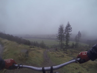
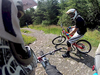
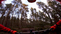
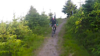
Photos of Ae Mountain Bike
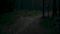
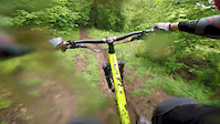
Videos of Ae Mountain Bike

trail: Ae Downhill
8:13 |
156 |
Aug 30, 2022
trail: Ae Downhill
0:23 |
227 |
Jan 13, 2021
trail: Omega Man
0:51 |
288 |
Oct 17, 2020
trail: Ae Downhill
0:58 |
173 |
Jan 7, 2020
trail: Ae Downhill
0:54 |
407 |
Jun 4, 2018

trail: Ae Downhill
0:48 |
99 |
May 8, 2018
trail: HP Sauce
0:52 |
100 |
Feb 23, 2018
trail: Omega Man
3:32 |
143 |
Jan 17, 2018
Current Trail Warnings
| status | trail | date | condition | user | info |
|---|---|---|---|---|---|
| Scrambled Eggs | May 26, 2026 @ 1:09pm (Europe/London) May 26, 2026 | Unknown | PorkyWPMDId | Logging disruption at the lower section... |
Recent Trail Reports
| status | trail | date | condition | info | user |
|---|---|---|---|---|---|
| Gub Hill | May 23, 2026 @ 8:17am (Europe/London) May 23, 2026 | Variable | seamanstanes | ||
| Rab's Slippy One | Apr 18, 2026 @ 12:13pm (Europe/London) Apr 18, 2026 | Unknown | seamanstanes | ||
| Omega Man | Apr 6, 2026 @ 8:35pm (Europe/London) Apr 6, 2026 | Ideal | bexrex | ||
| 97 dh | Apr 6, 2026 @ 8:32pm (Europe/London) Apr 6, 2026 | Ideal | bexrex | ||
| 97 Line (Lower) | Apr 6, 2026 @ 8:32pm (Europe/London) Apr 6, 2026 | Ideal | bexrex | ||
| End of ‘97 | Apr 6, 2026 @ 8:31pm (Europe/London) Apr 6, 2026 | Ideal | bexrex | ||
| Quarry Trail (TOP) | Apr 6, 2026 @ 8:30pm (Europe/London) Apr 6, 2026 | Unknown | bexrex | ||
| Quarry Trail (Middle) | Apr 6, 2026 @ 8:29pm (Europe/London) Apr 6, 2026 | Unknown | bexrex | ||
| Quarry Trail | Apr 6, 2026 @ 8:28pm (Europe/London) Apr 6, 2026 | Ideal | bexrex | ||
| RMS | Apr 6, 2026 @ 8:27pm (Europe/London) Apr 6, 2026 | Prevalent Mud | bexrex |
Activity Feed
| username | action | type | title | date |
|---|---|---|---|---|
| PorkyWPMDId | add | report | activity #95556999 | May 26, 2026 @ 5:09am May 26, 2026 |
| seamanstanes | add | report | activity #95293207 | May 23, 2026 @ 12:18am May 23, 2026 |
| LukasSchmid | vote | trail | activity #94158165 | May 6, 2026 @ 8:45am May 6, 2026 |
| LukasSchmid | add | photo | activity #94151416 and 1 more | May 6, 2026 @ 6:24am May 6, 2026 |
| dgriffit | wishlist | region | activity #93519520 | Apr 27, 2026 @ 8:39am Apr 27, 2026 |
Recent Comments
| username | type | title | comment | date |
|---|---|---|---|---|
| trail | Still closed | Apr 24, 2026 @ 10:12am Apr 24, 2026 | ||
| report | Still closed | Mar 25, 2026 @ 7:32am Mar 25, 2026 | ||
| report | all fallen trees are now cleared | Feb 28, 2026 @ 7:00am Feb 28, 2026 | ||
| report | Possible to lift bike over tree now...that was... | Jul 7, 2025 @ 11:08pm Jul 7, 2025 | ||
| trail | Running primo 👌 | Jun 6, 2025 @ 4:08pm Jun 6, 2025 |
Local Badges
-

Epic Ride Climb 2k45 awarded -

Climbing 10k Badge64 awarded -

Climbing 100k Badge5 awarded -

Epic Ride Descent 2k56 awarded -

Descent 10k Badge67 awarded -

Descent 100k Badge5 awarded
Activity Type Stats
| activitytype | trails | distance | descent | descent distance | total vertical | rating | global rank | state rank | photos | reports | routes | ridelogs |
|---|---|---|---|---|---|---|---|---|---|---|---|---|
| Mountain Bike | 150 | 135 miles | 25,676 ft | 71 miles | 1,873 ft | #916 | #37 | 955 | 906 | 5 | 11,086 | |
| E-Bike | 149 | 134 miles | 25,361 ft | 70 miles | 1,873 ft | #753 | #41 | 851 | 4 | 1,909 | ||
| Horse | 61 | 102 miles | 11,811 ft | 49 miles | 1,791 ft | #303 | #17 | 143 | 1 | |||
| Hike | 87 | 115 miles | 17,001 ft | 58 miles | 1,873 ft | #1,956 | #41 | 722 | 1 | 35 | ||
| Trail Running | 87 | 115 miles | 17,001 ft | 58 miles | 1,873 ft | #1,537 | #38 | 722 | 1 | 75 |
Frequently Asked Questions About Ae
▼
What are the best places to ride in Ae?
Ae has 1 areas to explore for mountain biking. The top rated areas are:
▼
What are the highest rated mountain biking trails in Ae?
The highest rated mountain biking trails in Ae are:
- Turn down for what (4.6/5)
- Raiders (4.3/5)
- 97 dh (4.3/5)
- Scrambled Eggs (4.3/5)
- Granny Green Love (4.3/5)
▼
What is the best time of the year to ride in Ae?
Based on ride log data, the most popular months to ride in Ae are:
- July (39 activities)
- February (38 activities)
- September (35 activities)
▼
Where can I park to ride in Ae?
There are 2 parking locations listed in Ae. The most popular parking spots are:
Activities
Trails
Points of Interest
- By bobochobo & contributors
- Admins: DMBinS, FLS, ATB, GHBC
- #5734 - 7,360 views
- ae activity log | embed map of Ae mountain bike trails | ae mountain biking points of interest
Downloading of trail gps tracks in kml & gpx formats is enabled for Ae.
You must login to download files.