close
-
Layers w
- Weather Layers
- Pro
- Pro
- Pro
- Pro
- Pro
- Pro
- More Layers
- Pro
- Pro
- Pro
- Pro
-
Upgrade to

3D
Trail Conditions
- Unknown
- Snow Groomed
- Snow Packed
- Snow Covered
- Snow Cover Partial
- Freeze/thaw Cycle
- Icy
- Prevalent Mud
- Wet
- Variable
- Ideal
- Dry
- Very Dry
Trail Flow (Ridden Direction)
Trailforks scans users ridelogs to determine the most popular direction each trail is ridden. A good flowing trail network will have most trails flowing in a single direction according to their intension.
The colour categories are based on what percentage of riders are riding a trail in its intended direction.
The colour categories are based on what percentage of riders are riding a trail in its intended direction.
- > 96%
- > 90%
- > 80%
- > 70%
- > 50%
- < 50%
- bi-directional trail
- no data
Trail Last Ridden
Trailforks scans ridelogs to determine the last time a trail was ridden.
- < 2 days
- < 1 week
- < 2 weeks
- < 1 month
- < 6 months
- > 6 months
Trail Ridden Direction
The intended direction a trail should be ridden.
- Downhill Only
- Downhill Primary
- Both Directions
- Uphill Primary
- Uphill Only
- One Direction
Contribute Details
Colors indicate trail is missing specified detail.
- Description
- Photos
- Description & Photos
- Videos
Trail Popularity ?
Trailforks scans ridelogs to determine which trails are ridden the most in the last 9 months.
Trails are compared with nearby trails in the same city region with a possible 25 colour shades.
Think of this as a heatmap, more rides = more kinetic energy = warmer colors.
- most popular
- popular
- less popular
- not popular
ATV/ORV/OHV Filter
Max Vehicle Width
inches
US Cell Coverage
Legend

Radar Time
Activity Recordings
Trailforks uses anonymized public activity data.
?
Activity Recordings
Trailforks uses anonymized public activity data.
?
Personal Heatmap
▶
Activity Types
all
/
none
▶
Options
2
Date range
month
–
Winter Trails
Warning
A routing network for winter maps does not exist. Selecting trails using the winter trails layer has been disabled.
Missing Trails
Most Popular
Least Popular
Trails are colored based on popularity. The more popular a trail is, the more red. Less popular trails trend towards green.
Jump Magnitude Heatmap
Heatmap of where riders jump on trails. Zoom in to see individual jumps, click circles to view jump details.
BC Backroad Status
![map legend]()
Service Road Atlas is a free to use, community-driven service for viewing and creating reports on the numerous back-country service roads around B.C. and Alberta.

Slope Aspect
Direction the slope faces
Trails Deemphasized
Trails are shown in grey.
Only show trails with no bike usage.
Suggested Layers
Based on selected activity type
Save the current map location and zoom level as your default home location whenever this page is loaded.
Save
No description for Alta has been added yet!
Login or register to submit one.
Activities Click to view
- Mountain Bike
82 trails
- E-Bike
8 trails
- Gravel Bike
12 trails
- Adaptive Bike
18 trails
- Winter Fat Bike
8 trails
- Horse
15 trails
- Hike
46 trails
- Trail Running
45 trails
- Dirtbike/Moto
6 trails
- Observed Trials
1 trails
- ATV/ORV/OHV
6 trails
- Snowmobile
4 trails
- Snowshoe
7 trails
- Downhill Ski
106 trails
- Backcountry Ski
4 trails
- Nordic Ski
9 trails
Region Details
- 17
- 23
- 35
- 5
Region Status
Open as of Jun 4, 2026Stats
- Avg Trail Rating
- Trails (view details)
- 209
- Trails Mountain Bike
- 82
- Trails E-Bike
- 8
- Trails Gravel Bike
- 12
- Trails Adaptive Bike
- 18
- Trails Winter Fat Bike
- 8
- Trails Horse
- 15
- Trails Hike
- 46
- Trails Trail Running
- 45
- Trails Dirtbike/Moto
- 6
- Trails Observed Trials
- 1
- Trails ATV/ORV/OHV
- 6
- Trails Snowmobile
- 4
- Trails Snowshoe
- 7
- Trails Downhill Ski
- 106
- Trails Backcountry Ski
- 4
- Trails Nordic Ski
- 9
- Total Distance
- 256 miles
- Total Descent
- 82,626 ft
- Total Vertical
- 4,501 ft
- Highest Trailhead
- 10,541 ft
- Reports
- 769
- Photos
- 356
- Ridden Counter
- 58,054
Sub Regions
-
Grand Targhee Resort
- 17
- 34
- 5
Popular Alta Mountain Biking Trails
• 90 ★ 3.0 • 741 ft • 32 ft • 1,340 • • mtb
Popular green difficulty family friendly singletrack. This mountain bike primary trail can be used downhill only with a 32 ft green climb. It features berm. On average it takes 1 minutes to complete this trail.
• 100 ★ 3.8 • 4,134 ft • 0 ft • 1,295 • • mtb
Really the only way to start your descent off the mountain unless you want to ride . This trail connects you to all the really fast fun DH trails at the resort. The trail itself is fun, and has some little jump options and starts with a...
• 100 ★ 4.7 • 746 ft • 4 ft • 1,281 • • mtb
Lower section that drops off of the short section of taking you all the way back to the lift.
• 95 ★ 4.5 • 3,812 ft • 0 ft • 1,241 • • mtb
Super fun, wide flow, a Trail, with some wooden features and table-top jumps. This trailer is a blast, what’s not to love?
• 100 ★ 3.4 • 2,162 ft • 45 ft • 1,091 • • mtb
Popular green difficulty singletrack. This mountain bike primary trail and has a easy overall physical rating with a 45 ft green climb. On average it takes 3 minutes to complete this trail.
• 90 ★ 4.7 • 2,759 ft • 0 ft • 1,067 • • mtb
Super wide, well burned down Hill Trail. Probably the second easiest downhill from Shoshone lift.
• 95 ★ 4.3 • 4 miles • 1,200 ft • 1,032 • • mtb
Love this trail going down. You can climb it, and it is a difficult climb up in a few sections. Beautiful view of the Tetons as you crest the highest point. Going down it has organic rock and root jumps even a gap that looks natural....
• 85 ★ 3.0 • 1,234 ft • 0 ft • 966 • • mtb
Nice trail that winds through the trees and provides a better route then using the road. When I rode this it was still a bit under construction and there was no signage and it is not on the park map. So not sure actual name.
Alta Mountain Bike Routes
★ 3.8 • 29 miles • 3,438 ft • 29 • Loop •
If you want to fully experience Grand Targhee's cross-country trails, then the Grand Targhee Loop is the...
★ 5.0 • 29 miles • 3,666 ft • 56 •
2020 Pierre's Hole course 50 k and 100 k race, 100 mile laps 2-3
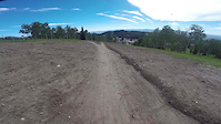
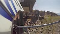
Photos of Alta Mountain Bike
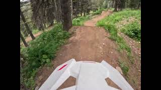
Videos of Alta Mountain Bike
trail: Shake em on down
3:30 |
79 |
Jul 20, 2018
trail: Grand Traverse
0:59 |
62 |
Nov 18, 2017
trail: Rock Garden
13:41 |
353 |
Sep 7, 2012
2:14 |
59 |
Oct 11, 2025
trail: Chutes and Ladders
0:52 |
52 |
Oct 3, 2025 , Alta

trail: Mill Creek
28:11 |
513 |
Aug 26, 2021 , Alta

trail: Rocky Mountain Way
28:11 |
442 |
Aug 26, 2021 , Alta

trail: Andys
28:11 |
526 |
Aug 26, 2021 , Alta
Recent Trail Reports
| status | trail | date | condition | info | user |
|---|---|---|---|---|---|
| Rocky Mountain Way | Jun 4, 2026 @ 8:05am (America/Denver) Jun 4, 2026 | Ideal | BonkedAgain | ||
| Mill Creek | May 24, 2026 @ 2:45pm (America/Denver) May 24, 2026 | Ideal | BonkedAgain | ||
| Cold Springs | May 23, 2026 @ 2:23pm (America/Denver) May 23, 2026 | Ideal | BonkedAgain | ||
| Yogi | Apr 12, 2026 @ 1:36pm (America/Denver) Apr 12, 2026 | Unknown | grandtargheebikepark | ||
| Space Connect | Apr 12, 2026 @ 1:35pm (America/Denver) Apr 12, 2026 | Unknown | grandtargheebikepark | ||
| Perma-Grin | Apr 12, 2026 @ 1:35pm (America/Denver) Apr 12, 2026 | Unknown | grandtargheebikepark | ||
| The Other one | Apr 12, 2026 @ 1:35pm (America/Denver) Apr 12, 2026 | Unknown | grandtargheebikepark | ||
| Out 'Chere | Apr 12, 2026 @ 1:35pm (America/Denver) Apr 12, 2026 | Unknown | grandtargheebikepark | ||
| Snowdrift | Apr 12, 2026 @ 1:35pm (America/Denver) Apr 12, 2026 | Unknown | grandtargheebikepark | ||
| Perma-One | Apr 12, 2026 @ 1:35pm (America/Denver) Apr 12, 2026 | Unknown | grandtargheebikepark |
Activity Feed
| username | action | type | title | date |
|---|---|---|---|---|
| Austinmacey | wishlist | route | activity #97335051 | Jun 19, 2026 @ 11:58am 15 hours |
| KimberlyPRN4Vo | wishlist | trail | activity #97321441 | Jun 19, 2026 @ 8:53am 18 hours |
| clay-bix | ridden | trail | activity #97282003 | Jun 18, 2026 @ 4:21pm 1 day |
| Claing1 | ridden | trail | activity #97128641 | Jun 16, 2026 @ 11:55am Jun 16, 2026 |
| jyarbro | wishlist | route | activity #97060397 and 1 more | Jun 15, 2026 @ 12:48pm Jun 15, 2026 |
Recent Comments
| username | type | title | comment | date |
|---|---|---|---|---|
| trail | i would say this is the closest targhee has to... | Nov 4, 2025 @ 9:25am Nov 4, 2025 | ||
| trail | kinda boring tbh | Nov 4, 2025 @ 9:24am Nov 4, 2025 | ||
| trail | its a rock garden pretty solid blue not a... | Nov 4, 2025 @ 9:21am Nov 4, 2025 | ||
| trail | fun its like you can just relax and you dont... | Nov 4, 2025 @ 9:20am Nov 4, 2025 | ||
| trail | squiggle trail very fun | Oct 9, 2025 @ 7:20pm Oct 9, 2025 |
Local Badges
-

10 Green Trails368 awarded -

10 Blue Trails577 awarded -

Epic Ride Climb 2k562 awarded -

Climbing 10k Badge96 awarded -

Climbing 100k Badge3 awarded -

Epic Ride Descent 2k941 awarded
Bike & Skill Parks
| name | type | city | rating |
|---|---|---|---|
| Grand Targhee Resort | bike park | Alta | |
| Skills park | skill park | Alta | |
| Drop zone | skill park | Alta |
Upcoming Local Events
Activity Type Stats
| activitytype | trails | distance | descent | descent distance | total vertical | rating | global rank | state rank | photos | reports | routes | ridelogs |
|---|---|---|---|---|---|---|---|---|---|---|---|---|
| Mountain Bike | 82 | 136 miles | 20,331 ft | 55 miles | 3,812 ft | #528 | #193 | 334 | 768 | 54 | 15,391 | |
| E-Bike | 8 | 23 miles | 289 ft | 2 miles | 3,031 ft | #3,861 | #1,299 | 400 | 1 | 79 | ||
| Gravel Bike | 12 | 33 miles | 4,626 ft | 16 miles | 3,812 ft | #325 | #936 | 52 | 25 | |||
| Adaptive Bike | 18 | 22 miles | 4,268 ft | 10 miles | 3,140 ft | #336 | #1,664 | 138 | 1 | |||
| Winter Fat Bike | 8 | 36 miles | 2,513 ft | 14 miles | 2,133 ft | #224 | #992 | 35 | 7 | |||
| Horse | 15 | 64 miles | 7,461 ft | 17 miles | 3,930 ft | #805 | #587 | 2 | 127 | 13 | ||
| Hike | 46 | 137 miles | 17,306 ft | 46 miles | 4,501 ft | #491 | #226 | 18 | 562 | 2 | 1,712 | |
| Trail Running | 45 | 135 miles | 17,260 ft | 46 miles | 4,501 ft | #1,273 | #465 | 559 | 10 | 318 | ||
| Dirtbike/Moto | 6 | 40 miles | 2,149 ft | 12 miles | 3,379 ft | #671 | #231 | 116 | 10 | |||
| Observed Trials | 1 | 6 miles | 46 ft | 1,860 ft | 1,345 ft | #216 | #44 | 1 | 4 | |||
| ATV/ORV/OHV | 6 | 40 miles | 2,149 ft | 12 miles | 3,379 ft | #481 | #162 | 116 | 1 | 5 | ||
| Snowmobile | 4 | 17 miles | 52 ft | 4,337 ft | 3,031 ft | #224 | #105 | 20 | ||||
| Snowshoe | 7 | 26 miles | 210 ft | 2 miles | 3,930 ft | #569 | #217 | 1 | 2 | 98 | ||
| Downhill Ski | 106 | 44 miles | 48,579 ft | 40 miles | 2,264 ft | #136 | #58 | 92 | 9,137 | |||
| Backcountry Ski | 4 | 21 miles | 705 ft | 2 miles | 3,573 ft | #414 | #90 | 3 | 604 | |||
| Nordic Ski | 9 | 19 miles | 902 ft | 6 miles | 1,716 ft | #584 | #193 | 1 | 2 | 1,218 |
Frequently Asked Questions About Alta
▼
What are the best places to ride in Alta?
Alta has 3 areas to explore for mountain biking. The top rated areas are:
▼
What are the highest rated mountain biking trails in Alta?
The highest rated mountain biking trails in Alta are:
- Blondie (4.5/5)
- Sticks n Stones (4.4/5)
- Otter Slide (4.4/5)
- Colter's Escape (4.4/5)
- yada, yada (4.3/5)
▼
What is the best time of the year to ride in Alta?
Based on ride log data, the most popular months to ride in Alta are:
- July (512 activities)
- August (361 activities)
- September (199 activities)
▼
Where can I park to ride in Alta?
There are 9 parking locations listed in Alta. The most popular parking spots are: View all parking and trailhead locations on the map to plan your visit.
Activities
- Alta Mountain Biking Trails
- Alta E-Biking Trails
- Alta Gravel Biking Trails
- Alta Adaptive Biking Trails
- Alta Winter Fat Biking Trails
- Alta Horseback Trails
- Alta Hiking Trails
- Alta Trail Running Trails
- Alta Dirtbiking Trails
- Alta ATVing/Offroading Trails
- Alta Snowshoeing Trails
- Alta Skiing Trails
- Alta Nordic Skiing Trails
Trails
Points of Interest
- By todd
 Trailforks & contributors
 - Admins: WP, chuktA
- #7172 - 6,862 views
- alta activity log | embed map of Alta mountain bike trails | alta mountain biking points of interest
Downloading of trail gps tracks in kml & gpx formats is enabled for Alta.
You must login to download files.