close
-
Layers w
- Weather Layers
- Pro
- Pro
- Pro
- Pro
- Pro
- Pro
- More Layers
- Pro
- Pro
- Pro
- Pro
-
Upgrade to

3D
Trail Conditions
- Unknown
- Snow Groomed
- Snow Packed
- Snow Covered
- Snow Cover Partial
- Freeze/thaw Cycle
- Icy
- Prevalent Mud
- Wet
- Variable
- Ideal
- Dry
- Very Dry
Trail Flow (Ridden Direction)
Trailforks scans users activity logs to determine the most popular direction each trail is ridden. A good flowing trail network will have most trails flowing in a single direction according to their intension.
The colour categories are based on what percentage of users are riding a trail in its intended direction.
The colour categories are based on what percentage of users are riding a trail in its intended direction.
- > 96%
- > 90%
- > 80%
- > 70%
- > 50%
- < 50%
- bi-directional trail
- no data
Trail Last Ridden
Trailforks scans activity logs to determine the last time a trail was ridden.
- < 2 days
- < 1 week
- < 2 weeks
- < 1 month
- < 6 months
- > 6 months
Trail Ridden Direction
The intended direction a trail should be ridden.
- Downhill Only
- Downhill Primary
- Both Directions
- Uphill Primary
- Uphill Only
- One Direction
Contribute Details
Colors indicate trail is missing specified detail.
- Description
- Photos
- Description & Photos
- Videos
Trail Popularity ?
Trailforks scans activity logs to determine which trails are ridden the most in the last 9 months.
Trails are compared with nearby trails in the same city region with a possible 25 colour shades.
Think of this as a heatmap, more activities = more kinetic energy = warmer colors.
- most popular
- popular
- less popular
- not popular
ATV/ORV/OHV Filter
Max Vehicle Width
inches
US Cell Coverage
Legend

Radar Time
Activity Recordings
Trailforks uses anonymized public activity data.
?
Activity Recordings
Trailforks uses anonymized public activity data.
?
Personal Heatmap
▶
Activity Types
all
/
none
▶
Options
2
Date range
month
–
Winter Trails
Warning
A routing network for winter maps does not exist. Selecting trails using the winter trails layer has been disabled.
Missing Trails
Most Popular
Least Popular
Trails are colored based on popularity. The more popular a trail is, the more red. Less popular trails trend towards green.
Jump Magnitude Heatmap
Heatmap of where users jump on trails. Zoom in to see individual jumps, click circles to view jump details.
BC Backroad Status
![map legend]()
Service Road Atlas is a free to use, community-driven service for viewing and creating reports on the numerous back-country service roads around B.C. and Alberta.

Slope Aspect
Direction the slope faces
Trails Deemphasized
Trails are shown in grey.
Only show trails with no bike usage.
Suggested Layers
Based on selected activity type
Save the current map location and zoom level as your default home location whenever this page is loaded.
Save
No description for Annot has been added yet!
Login or register to submit one.
This region uses the Uk/Euro style trail grading system.
Activities Click to view
- Mountain Bike
58 trails
- E-Bike
33 trails
- Gravel Bike
8 trails
- Adaptive Bike
9 trails
- Hike
59 trails
- Trail Running
59 trails
Region Details
- 7
- 18
- 19
- 8
Region Status
Open as of May 30, 2026Stats
- Avg Trail Rating
- Trails (view details)
- 52
- Trails Mountain Bike
- 59
- Trails E-Bike
- 33
- Trails Gravel Bike
- 8
- Trails Adaptive Bike
- 9
- Trails Hike
- 59
- Trails Trail Running
- 59
- Total Distance
- 53 miles
- Total Descent
- 29,568 ft
- Total Vertical
- 4,942 ft
- Highest Trailhead
- 7,236 ft
- Reports
- 41
- Photos
- 29
- Completed Counter
- 315
Popular Annot Mountain Biking Trails
• 85 ★ 4.0 • 1 mile • 9 ft • 22 • • hike
Très belles vues, sentier souvent bien trialisant et pentu ! Attention exposition au début, chute interdite sur vire, pas trop de pente, se roule bien. Ca devient plus raide et trialisant des que l'on passe la chambre du roy. EN :...
• 90 ★ 5.0 • 1 mile • 0 ft • 19 • • hike
Beau single qui serpente entre les grès et longe une crete avec des vue magnifiques sur sa premiere moitié. Après il prend plus de pente et devient trialisant avec des passages exposés (chute interdite) et continu de serpenté en...
• 100 ★ 4.5 • 4,383 ft • 2 ft • 19 • • hike
Popular red difficulty singletrack. This hike primary trail and has a moderate overall physical rating with a 2 ft green climb. It features berm. On average it takes 22 minutes to complete this trail.
• 95 ★ 5.0 • 2 miles • 78 ft • 12 • • hike
Popular blue difficulty singletrack. This hike primary trail. Trail visibility is always easy to follow. On average it takes 7 minutes to complete this trail.
• 100 ★ 4.5 • 4,167 ft • 0 ft • 11 • • hike
Popular red difficulty singletrack. This hike primary trail. On average it takes 4 minutes to complete this trail.
• 95 ★ 0.0 • 2 miles • 0 ft • 6 • • hike
Sentier étroit, racines, caillasses et dalles rocheuses.nAncienne voie romaine pas super propre qui tabasse pas mal mais sans grosse difficulté technique. nIl y a quelques passages T4 mais rien d'extrême. Le sentier se prolonge...
• 5 ★ 0.0 • 4,803 ft • 0 ft • 6 • • hike
Sentier technique avec des dalles de grès et de grosses pierres, parfois dissimulées sous les feuilles mortes. Quelques épingles compliquées aussi.
• 5 ★ 4.4 • 2 miles • 0 ft • 5 •
Less popular blue difficulty singletrack. This multi-use trail can be used downhill primary. On average it takes 22 minutes to complete this trail.
Annot Mountain Bike Routes
19 miles • 5,309 ft • 8 • Out & Back •
Tentative d'exploitation de sentiers "ploté" et de reco à venir pour faire une boucle /
Photos of Annot Mountain Bike
Videos of Annot Mountain Bike
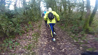
trail: trace
8:23 |
47 |
Jan 18, 2016
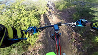
trail: trace
8:02 |
72 |
Dec 31, 2015
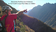
trail: trace
9:49 |
490 |
Nov 17, 2015
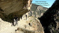
trail: trace
8:34 |
4611 |
Nov 10, 2015
trail: trace
3:52 |
68 |
May 16, 2015
trail: trace
4:58 |
87 |
Apr 6, 2015
trail: trace
19:22 |
835 |
Aug 27, 2014
trail: trace
13:52 |
220 |
Jul 20, 2014
Recent Trail Reports
| status | trail | date | condition | info | user |
|---|---|---|---|---|---|
| Chambre et jardins du roi | May 30, 2026 @ 3:35am (America/Vancouver) May 30, 2026 | Ideal | provencemb B MTB Co | ||
| Les Roches Droites | May 30, 2026 @ 3:32am (America/Vancouver) May 30, 2026 | Ideal | provencemb B MTB Co | ||
| Rocher de Pelloussis | May 30, 2026 @ 3:25am (America/Vancouver) May 30, 2026 | Ideal | provencemb B MTB Co | ||
| Les Barmettes Bas | Sep 12, 2025 @ 9:01pm (Europe/Paris) Sep 12, 2025 | Ideal | zestyman | ||
| Les Barmettes haut | Sep 12, 2025 @ 8:59pm (Europe/Paris) Sep 12, 2025 | Ideal | zestyman | ||
| Ravin de Combe Renard | Sep 12, 2025 @ 8:54pm (Europe/Paris) Sep 12, 2025 | Ideal | zestyman | ||
| Le chaudoulet | Sep 12, 2025 @ 8:42pm (Europe/Paris) Sep 12, 2025 | Ideal | zestyman | ||
| Puy de Rent UpHill | Aug 3, 2021 @ 8:05am Aug 3, 2021 | Ideal | Lolodive | ||
| Les Espaluns | Jul 25, 2020 @ 12:29am Jul 25, 2020 | Variable | Youshi | ||
| Ravin des Glaïres | Oct 6, 2019 @ 12:51am Oct 6, 2019 | Dry | popeur |
Activity Feed
| username | action | type | title | date |
|---|---|---|---|---|
| provencemb | add | photo | activity #95834752 and 15 more | May 30, 2026 @ 3:30am May 30, 2026 |
| provencemb | checkin | trail | activity #95834514 and 2 more | May 30, 2026 @ 3:25am May 30, 2026 |
| provencemb | ridden | trail | activity #95834513 and 2 more | May 30, 2026 @ 3:25am May 30, 2026 |
| provencemb | add | report | activity #95834512 and 2 more | May 30, 2026 @ 3:25am May 30, 2026 |
| provencemb | vote | trail | activity #95834492 and 1 more | May 30, 2026 @ 3:25am May 30, 2026 |
Recent Comments
| username | type | title | comment | date |
|---|---|---|---|---|
| trail | Très bon sentier | Jan 6, 2026 @ 9:46am Jan 6, 2026 | ||
| trail | Sentier étroit, racines, caillasses et dalles... | Sep 22, 2025 @ 2:38am Sep 22, 2025 | ||
| trail | Sentier technique avec des dalles de grès et... | Sep 22, 2025 @ 2:29am Sep 22, 2025 | ||
| trail | Le final de ce sentier (celui qui correspond... | Sep 21, 2025 @ 10:51pm Sep 21, 2025 | ||
| report | Beau sentier sans difficulté. Ne pas prendre... | Sep 12, 2025 @ 12:04pm Sep 12, 2025 |
Local Badges
-

10 Black Trails0 awarded -

Epic Ride Climb 2k14 awarded -

Climbing 10k Badge1 awarded -

Climbing 100k Badge0 awarded -

Epic Ride Descent 2k44 awarded -

Descent 10k Badge1 awarded
Activity Type Stats
| activitytype | trails | distance | descent | descent distance | total vertical | rating | global rank | state rank | photos | reports | routes | activity logs |
|---|---|---|---|---|---|---|---|---|---|---|---|---|
| Mountain Bike | 58 | 53 miles | 29,567 ft | 37 miles | 4,941 ft | #2,923 | #80 | 29 | 42 | 1 | 269 | |
| E-Bike | 33 | 18 miles | 5,692 ft | 9 miles | 3,543 ft | #4,064 | #245 | 36 | 94 | |||
| Gravel Bike | 8 | #236 | #52 | 1 | ||||||||
| Adaptive Bike | 9 | #350 | #183 | |||||||||
| Hike | 59 | 53 miles | 29,567 ft | 37 miles | 4,941 ft | #3,503 | #94 | 42 | 38 | |||
| Trail Running | 59 | 53 miles | 29,567 ft | 37 miles | 4,941 ft | #3,348 | #104 | 42 | 1 |
Frequently Asked Questions About Annot
▼
What are the highest rated mountain biking trails in Annot?
The highest rated mountain biking trails in Annot are:
- Crête de la barre (4.2/5)
- Les Barmettes Bas (4.1/5)
- Les Barmettes haut (4.1/5)
- Palluy (4.1/5)
- Le Roncheret (4.1/5)
▼
What is the best time of the year to ride in Annot?
Based on activity log data, the most popular months to ride in Annot are:
- July (4 activities)
- September (2 activities)
- November (2 activities)
▼
Where can I park to ride in Annot?
▼
What is the longest trail in Annot?
The longest trail in Annot is Les Roches Rouaines at 3.3 miles. View all trails sorted by distance.
Activities
Trails
Points of Interest
- By hpman83
 TRAILFORKS TFFRANCE & contributors
 - Admins: tomzaniroli, provencemb
- #15971 - 3,149 views
- annot activity log | embed map of Annot mountain bike trails | annot mountain biking points of interest
Downloading of trail gps tracks in kml & gpx formats is enabled for Annot.
You must login to download files.