close
-
Layers w
- Weather Layers
- Pro
- Pro
- Pro
- Pro
- Pro
- Pro
- More Layers
- Pro
- Pro
- Pro
- Pro
-
Upgrade to

3D
Trail Conditions
- Unknown
- Snow Groomed
- Snow Packed
- Snow Covered
- Snow Cover Partial
- Freeze/thaw Cycle
- Icy
- Prevalent Mud
- Wet
- Variable
- Ideal
- Dry
- Very Dry
Trail Flow (Ridden Direction)
Trailforks scans users ridelogs to determine the most popular direction each trail is ridden. A good flowing trail network will have most trails flowing in a single direction according to their intension.
The colour categories are based on what percentage of riders are riding a trail in its intended direction.
The colour categories are based on what percentage of riders are riding a trail in its intended direction.
- > 96%
- > 90%
- > 80%
- > 70%
- > 50%
- < 50%
- bi-directional trail
- no data
Trail Last Ridden
Trailforks scans ridelogs to determine the last time a trail was ridden.
- < 2 days
- < 1 week
- < 2 weeks
- < 1 month
- < 6 months
- > 6 months
Trail Ridden Direction
The intended direction a trail should be ridden.
- Downhill Only
- Downhill Primary
- Both Directions
- Uphill Primary
- Uphill Only
- One Direction
Contribute Details
Colors indicate trail is missing specified detail.
- Description
- Photos
- Description & Photos
- Videos
Trail Popularity ?
Trailforks scans ridelogs to determine which trails are ridden the most in the last 9 months.
Trails are compared with nearby trails in the same city region with a possible 25 colour shades.
Think of this as a heatmap, more rides = more kinetic energy = warmer colors.
- most popular
- popular
- less popular
- not popular
ATV/ORV/OHV Filter
Max Vehicle Width
inches
US Cell Coverage
Legend

Radar Time
Activity Recordings
Trailforks uses anonymized public activity data.
?
Activity Recordings
Trailforks uses anonymized public activity data.
?
Personal Heatmap
▶
Activity Types
all
/
none
▶
Options
2
Date range
month
–
Winter Trails
Warning
A routing network for winter maps does not exist. Selecting trails using the winter trails layer has been disabled.
Missing Trails
Most Popular
Least Popular
Trails are colored based on popularity. The more popular a trail is, the more red. Less popular trails trend towards green.
Jump Magnitude Heatmap
Heatmap of where riders jump on trails. Zoom in to see individual jumps, click circles to view jump details.
BC Backroad Status
![map legend]()
Service Road Atlas is a free to use, community-driven service for viewing and creating reports on the numerous back-country service roads around B.C. and Alberta.

Slope Aspect
Direction the slope faces
Trails Deemphasized
Trails are shown in grey.
Only show trails with no bike usage.
Suggested Layers
Based on selected activity type
Save the current map location and zoom level as your default home location whenever this page is loaded.
SaveAZTEC’S MOUNTAIN BIKING TRAILS RANKED AMONG THE FOUR CORNERS’ BEST
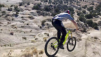
For the truly adventurous, there is no greater thrill than mountain biking in Aztec’s high desert terrain. These landscapes offer technical slickrock, rocky elevation climbs and tumbling downhills, some of the finest single-track trails in the Southwest.
Aztec offers a wonderful variety of mountain bike trails, but the two stand apart.
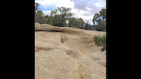
At the forefront is the Alien Run, a BLM-protected pro-level bike park of one-direction, 5-, 12- and 19-mile loops set amongst piñon- and juniper-punctuated canyons and massive sandstone outcroppings.
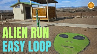
The other must-try is the Mountain View Trails, a 12-mile trail park engineered especially for beginner-to-intermediate skill levels.
For the truly adventurous, there is no greater thrill than mountain biking in Aztec’s high desert terrain. These landscapes offer technical slickrock, rocky elevation climbs and tumbling downhills, some of the finest single-track trails in the Southwest.
Aztec offers a wonderful variety of mountain bike trails, but the two stand apart.
At the forefront is the Alien Run, a BLM-protected pro-level bike park of one-direction, 5-, 12- and 19-mile loops set amongst piñon- and juniper-punctuated canyons and massive sandstone outcroppings.
The other must-try is the Mountain View Trails, a 12-mile trail park engineered especially for beginner-to-intermediate skill levels.
Activities Click to view
- Mountain Bike
37 trails
- E-Bike
21 trails
- Gravel Bike
0 trails
- Adaptive Bike
0 trails
- Winter Fat Bike
0 trails
- Horse
58 trails
- Hike
45 trails
- Trail Running
47 trails
- Dirtbike/Moto
15 trails
- ATV/ORV/OHV
10 trails
Region Details
- 11
- 3
- 5
- 14
- 1
Region Status
Open as of Dec 20, 2025Stats
- Avg Trail Rating
- Trails (view details)
- 83
- Trails Mountain Bike
- 37
- Trails E-Bike
- 21
- Trails Horse
- 58
- Trails Hike
- 45
- Trails Trail Running
- 47
- Trails Dirtbike/Moto
- 15
- Trails ATV/ORV/OHV
- 10
- Total Distance
- 189 miles
- Total Descent
- 16,605 ft
- Total Vertical
- 1,378 ft
- Highest Trailhead
- 6,927 ft
- Reports
- 205
- Photos
- 89
- Ridden Counter
- 3,726
Sub Regions
-
Alien Run
- 1
- 5
- 1
-
Aztec Area BLM Moto Trails
- 1
- 4
-
Mountain View
- 3
- 4
Popular Aztec Mountain Biking Trails
• 100 ★ 4.1 • 9 miles • 667 ft • 696 •
This trail is in Hart Canyon, at the site of a supposed UFO crash from back in the 40's. This is a ten mile one-way loop that takes you in and out of the Juniper trees, and along the slick rock shelves of the canyon. At the Eastern end...
• 100 ★ 4.5 • 4,770 ft • 30 ft • 580 •
Popular blue difficulty singletrack. This multi-use trail can be used both directions and has a moderate overall physical rating with a 30 ft green climb. On average it takes 2 minutes to complete this trail.
• 95 ★ 3.4 • 7 miles • 938 ft • 512 •
is an extension of the Alien Trail loop, the two of which combined equal a 16-mile ride. Due to the length of the combined loops and the endurance required for this trail (it's an unrelenting intermediate trail without much variation),...
• 90 ★ 5.0 • 2,546 ft • 19 ft • 293 •
This trail is in Hart Canyon, at the site of a supposed UFO crash from back in the 40's. This is a five mile one-way loop that takes you in and out of the Juniper trees, and along the slick rock shelves of the canyon. Taking this...
• 75 ★ 5.0 • 2 miles • 160 ft • 90 •
Across the canyon from Alien Run, this is the west section of a 7 mile loop rolls with very smooth single track. Great views are abound here, showcasing the San Juan Mountains of Southwestern Colorado. This trail is very well marked...
Aztec Mountain Bike Routes
Alien Run Super Loop Featured
16 miles • 1,127 ft • 2 • Loop •
The Super Loop combines the and trails. It has a fair amount of climbing and descending and provides a...
3 miles • 94 ft • 3 • Loop •
Lace up for one of the Four Corners’ most spirited running events! The Aztec Santa Dash 5K & 10K Run...
35 miles • 2,969 ft • 5 •
MIx of Single tracks and dirt roads will make the 55 mile course great for advance riders. 20+ Miles of...
Photos of Aztec Mountain Bike
Videos of Aztec Mountain Bike

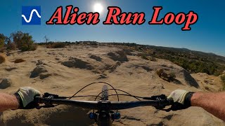
trail: Alien Run
0:09 |
56 |
Oct 24, 2021
trail: Alien Run Loop
0:09 |
116 |
Oct 24, 2021
trail: Alien Run Loop
0:49 |
267 |
Dec 10, 2018

trail: Alien Run Loop
0:54 |
108 |
Feb 7, 2018
trail: Mountain View West
6:56 |
262 |
Feb 2, 2014
trail: Alien Run Loop
42:23 |
84 |
Feb 6, 2026 , Aztec
youtuber
![Alien Run Loop]()
trail: Alien Run Loop
10:28 |
280 |
Feb 7, 2024 , Aztec

trail: Alien Run Loop
9:16 |
751 |
May 26, 2019 , Aztec
Recent Trail Reports
| status | trail | date | condition | info | user |
|---|---|---|---|---|---|
| Alien Run Loop | Dec 20, 2025 @ 1:21pm (America/Denver) Dec 20, 2025 | Variable | rustypharaoh | ||
| Mountain View South | Feb 28, 2026 @ 12:18pm (America/Denver) Feb 28, 2026 | Dry | CHRISJAWORSKY5qR | ||
| MV East Cutoff | Feb 28, 2026 @ 12:18pm (America/Denver) Feb 28, 2026 | Dry | CHRISJAWORSKY5qR | ||
| Mountain View East | Feb 28, 2026 @ 12:18pm (America/Denver) Feb 28, 2026 | Dry | CHRISJAWORSKY5qR | ||
| Outer Limits | Feb 28, 2026 @ 10:13pm (America/Denver) Feb 28, 2026 | Dry | Mrtrickdk | ||
| Alien Run | Feb 8, 2026 @ 3:18pm (America/Denver) Feb 8, 2026 | Dry | HisHolyDudenurse | ||
| MV West Cutoff | Feb 1, 2026 @ 1:13pm (America/Denver) Feb 1, 2026 | Variable | BradChipman FAST | ||
| Area 51 | Feb 28, 2025 @ 10:36pm Feb 28, 2025 | Ideal | EliMfgFs4 | ||
| The Black Hole | Feb 7, 2025 @ 7:50pm Feb 7, 2025 | Ideal | WillieJacobsz Trailforks | ||
| Parking Area Outline | Feb 7, 2025 @ 7:50pm Feb 7, 2025 | Ideal | WillieJacobsz Trailforks |
Activity Feed
| username | action | type | title | date |
|---|---|---|---|---|
| AirBike6 | wishlist | region | activity #95793754 | May 29, 2026 @ 12:02pm May 29, 2026 |
| chelito12 | wishlist | route | activity #95581342 | May 26, 2026 @ 12:01pm May 26, 2026 |
| espanser | wishlist | trail | activity #94203570 | May 7, 2026 @ 1:13am May 7, 2026 |
| ogston | ridden | route | activity #93710009 | Apr 30, 2026 @ 7:00am Apr 30, 2026 |
| czadagoat | wishlist | route | activity #93595746 | Apr 28, 2026 @ 11:39am Apr 28, 2026 |
Recent Comments
| username | type | title | comment | date |
|---|---|---|---|---|
| report | Super bad mud !! | Jan 7, 2026 @ 3:17pm Jan 7, 2026 | ||
| trail | good info! In the future you can put this as... | Dec 16, 2025 @ 11:10am Dec 16, 2025 | ||
| trail | Just did this and it was very muddy. West... | Dec 14, 2025 @ 2:45pm Dec 14, 2025 | ||
| trail | Stopped here passing through while headed... | Apr 16, 2025 @ 12:35pm Apr 16, 2025 | ||
| trail | It’s a dirt bike trail. And a really good... | Nov 26, 2024 @ 8:19am Nov 26, 2024 |
Local Badges
-

10 Blue Trails69 awarded -

Epic Mountain Bike Climb 2k6 awarded -

Climbing 10k Badge11 awarded -

Mountain Biking 100k Badge1 awarded -

Epic Ride Descent 2k6 awarded -

Descent 10k Badge11 awarded
Bike & Skill Parks
| name | type | city | rating |
|---|---|---|---|
| Aztec Motocross Track | skill park | Aztec |
Activity Type Stats
| activitytype | trails | distance | descent | descent distance | total vertical | rating | global rank | state rank | photos | reports | routes | ridelogs |
|---|---|---|---|---|---|---|---|---|---|---|---|---|
| Mountain Bike | 37 | 78 miles | 7,470 ft | 30 miles | 1,257 ft | #2,877 | #1,017 | 90 | 205 | 15 | 5,239 | |
| E-Bike | 21 | 55 miles | 5,433 ft | 23 miles | 860 ft | #3,081 | #1,125 | 149 | 2 | 285 | ||
| Horse | 58 | 139 miles | 12,264 ft | 55 miles | 1,378 ft | #224 | #425 | 30 | 6 | |||
| Hike | 45 | 96 miles | 9,140 ft | 36 miles | 1,365 ft | #3,113 | #1,115 | 204 | 7 | 183 | ||
| Trail Running | 47 | 118 miles | 10,154 ft | 42 miles | 1,365 ft | #1,974 | #640 | 204 | 8 | 50 | ||
| Dirtbike/Moto | 15 | 52 miles | 4,728 ft | 21 miles | 1,362 ft | #654 | #225 | 30 | 1 | 47 | ||
| ATV/ORV/OHV | 10 | 36 miles | 3,330 ft | 15 miles | 860 ft | #602 | #234 | 29 | 1 |
Frequently Asked Questions About Aztec
▼
What are the best places to ride in Aztec?
Aztec has 5 areas to explore for mountain biking. The top rated areas are:
▼
What are the highest rated mountain biking trails in Aztec?
The highest rated mountain biking trails in Aztec are:
- The Black Hole (4.2/5)
- Area 51 Connector (4.1/5)
- Alien Run Shortcut (4.1/5)
- Big Apple (4.1/5)
- Mountain View West (4.1/5)
▼
What is the best time of the year to ride in Aztec?
Based on ride log data, the most popular months to ride in Aztec are:
- May (57 activities)
- October (48 activities)
- April (44 activities)
▼
Where can I park to ride in Aztec?
There are 3 parking locations listed in Aztec. The most popular parking spots are: View all parking and trailhead locations on the map to plan your visit.
Activities
Trails
- By crankyanken & contributors
- Admins: ATOS
- #4029 - 6,428 views
- aztec activity log | embed map of Aztec mountain bike trails | aztec mountain biking points of interest polygons
Downloading of trail gps tracks in kml & gpx formats is enabled for Aztec.
You must login to download files.