close
-
Layers w
- Weather Layers
- Pro
- Pro
- Pro
- Pro
- Pro
- Pro
- More Layers
- Pro
- Pro
- Pro
- Pro
-
Upgrade to

3D
Trail Conditions
- Unknown
- Snow Groomed
- Snow Packed
- Snow Covered
- Snow Cover Partial
- Freeze/thaw Cycle
- Icy
- Prevalent Mud
- Wet
- Variable
- Ideal
- Dry
- Very Dry
Trail Flow (Ridden Direction)
Trailforks scans users ridelogs to determine the most popular direction each trail is ridden. A good flowing trail network will have most trails flowing in a single direction according to their intension.
The colour categories are based on what percentage of riders are riding a trail in its intended direction.
The colour categories are based on what percentage of riders are riding a trail in its intended direction.
- > 96%
- > 90%
- > 80%
- > 70%
- > 50%
- < 50%
- bi-directional trail
- no data
Trail Last Ridden
Trailforks scans ridelogs to determine the last time a trail was ridden.
- < 2 days
- < 1 week
- < 2 weeks
- < 1 month
- < 6 months
- > 6 months
Trail Ridden Direction
The intended direction a trail should be ridden.
- Downhill Only
- Downhill Primary
- Both Directions
- Uphill Primary
- Uphill Only
- One Direction
Contribute Details
Colors indicate trail is missing specified detail.
- Description
- Photos
- Description & Photos
- Videos
Trail Popularity ?
Trailforks scans ridelogs to determine which trails are ridden the most in the last 9 months.
Trails are compared with nearby trails in the same city region with a possible 25 colour shades.
Think of this as a heatmap, more rides = more kinetic energy = warmer colors.
- most popular
- popular
- less popular
- not popular
ATV/ORV/OHV Filter
Max Vehicle Width
inches
US Cell Coverage
Legend

Radar Time
Activity Recordings
Trailforks uses anonymized public activity data.
?
Activity Recordings
Trailforks uses anonymized public activity data.
?
Personal Heatmap
▶
Activity Types
all
/
none
▶
Options
2
Date range
month
–
Winter Trails
Warning
A routing network for winter maps does not exist. Selecting trails using the winter trails layer has been disabled.
Missing Trails
Most Popular
Least Popular
Trails are colored based on popularity. The more popular a trail is, the more red. Less popular trails trend towards green.
Jump Magnitude Heatmap
Heatmap of where riders jump on trails. Zoom in to see individual jumps, click circles to view jump details.
BC Backroad Status
![map legend]()
Service Road Atlas is a free to use, community-driven service for viewing and creating reports on the numerous back-country service roads around B.C. and Alberta.

Slope Aspect
Direction the slope faces
Trails Deemphasized
Trails are shown in grey.
Only show trails with no bike usage.
Suggested Layers
Based on selected activity type
Save the current map location and zoom level as your default home location whenever this page is loaded.
SaveThis region is Unsanctioned, Ride at your own Risk!
The main tourist destinations in the county are:
The cities of Bacău and Onești.
The resorts:
Slănic-Moldova
Poiana Sărată
Târgu Ocna
Poiana Uzului
The Nemira Mountains.
The cities of Bacău and Onești.
The resorts:
Slănic-Moldova
Poiana Sărată
Târgu Ocna
Poiana Uzului
The Nemira Mountains.
This region uses the Uk/Euro style trail grading system.
Region Details
- 7
- 5
Stats
- Avg Trail Rating
- Trails (view details)
- 13
- Trails Mountain Bike
- 13
- Trails E-Bike
- 10
- Trails Horse
- 5
- Trails Hike
- 13
- Trails Trail Running
- 13
- Trails Dirtbike/Moto
- 5
- Trails ATV/ORV/OHV
- 5
- Trails Backcountry Ski
- 3
- Total Distance
- 40 miles
- Total Descent Distance
- 14 miles
- Total Descent
- 6,089 ft
- Total Vertical
- 4,610 ft
- Highest Trailhead
- 5,292 ft
- Reports
- 56
- Photos
- 2
- Ridden Counter
- 75
Sub Regions
- Dărmăneşti (2)
- Gârleni (8)
- Slanic Moldova (3)
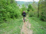
Popular Bacau Mountain Biking Trails
• 40 ★ 5.0 • 1 mile • 11 ft • 11 •
Moderately popular blue difficulty singletrack. This mountain bike primary trail can be used downhill primary and has a moderate overall physical rating. It features berm and rock garden. Trail visibility is always easy to follow. On average it takes 26 minutes to complete this trail.
• 100 ★ 5.0 • 1 mile • 0 ft • 10 •
Popular blue difficulty singletrack. This mountain bike primary trail can be used downhill primary. It features berm and rock garden. On average it takes 21 minutes to complete this trail.
• 5 ★ 5.0 • 1 mile • 0 ft • 5 •
Less popular blue difficulty singletrack. This mountain bike primary trail can be used downhill primary. It features rock garden. On average it takes 14 minutes to complete this trail.
• 5 ★ 0.0 • 4,882 ft • 11 ft • 3 • • hike
Mainly hike path. Ends with some tight stairs, switchbacks, not in good condition. Somebody with skills will not have too many problems.
• 5 ★ 3.0 • 3,835 ft • 22 ft • 2 •
Less popular blue difficulty singletrack. This mountain bike primary trail can be used downhill primary and has a moderate overall physical rating with a 22 ft black diamond climb. Trail visibility is always easy to follow.
• 5 ★ 0.0 • 2,621 ft • 3 ft • 1 •
fresh trail that wants to be a ps4 in a future contest. its a bit short but maybe it wil develop in aa longer one. its not that technical with some berms, tight turns, rocks and a jump.
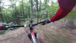
Videos of Bacau Mountain Bike
trail: 300
0:34 |
590 |
May 17, 2010

trail: Nemira
3:47 |
289 |
Apr 16, 2021 , Dărmăneşti

trail: 300
5:15 |
358 |
Mar 24, 2021 , Slanic Moldova
trail: Lespezi Trail
423 |
Aug 26, 2020 , Gârleni
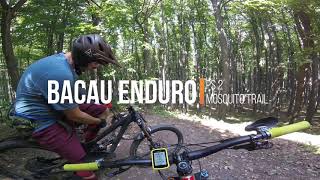
trail: Mosquitos
322 |
Aug 26, 2020 , Gârleni

trail: Spring Trail
362 |
Aug 26, 2020 , Gârleni
Recent Trail Reports
| status | trail | date | condition | info | user |
|---|---|---|---|---|---|
| Mosquitos Gârleni | Jun 18, 2024 @ 10:07am Jun 18, 2024 | Variable | freeriezer | ||
| Spring Trail Gârleni | Jun 18, 2024 @ 10:07am Jun 18, 2024 | Variable | freeriezer | ||
| Lespezi Trail Gârleni | Jun 18, 2022 @ 7:56am Jun 18, 2022 | Very Dry | Simperingbog | ||
| Drum Forestier Gârleni | Jun 18, 2022 @ 7:56am Jun 18, 2022 | Very Dry | Simperingbog | ||
| Mosquitos Exit Gârleni | Jan 18, 2022 @ 11:55pm Jan 18, 2022 | Ideal | Simperingbog |
Activity Feed
| username | action | type | title | date |
|---|---|---|---|---|
| pufalot | update | trail | activity #80051929 | Sep 10, 2025 @ 9:11am Sep 10, 2025 |
| pufalot | update | region | activity #59718553 | Sep 30, 2024 @ 11:01am Sep 30, 2024 |
| bigrims | ridden | trail | activity #54675239 | Jun 25, 2024 @ 9:20am Jun 25, 2024 |
| freeriezer | ridden | trail | activity #54327583 and 1 more | Jun 18, 2024 @ 10:08am Jun 18, 2024 |
| freeriezer | add | report | activity #54327552 and 2 more | Jun 18, 2024 @ 10:07am Jun 18, 2024 |
Recent Comments
| username | type | title | comment | date |
|---|---|---|---|---|
| trail | I just realized they changed the rating system ... | Jun 18, 2024 @ 10:11am Jun 18, 2024 | ||
| trail | Really nicely build trail. Unfortunately 2 big... | Jun 18, 2024 @ 10:05am Jun 18, 2024 |
Activity Type Stats
| activitytype | trails | distance | descent | descent distance | total vertical | rating | global rank | state rank | photos | reports | routes | ridelogs |
|---|---|---|---|---|---|---|---|---|---|---|---|---|
| Mountain Bike | 13 | 40 miles | 6,089 ft | 14 miles | 4,610 ft | 2 | 56 | 1,458 | ||||
| E-Bike | 10 | 35 miles | 5,161 ft | 13 miles | 4,610 ft | 55 | 1 | 151 | ||||
| Horse | 5 | 30 miles | 1,919 ft | 8 miles | 4,610 ft | |||||||
| Hike | 13 | 40 miles | 6,089 ft | 14 miles | 4,610 ft | 54 | 53 | |||||
| Trail Running | 13 | 40 miles | 6,089 ft | 14 miles | 4,610 ft | 54 | ||||||
| Dirtbike/Moto | 5 | 30 miles | 1,919 ft | 8 miles | 4,610 ft | 5 | ||||||
| ATV/ORV/OHV | 5 | 30 miles | 1,919 ft | 8 miles | 4,610 ft | 2 | ||||||
| Backcountry Ski | 3 | 7 miles | 1,178 ft | 4 miles | 4,610 ft |
Activities
Trails
Points of Interest
- By punksovereign & contributors
- Admins: pufalot
- #6383 - 3,495 views
- bacau activity log | embed map of Bacau mountain bike trails |
Downloading of trail gps tracks in kml & gpx formats is enabled for Bacau.
You must login to download files.