close
-
Layers w
- Weather Layers
- Pro
- Pro
- Pro
- Pro
- Pro
- Pro
- More Layers
- Pro
- Pro
- Pro
- Pro
-
Upgrade to

3D
Trail Conditions
- Unknown
- Snow Groomed
- Snow Packed
- Snow Covered
- Snow Cover Partial
- Freeze/thaw Cycle
- Icy
- Prevalent Mud
- Wet
- Variable
- Ideal
- Dry
- Very Dry
Trail Flow (Ridden Direction)
Trailforks scans users activity logs to determine the most popular direction each trail is ridden. A good flowing trail network will have most trails flowing in a single direction according to their intension.
The colour categories are based on what percentage of users are riding a trail in its intended direction.
The colour categories are based on what percentage of users are riding a trail in its intended direction.
- > 96%
- > 90%
- > 80%
- > 70%
- > 50%
- < 50%
- bi-directional trail
- no data
Trail Last Ridden
Trailforks scans activity logs to determine the last time a trail was ridden.
- < 2 days
- < 1 week
- < 2 weeks
- < 1 month
- < 6 months
- > 6 months
Trail Ridden Direction
The intended direction a trail should be ridden.
- Downhill Only
- Downhill Primary
- Both Directions
- Uphill Primary
- Uphill Only
- One Direction
Contribute Details
Colors indicate trail is missing specified detail.
- Description
- Photos
- Description & Photos
- Videos
Trail Popularity ?
Trailforks scans activity logs to determine which trails are ridden the most in the last 9 months.
Trails are compared with nearby trails in the same city region with a possible 25 colour shades.
Think of this as a heatmap, more activities = more kinetic energy = warmer colors.
- most popular
- popular
- less popular
- not popular
ATV/ORV/OHV Filter
Max Vehicle Width
inches
US Cell Coverage
Legend

Radar Time
Activity Recordings
Trailforks uses anonymized public activity data.
?
Activity Recordings
Trailforks uses anonymized public activity data.
?
Personal Heatmap
▶
Activity Types
all
/
none
▶
Options
2
Date range
month
–
Winter Trails
Warning
A routing network for winter maps does not exist. Selecting trails using the winter trails layer has been disabled.
Missing Trails
Most Popular
Least Popular
Trails are colored based on popularity. The more popular a trail is, the more red. Less popular trails trend towards green.
Jump Magnitude Heatmap
Heatmap of where users jump on trails. Zoom in to see individual jumps, click circles to view jump details.
BC Backroad Status
![map legend]()
Service Road Atlas is a free to use, community-driven service for viewing and creating reports on the numerous back-country service roads around B.C. and Alberta.

Slope Aspect
Direction the slope faces
Trails Deemphasized
Trails are shown in grey.
Only show trails with no bike usage.
Suggested Layers
Based on selected activity type
Save the current map location and zoom level as your default home location whenever this page is loaded.
SaveFill yourself with oxygen and pleasure by discovering the natural wonders of the Ubaye.
A landscape with a predilection to mountain biking, the valley offers, from Pontis to Larche, over 340 km of itineraries marked and labelled by the French Cycling Federation.
One single track runs over 100 km from East to West and follows in part an old railway with tunnels: the Transubayenne.
A landscape with a predilection to mountain biking, the valley offers, from Pontis to Larche, over 340 km of itineraries marked and labelled by the French Cycling Federation.
One single track runs over 100 km from East to West and follows in part an old railway with tunnels: the Transubayenne.
source: ...
This region uses the Uk/Euro style trail grading system.
Activities Click to view
- Mountain Bike
86 trails
- E-Bike
77 trails
- Adaptive Bike
0 trails
- Horse
5 trails
- Hike
76 trails
- Trail Running
77 trails
- Dirtbike/Moto
4 trails
- Observed Trials
4 trails
- ATV/ORV/OHV
3 trails
- Snowmobile
2 trails
- Snowshoe
2 trails
- Downhill Ski
89 trails
- Backcountry Ski
6 trails
- Nordic Ski
2 trails
Region Details
- 13
- 2
- 15
- 35
- 18
Region Status
Open as of Jul 25, 2026Stats
- Avg Trail Rating
- Trails (view details)
- 176
- Trails Mountain Bike
- 86
- Trails E-Bike
- 77
- Trails Horse
- 5
- Trails Hike
- 76
- Trails Trail Running
- 77
- Trails Dirtbike/Moto
- 4
- Trails Observed Trials
- 4
- Trails ATV/ORV/OHV
- 3
- Trails Snowmobile
- 2
- Trails Snowshoe
- 2
- Trails Downhill Ski
- 89
- Trails Backcountry Ski
- 6
- Trails Nordic Ski
- 2
- Total Distance
- 189 miles
- Total Descent
- 136,882 ft
- Total Vertical
- 6,259 ft
- Highest Trailhead
- 9,604 ft
- Reports
- 139
- Photos
- 75
- Completed Counter
- 3,057
Sub Regions
-
Pra Loup Bike Park
- 1
- 3
- 3
- 2
-
Ubaye
- 11
- 25
- 16
Popular Barcelonnette Mountain Biking Trails
• 90 ★ 1.0 • 1 mile • 25 ft • 53 •
Popular blue difficulty singletrack. This mountain bike primary trail can be used downhill only. On average it takes 8 minutes to complete this trail.
• 100 ★ 3.7 • 4,952 ft • 13 ft • 41 •
Popular blue difficulty singletrack. This mountain bike primary trail can be used downhill only. On average it takes 4 minutes to complete this trail.
• 80 ★ 3.0 • 4,344 ft • 4 ft • 40 •
Popular black difficulty singletrack. This mountain bike primary trail can be used downhill only and has a hard overall physical rating. It features drop and jump. On average it takes 9 minutes to complete this trail.
• 5 ★ 0.0 • 3,195 ft • 36 ft • 24 •
Less popular blue difficulty singletrack. This mountain bike primary trail can be used downhill primary and has a easy overall physical rating. On average it takes 2 minutes to complete this trail.
• 85 ★ 0.0 • 3,182 ft • 0 ft • 22 •
Popular blue difficulty singletrack. This mountain bike primary trail can be used both directions. It features jump. On average it takes 4 minutes to complete this trail.
• 35 ★ 2.7 • 1 mile • 9 ft • 19 •
Less popular red difficulty singletrack. This mountain bike primary trail can be used downhill only and has a hard overall physical rating. It features bridge, drop and jump. On average it takes 6 minutes to complete this trail.
• 95 ★ 0.0 • 1 mile • 0 ft • 17 •
Popular red difficulty singletrack. This mountain bike primary trail can be used downhill only and has a hard overall physical rating with a 0 ft black diamond climb. Trail visibility is always easy to follow. On average it takes 21 minutes to complete this trail.
• 45 ★ 1.0 • 4,747 ft • 7 ft • 16 •
Moderately popular black difficulty singletrack. This mountain bike primary trail can be used downhill only. On average it takes 9 minutes to complete this trail.
Barcelonnette Mountain Bike Routes
30 miles • 5,907 ft • 0 • Point to Point •
This is the second part of the Alpes Provence Great Crossing for mtb, created with the help of the french...
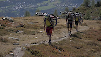
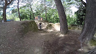
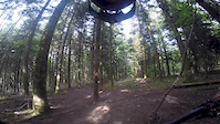
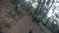
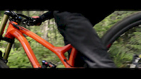
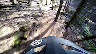
Photos of Barcelonnette Mountain Bike
Videos of Barcelonnette Mountain Bike

Recent Trail Reports
| status | trail | date | condition | info | user |
|---|---|---|---|---|---|
| La Berarde (FFC N°3) | Jul 25, 2026 @ 10:56am (Europe/Monaco) Jul 25, 2026 | Very Dry | Delphi1507 | ||
| Bonnet Vert - Retour | Nov 6, 2025 @ 11:48am (Europe/Paris) Nov 6, 2025 | Dry | Petrus3888 | ||
| Crête de Vescal | Aug 31, 2025 @ 10:04am Aug 31, 2025 | Ideal | 4BxGPH | ||
| Les Cognetons Bas | Jul 20, 2025 @ 2:31pm Jul 20, 2025 | Dry | freerider48 TRAILFORKS | ||
| Les Cognetons | Jul 20, 2025 @ 2:31pm Jul 20, 2025 | Dry | freerider48 TRAILFORKS | ||
| Flow | Jul 31, 2024 @ 2:53am Jul 31, 2024 | Dry | SportAdvies | ||
| Blue Brothers | Jul 31, 2024 @ 2:53am Jul 31, 2024 | Dry | SportAdvies | ||
| Télésiège | Jul 31, 2024 @ 2:53am Jul 31, 2024 | Dry | SportAdvies | ||
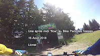
| enduro molanes-mairie d'uvernet | Dec 31, 2023 @ 2:11am Dec 31, 2023 | Snow Covered | LionelBloch | ||
| Blackjack | Aug 5, 2023 @ 12:45pm Aug 5, 2023 | Very Dry | dopingrolf MTBKarlsruhe |
Activity Feed
| username | action | type | title | date |
|---|---|---|---|---|
| Delphi1507 | add | report | activity #99958327 | Jul 25, 2026 @ 6:09am Jul 25, 2026 |
| zestyman | add | report | activity #95561426 | May 26, 2026 @ 6:50am May 26, 2026 |
| zestyman | vote | trail | activity #95561285 | May 26, 2026 @ 6:47am May 26, 2026 |
| trailforks | add | event | activity #93498766 | Apr 26, 2026 @ 9:46pm Apr 26, 2026 |
| xavier30 | vote | trail | activity #87523763 | Jan 20, 2026 @ 6:58am Jan 20, 2026 |
Recent Comments
| username | type | title | comment | date |
|---|---|---|---|---|
| trail | aucune difficulté tout se fait sur piste... | Jan 20, 2026 @ 6:56am Jan 20, 2026 | ||
| trail | No maintenance at alle. Rocks, stones, dust,... | Aug 5, 2023 @ 12:45pm Aug 5, 2023 | ||
| trail | No maintenance at alle. Rocks, stones, dust,... | Aug 5, 2023 @ 12:44pm Aug 5, 2023 | ||
| trail | No maintenance at alle. Rocks, stones, dust,... | Aug 5, 2023 @ 12:42pm Aug 5, 2023 | ||
| trail | No maintenance at alle. Rocks, stones, dust,... | Aug 5, 2023 @ 12:41pm Aug 5, 2023 |
Local Badges
-

10 Black Trails0 awarded -

10 Blue Trails2 awarded -

Epic Ride Climb 2k154 awarded -

Climbing 10k Badge11 awarded -

Climbing 100k Badge0 awarded -

Epic Ride Descent 2k154 awarded
Bike & Skill Parks
| name | type | city | rating |
|---|---|---|---|
| Pra Loup Bike Park | bike park | Barcelonnette |
Upcoming Local Events
Activity Type Stats
| activitytype | trails | distance | descent | descent distance | total vertical | rating | global rank | state rank | photos | reports | routes | activity logs |
|---|---|---|---|---|---|---|---|---|---|---|---|---|
| Mountain Bike | 86 | 140 miles | 82,999 ft | 103 miles | 6,260 ft | #1,625 | #33 | 75 | 139 | 1 | 1,071 | |
| E-Bike | 77 | 129 miles | 74,856 ft | 94 miles | 6,060 ft | #899 | #70 | 103 | 129 | |||
| Horse | 5 | 2 miles | 190 ft | 2,956 ft | 2,533 ft | #971 | #40 | 6 | ||||
| Hike | 76 | 125 miles | 73,271 ft | 94 miles | 6,260 ft | #1,455 | #36 | 111 | 1 | 166 | ||
| Trail Running | 77 | 125 miles | 73,914 ft | 94 miles | 6,260 ft | #1,073 | 111 | 20 | ||||
| Dirtbike/Moto | 4 | 2 miles | 190 ft | 2,956 ft | 2,533 ft | #370 | #11 | 6 | ||||
| Observed Trials | 4 | 2 miles | 190 ft | 2,956 ft | 2,533 ft | #94 | #12 | 1 | ||||
| ATV/ORV/OHV | 3 | 2 miles | 13 ft | 1,119 ft | 1,152 ft | #271 | #13 | 6 | ||||
| Snowmobile | 2 | 860 ft | 1,152 ft | #120 | #7 | |||||||
| Snowshoe | 2 | 860 ft | 1,152 ft | #36 | #4 | 14 | ||||||
| Downhill Ski | 89 | 47 miles | 50,827 ft | 46 miles | 3,045 ft | #103 | #18 | 337 | ||||
| Backcountry Ski | 6 | 2 miles | 3,058 ft | 2 miles | 2,333 ft | #66 | #6 | 64 | ||||
| Nordic Ski | 2 | 860 ft | 1,152 ft | #70 | #7 | 6 |
Frequently Asked Questions About Barcelonnette
▼
What are the best places to ride in Barcelonnette?
Barcelonnette has 4 areas to explore for mountain biking. The top rated areas are:
▼
What are the highest rated mountain biking trails in Barcelonnette?
The highest rated mountain biking trails in Barcelonnette are:
- La Berarde (FFC N°3) (4.1/5)
- Blue Brothers (3.9/5)
- Blackjack (3.7/5)
- Master Ride (3.6/5)
- Flow (3.6/5)
▼
What is the best time of the year to ride in Barcelonnette?
Based on activity log data, the most popular months to ride in Barcelonnette are:
- July (10 activities)
- August (8 activities)
- December (7 activities)
▼
Where can I park to ride in Barcelonnette?
There are 3 parking locations listed in Barcelonnette. The most popular parking spots are: View all parking and trailhead locations on the map to plan your visit.
Activities
Trails
- By lunule07 & contributors
- Admins: tomzaniroli, provencemb
- #9300 - 5,249 views
- barcelonnette activity log | embed map of Barcelonnette mountain bike trails | barcelonnette mountain biking points of interest
Downloading of trail gps tracks in kml & gpx formats is enabled for Barcelonnette.
You must login to download files.