close
-
Layers w
- Weather Layers
- Pro
- Pro
- Pro
- Pro
- Pro
- Pro
- More Layers
- Pro
- Pro
- Pro
- Pro
-
Upgrade to

3D
Trail Conditions
- Unknown
- Snow Groomed
- Snow Packed
- Snow Covered
- Snow Cover Partial
- Freeze/thaw Cycle
- Icy
- Prevalent Mud
- Wet
- Variable
- Ideal
- Dry
- Very Dry
Trail Flow (Ridden Direction)
Trailforks scans users activity logs to determine the most popular direction each trail is ridden. A good flowing trail network will have most trails flowing in a single direction according to their intension.
The colour categories are based on what percentage of users are riding a trail in its intended direction.
The colour categories are based on what percentage of users are riding a trail in its intended direction.
- > 96%
- > 90%
- > 80%
- > 70%
- > 50%
- < 50%
- bi-directional trail
- no data
Trail Last Ridden
Trailforks scans activity logs to determine the last time a trail was ridden.
- < 2 days
- < 1 week
- < 2 weeks
- < 1 month
- < 6 months
- > 6 months
Trail Ridden Direction
The intended direction a trail should be ridden.
- Downhill Only
- Downhill Primary
- Both Directions
- Uphill Primary
- Uphill Only
- One Direction
Contribute Details
Colors indicate trail is missing specified detail.
- Description
- Photos
- Description & Photos
- Videos
Trail Popularity ?
Trailforks scans activity logs to determine which trails are ridden the most in the last 9 months.
Trails are compared with nearby trails in the same city region with a possible 25 colour shades.
Think of this as a heatmap, more activities = more kinetic energy = warmer colors.
- most popular
- popular
- less popular
- not popular
ATV/ORV/OHV Filter
Max Vehicle Width
inches
US Cell Coverage
Legend

Radar Time
Activity Recordings
Trailforks uses anonymized public activity data.
?
Activity Recordings
Trailforks uses anonymized public activity data.
?
Personal Heatmap
▶
Activity Types
all
/
none
▶
Options
2
Date range
month
–
Winter Trails
Warning
A routing network for winter maps does not exist. Selecting trails using the winter trails layer has been disabled.
Missing Trails
Most Popular
Least Popular
Trails are colored based on popularity. The more popular a trail is, the more red. Less popular trails trend towards green.
Jump Magnitude Heatmap
Heatmap of where users jump on trails. Zoom in to see individual jumps, click circles to view jump details.
BC Backroad Status
![map legend]()
Service Road Atlas is a free to use, community-driven service for viewing and creating reports on the numerous back-country service roads around B.C. and Alberta.

Slope Aspect
Direction the slope faces
Trails Deemphasized
Trails are shown in grey.
Only show trails with no bike usage.
Suggested Layers
Based on selected activity type
Save the current map location and zoom level as your default home location whenever this page is loaded.
Save
No description for Belfry has been added yet!
Login or register to submit one.
Activities Click to view
- Mountain Bike
53 trails
- E-Bike
43 trails
- Adaptive Bike
0 trails
- Winter Fat Bike
0 trails
- Hike
53 trails
- Trail Running
53 trails
- Dirtbike/Moto
10 trails
Region Details
- 1
- 17
- 21
- 11
- 3
Region Status
Open as of Feb 5, 2026Stats
- Avg Trail Rating
- Trails (view details)
- 53
- Trails Mountain Bike
- 53
- Trails E-Bike
- 43
- Trails Horse
- 2
- Trails Hike
- 53
- Trails Trail Running
- 53
- Trails Dirtbike/Moto
- 10
- Trails ATV/ORV/OHV
- 2
- Total Distance
- 84 miles
- Total Descent
- 18,135 ft
- Total Vertical
- 3,492 ft
- Highest Trailhead
- 7,397 ft
- Reports
- 46
- Photos
- 27
- Completed Counter
- 629
Sub Regions
-
Elk Basin
- 17
- 21
- 11
- 3
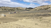
Popular Belfry Mountain Biking Trails
• 100 ★ 3.5 • 2 miles • 525 ft • 43 •
Trail goes through sections of sagebrush and rambles up sections of Rimrock featuring slabs reminiscent of Moab
• 95 ★ 4.4 • 1 mile • 58 ft • 35 •
A strait shot that is a great way to end your day of riding. This 1.5 mile trail has a little of everything, flow, loose rock and small drops. Especially fun if you have a tail wind. Head wind kills the fun for this one.
• 90 ★ 3.0 • 2 miles • 616 ft • 34 •
This access road opens this entire basin of riding. One steep hill, but it's short and the rest is easy to moderate riding.
• 100 ★ 3.0 • 1,892 ft • 6 ft • 33 •
Fun, smooth single track. This trail takes a while to dry out after a storm, so make sure it's dry before riding.
• 85 ★ 4.0 • 2 miles • 108 ft • 21 •
A great extension to the 50/50 or a fun loop all by itself. 2/3 of the way into the trail there is a section that is black diamond, but it is easily walkable. The rest of the ride is easy to intermediate riding.
• 50 ★ 3.0 • 6 miles • 935 ft • 17 •
This was one of the first trails in the area consistently ridden by local mountain bikers. To ride the entire trail without a foot dab would certainly be a feather in one's cap.
• 90 ★ 4.0 • 1,954 ft • 51 ft • 16 •
Feels like riding on the moon. Look for the rock that resembles the name.
Belfry Mountain Bike Routes
6 miles • 751 ft • 4 •
DITBY Routes 6 mile course, please complete backwards Purple flags
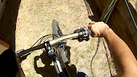
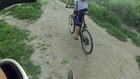
Photos of Belfry Mountain Bike
Videos of Belfry Mountain Bike
trail: Flying BMWs
0:07 |
193 |
Apr 1, 2020
trail: Full Face?
0:14 |
25 |
Jun 16, 2015

trail: Full Face?
2:40 |
5951 |
Apr 6, 2015
trail: Full Face?
0:38 |
294 |
Apr 24, 2012
trail: Full Face?
0:49 |
646 |
Sep 15, 2009
Recent Trail Reports
| status | trail | date | condition | info | user |
|---|---|---|---|---|---|
| Mini-Moab | Jan 3, 2026 @ 12:16pm (America/Denver) Jan 3, 2026 | Dry | mbag | ||
| Bad lands | May 10, 2025 @ 9:47am May 10, 2025 | Ideal | S-Hagfeldt | ||
| Danimal Bypass | May 16, 2024 @ 2:30pm May 16, 2024 | Dry | koogmtb | ||
| Hank's Choice | Mar 12, 2024 @ 12:00am Mar 12, 2024 | Prevalent Mud | BradenGmbcJJ | ||
| Gurney | Aug 10, 2023 @ 12:24pm Aug 10, 2023 | Dry | HeatherGrant | ||
| Corkscrew | May 9, 2023 @ 10:51am May 9, 2023 | Ideal | Nickstayner | ||
| Pipe Line Bypass | May 9, 2023 @ 10:51am May 9, 2023 | Ideal | Nickstayner | ||
| Mini-Porcupine | May 6, 2023 @ 7:05am May 6, 2023 | Dry | Nickstayner | ||
| Exit Strategy | May 6, 2023 @ 7:05am May 6, 2023 | Dry | Nickstayner | ||
| Shortcut | May 6, 2023 @ 7:05am May 6, 2023 | Dry | Nickstayner |
Activity Feed
| username | action | type | title | date |
|---|---|---|---|---|
| rbrown271uFcn6V | ridden | trail | activity #97764624 | Jun 25, 2026 @ 6:42am Jun 25, 2026 |
| reida500 | wishlist | trail | activity #96624852 and 3 more | Jun 9, 2026 @ 12:57pm Jun 9, 2026 |
| JessemofYO5 | wishlist | region | activity #95746169 | May 28, 2026 @ 5:49pm May 28, 2026 |
| ElliotHayhurst | wishlist | region | activity #93632000 | Apr 29, 2026 @ 12:31am Apr 29, 2026 |
| WillJsuXU6 | vote | trail | activity #92912828 | Apr 18, 2026 @ 6:52pm Apr 18, 2026 |
Recent Comments
| username | type | title | comment | date |
|---|---|---|---|---|
| report | I r min was n e | Oct 19, 2024 @ 12:30pm Oct 19, 2024 | ||
| trail | >50% push-a-bike | May 9, 2023 @ 6:02am May 9, 2023 | ||
| trail | Pretty lame that some Mountain Bike nut keeps... | Jun 18, 2022 @ 6:58pm Jun 18, 2022 | ||
| report | I was there on June 24th and the whole basin... | Jun 25, 2020 @ 7:14am Jun 25, 2020 | ||
| trail | This is an off road motorcycle trail. It is... | Jan 22, 2020 @ 2:29pm Jan 22, 2020 |
Local Badges
-

10 Green Trails6 awarded -

10 Blue Trails8 awarded -

Epic Ride Climb 2k8 awarded -

Climbing 10k Badge4 awarded -

Climbing 100k Badge0 awarded -

Epic Ride Descent 2k8 awarded
Activity Type Stats
| activitytype | trails | distance | descent | descent distance | total vertical | rating | global rank | state rank | photos | reports | routes | activity logs |
|---|---|---|---|---|---|---|---|---|---|---|---|---|
| Mountain Bike | 53 | 84 miles | 18,136 ft | 44 miles | 3,491 ft | #3,216 | #1,105 | 27 | 46 | 5 | 529 | |
| E-Bike | 43 | 69 miles | 14,675 ft | 34 miles | 3,409 ft | #2,595 | #1,032 | 44 | 3 | 10 | ||
| Horse | 2 | 5 miles | 85 ft | 2,549 ft | 2,405 ft | 4 | 4 | 2 | ||||
| Hike | 53 | 84 miles | 18,136 ft | 44 miles | 3,491 ft | #3,533 | #1,243 | 46 | 4 | 35 | ||
| Trail Running | 53 | 84 miles | 18,136 ft | 44 miles | 3,491 ft | #2,972 | #864 | 46 | 5 | 47 | ||
| Dirtbike/Moto | 10 | 13 miles | 1,250 ft | 3 miles | 3,215 ft | #1,060 | #413 | 3 | 4 | 40 | ||
| ATV/ORV/OHV | 2 | 9 miles | 233 ft | 1 mile | 3,215 ft | 4 | 2 |
Frequently Asked Questions About Belfry
▼
What are the best places to ride in Belfry?
Belfry has 1 areas to explore for mountain biking. The top rated areas are:
▼
What are the highest rated mountain biking trails in Belfry?
The highest rated mountain biking trails in Belfry are:
- Full Face? (4.1/5)
- Sidewinder (4.1/5)
- Mr. Pfister's sister (4.1/5)
- Mini-Moab (4.1/5)
- No Fences (4/5)
▼
What is the best time of the year to ride in Belfry?
Based on activity log data, the most popular months to ride in Belfry are:
- May (46 activities)
- April (39 activities)
- June (24 activities)
▼
Where can I park to ride in Belfry?
There are 4 parking locations listed in Belfry. The most popular parking spots are: View all parking and trailhead locations on the map to plan your visit.
Activities
Trails
- By Dkelleher
 & contributors
 - Admins: apply
- #16346 - 4,713 views
- belfry activity log | embed map of Belfry mountain bike trails | belfry mountain biking points of interest
Downloading of trail gps tracks in kml & gpx formats is enabled for Belfry.
You must login to download files.